
East Evans Creek Fire Lines Hold Despite Increased Activity, Large Smoke Plume
All Evacuation Levels Remain Overnight; Livestock Shelter Consolidated at Jackson County Expo

FAST FIRE FACTS
Name: East Evans Creek Fire
Location: Approximately seven miles west of Shady Cove
Acres: 2,656, last official estimate
Containment: 0%, last reported Sunday morning
Current activity: Increased fire behavior on the northern end; established lines holding
Evacuations: Level 1, Level 2 and Level 3 zones remain active overnight
Aircraft:
3 Large Air Tankers
3 Type 1 helicopters
6 Type 2 helicopters
3 Type 3 helicopters
1 lead plane
1 air attack
Roadblocks: Antioch Road, East Evans Creek Road and West Fork Evans Creek Road
Cause: Vehicle crashed into a power pole; the cause of the crash remains under investigation
Updated: 7:30 p.m. Sunday, July 12
East Evans Creek Fire PM update for 7/12/26.
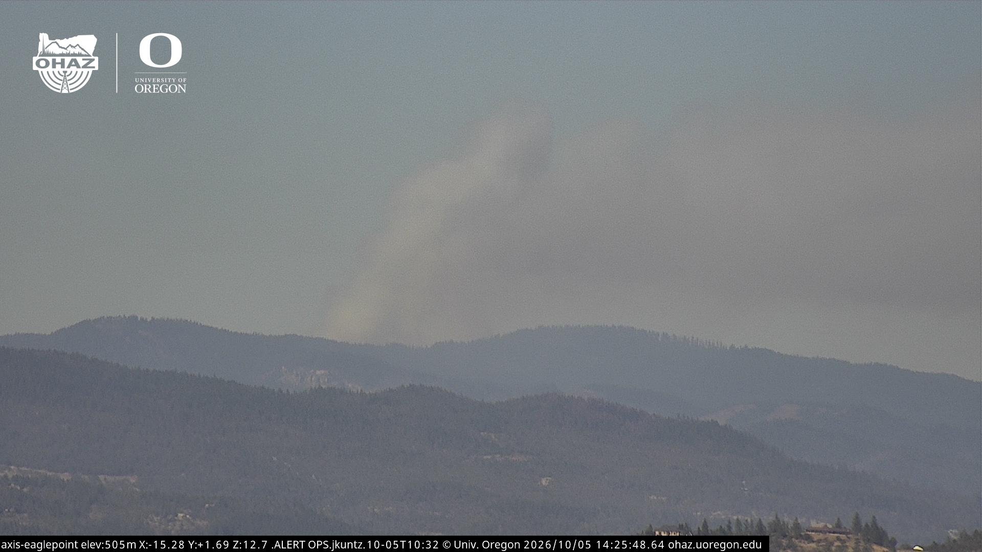
SAMS VALLEY, Ore. — Hot temperatures and windy conditions increased fire activity on the north end of the East Evans Creek Fire Sunday evening, sending a large smoke plume above the incident that was visible across the valley.
Despite the heightened activity, Oregon Department of Forestry officials said all established lines continued to hold and the fire was not gaining ground.
No updated acreage or containment estimate was released Sunday evening. The fire remained last estimated at 2,656 acres and 0% containment based on Sunday morning information.
Aircraft concentrated on the more active northern portion of the fire, while firefighters remained engaged along the southern line near the majority of threatened homes.
Jackson County officials said all Level 1, Level 2 and Level 3 evacuation zones will remain in place overnight.
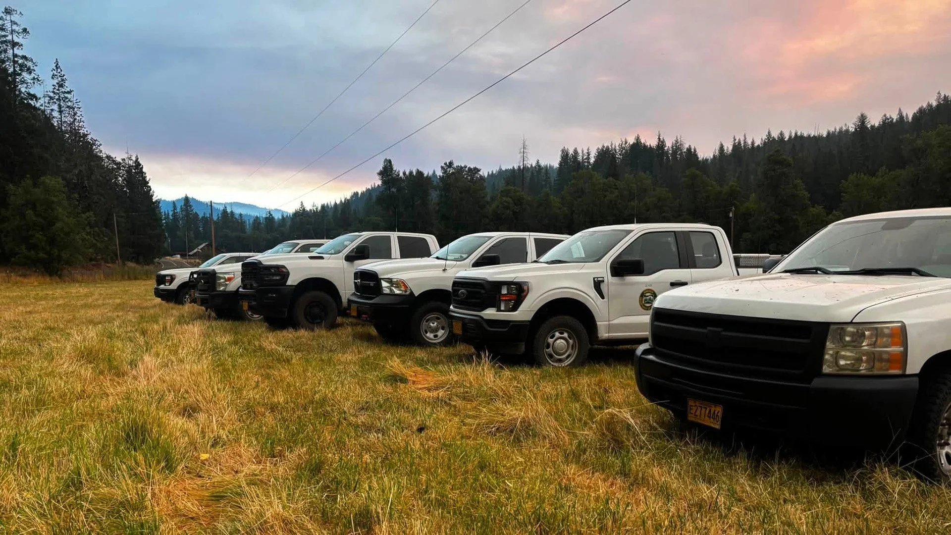
A Rural Metro Fire vehicle stands staged near the East Evans Creek Fire as a large smoke plume rises from increased fire activity on the northern end of the incident Sunday evening. Officials said established fire lines continued to hold. (Rural Metro Fire)
HEAT AND WIND INCREASE FIRE ACTIVITY
Firefighters reported heightened activity on the northern end of the fire as hot temperatures and windy conditions affected the incident Sunday afternoon and evening.
The increased burning produced a large smoke column visible from surrounding communities and across the Rogue Valley.
Officials emphasized that the visible plume did not mean the fire had escaped established lines. ODF reported that suppression lines were holding and the fire was not advancing beyond them.
Additional information was expected after firefighters returned from the line and incident managers received updated reports from the field.


AIRCRAFT CONCENTRATE ON NORTHERN FLANK
A substantial aerial response was directed toward the more active northern portion of the fire Sunday evening.
Aircraft working the incident included three Large Air Tankers, three Type 1 helicopters, six Type 2 helicopters, three Type 3 helicopters, a lead plane and an air attack platform.
Large Air Tankers were dropping retardant to establish temporary barriers and slow fire movement. Helicopters were using water bucket drops to cool hotspots and support firefighters working on the ground.
A lead plane helps guide air tankers into their assigned drop areas, while the air attack platform coordinates aircraft operating above the incident.
CREWS REMAIN ENGAGED NEAR HOMES
Ground crews continued working along the southern portion of the fire, where the majority of threatened residences are located.
Structural firefighters have remained focused on protecting homes and critical infrastructure, while wildland crews continue strengthening fire lines and working directly along the fire’s edge where terrain permits.
The fire began Friday afternoon after a vehicle crashed into a power pole and ignited dry vegetation. The Jackson County Sheriff’s Office continues investigating what caused the crash.
Operational Map
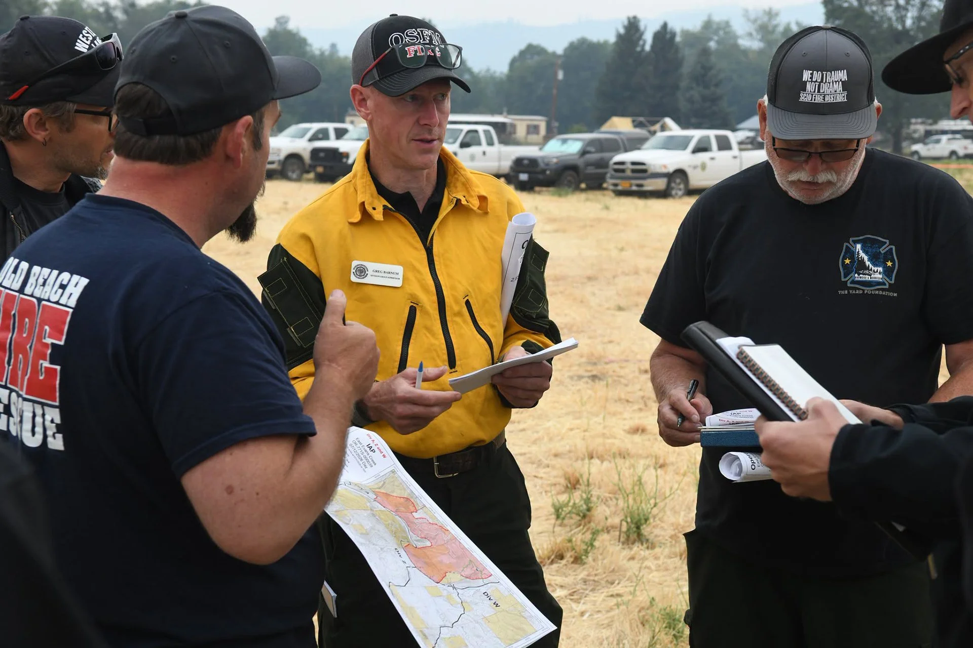
A July 12 briefing map shows the mapped perimeter, completed fire lines, division assignments and remaining uncontained edges of the East Evans Creek Fire. The map reflects the 2,656-acre estimate based on mapping completed July 11. (ODF/OSFM)
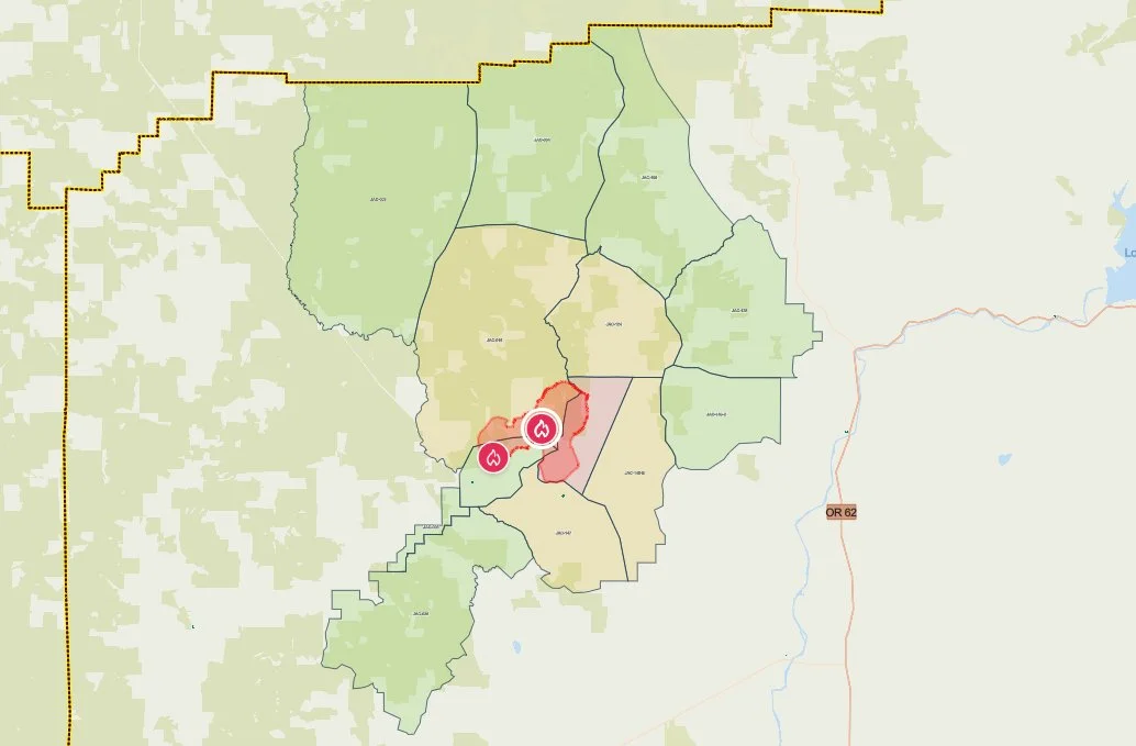
Current evacuation zones surrounding the Evans Creek Road Fire are shown on the Jackson County Sheriff’s Office emergency map Saturday morning. Red marks Level 3, yellow Level 2 and green Level 1 areas. (Jackson County Sheriff’s Office / Genasys Protect)
EVACUATIONS REMAIN OVERNIGHT
The Jackson County Sheriff’s Office and Jackson County Emergency Management said all evacuation levels will remain in place overnight.
Residents can check whether a specific address is within an evacuation zone through Genasys Protect. Additional fire and evacuation information is available through the Ready Jackson County Emergency Information Hub.
Jackson County Sheriff’s Office and Jackson County Emergency Management evacuation notices remained in effect Saturday evening.
Level 3, Go Now
JAC-148A
This zone includes residences adjacent to East Evans Creek Road from addresses 19385 through 21899. Residences at 21612 Antioch Road and 21615 Antioch Road are also included.
Level 2, Be Set
JAC-016
JAC-124
JAC-147
JAC-148B
Level 1, Be Ready
JAC-003
JAC-004
JAC-017
JAC-026
JAC-036
JAC-109
JAC-126
JAC-149B
Residents within evacuation areas should remain prepared for conditions or evacuation levels to change and continue monitoring official alerts.

ROADBLOCKS REMAIN IN PLACE
Roadblocks are in place at the following locations:
Antioch Road near the eight-mile marker
East Evans Creek Road at Meadows Road on the eastern side
West Fork Evans Creek Road on the western side
Officials are asking the public to avoid the fire area so firefighters, aircraft support crews and heavy equipment can operate safely.
ALL LIVESTOCK NOW DIRECTED TO EXPO
Jackson County officials announced Sunday evening that all livestock can now be taken to the Jackson County Expo at:
Jackson County Expo
21 Peninger Road
Central Point
Expo staff and volunteers are prepared to receive horses and other livestock. Owners should bring feed, water containers and necessary medications when possible.
The Josephine County Fairgrounds is no longer receiving livestock from the fire.
Anyone needing livestock sheltering assistance should call 541-776-7206.
An evacuation shelter for residents and domestic pets remains open at:
Hanby Middle School
806 Sixth Avenue
Gold Hill
RELATED
July 12, 2026:
July 11, 2026:
July 10, 2026:
Cover image: A large smoke plume rises from the East Evans Creek Fire on Sunday evening as hot, windy conditions increase fire activity on the northern end of the incident. ODF reported established lines remained secure and the fire was not gaining ground. (Oregon Department of Forestry)


More Firewatch




ODF Southwest Oregon’s 4 Alpha Fox helicopter has completed its 75-day seasonal contract after introducing approved night-vision wildfire flights this year. One recent after-dark mission located three lightning-caused fires.