
Evans Creek Road Fire Grows to 1,550 Acres, Crosses Two Roads
Crews are building containment lines as aircraft drop retardant on the fast-moving Jackson County fire.

Fire Facts
Name: Evans Creek Road Fire
Location: 18000 block of E Evans Creek Rd, Jackson County
Size: 1552 acres
Containment: Not reported
Evacuations:
Level 3: JAC-148-A
Level 2: JAC-016, JAC-124, JAC-148-B
Level 1: JAC-003, JAC-004, JAC-017, JAC-026, JAC-036, JAC-109, JAC-126, JAC-147, and JAC-149-B
Activity: Fast-moving fire has crossed East Evans Creek Road and Meadows Road
Supression: Aircraft dropping retardant; crews constructing and strengthening containment lines
Resources:
- 2 LAT
- 1 VLAT
- 2 Type 1 helicopters
- 2 Type 2 helicopters
- 1 Type 3 helicopter
- 1 Air Attack
- Ground crews
- Additional resources continue arriving
Management:
ODF Incident Management Team 1 ordered
Last Update: 6:15 p.m. Friday, July 10
UPDATE 7/10/26 9:00 PM
The Evans Creek Road Fire is now estimated at approximately 1,550 acres.
The fire has crossed East Evans Creek Road and Meadows Road and continues to be driven by hot, dry conditions, low humidity, steep terrain and active fire behavior.
Aircraft are dropping retardant while ground crews construct and strengthen containment lines. Additional resources continue arriving to support suppression efforts.
Evacuations now include
Level 3: JAC-148-A
Level 2: JAC-016, JAC-124, JAC-148-B
Level 1: JAC-003, JAC-004, JAC-017, JAC-026, JAC-036, JAC-109, JAC-126, JAC-147, and JAC-149-B
An evacuation shelter is now open at Hanby Middle School, 806 Sixth Ave. in Gold Hill, for people evacuating with domestic pets.
The latest perimeter map shows the Evans Creek Road Fire after it crossed East Evans Creek Road and Meadows Road Friday evening. The fire was estimated at approximately 1,550 acres by the Oregon Department of Forestry. Map: Watch Duty
Editors note: Unless there are any major changes, this will be our last update of the evening.
—
UPDATE 7/10/26 6:25 PM
The Evans Creek Road Fire is now estimated at 700 to 1,000 acres after multiple spot fires caused rapid growth, according to the Oregon Department of Forestry.
Crews caught the first two spot fires, but a third contributed to the fire’s significant expansion. The fire is burning into the previous East Evans Fire scar, while extreme heat, low humidity and steep terrain continue to challenge suppression efforts.
Heavy smoke is limiting aviation operations on portions of the fire. Firefighters remain engaged on the ground and in the air, with additional resources being ordered for overnight operations.
ODF Incident Management Team 1 has been ordered and will assume command of the incident.
—-
UPDATE 7/10/26 6:20 PM
Jackson County officials have issued a Level 3 “GO NOW” evacuation order for Zone JAC-148-A near the East Evans Fire. Residents in the affected zone should leave immediately and follow directions from emergency officials.
Level 2 “BE SET” notices are in effect for JAC-016 and JAC-148-B. Level 1 “BE READY” notices remain in effect for JAC-017, JAC-026, JAC-036 and JAC-147.
—
UPDATE 7/10/26, 5:36pm
The Evans Creek Road Fire is now estimated at 75 to 100 acres, according to the Oregon Department of Forestry.
Crews are working in extreme heat, low humidity and steep terrain while also attacking a spot fire. The coordinated response includes two Large Air Tankers, one Very Large Air Tanker, two Type 1 helicopters, two Type 2 helicopters, one Type 3 helicopter and Air Attack.
—
UPDATE 7/10/26, 5:20pm
Jackson County Sheriff’s Office deputies are conducting door-to-door evacuation notifications near the fire in the 18000 block of East Evans Creek Road.
East Evans Creek Road is blocked at Meadows Road on the east side and West Fork Evans Creek Road on the west side. The public is asked to avoid the area while fire crews work.
JACKSON COUNTY, Ore. — Firefighters are mounting an aggressive initial attack on the Evans Creek Road Fire, which grew to an estimated 75 acres Friday afternoon along East Evans Creek Road in Jackson County.
Air Attack reported the latest acreage as the first air tanker was arriving over the incident to support crews working to slow its spread.
The fire was initially estimated at 2 to 3 acres shortly after 3 p.m. It grew quickly through wind-exposed, steep terrain, reaching between 10 and 15 acres within minutes and an estimated 15 to 20 acres by about 3:30 p.m.
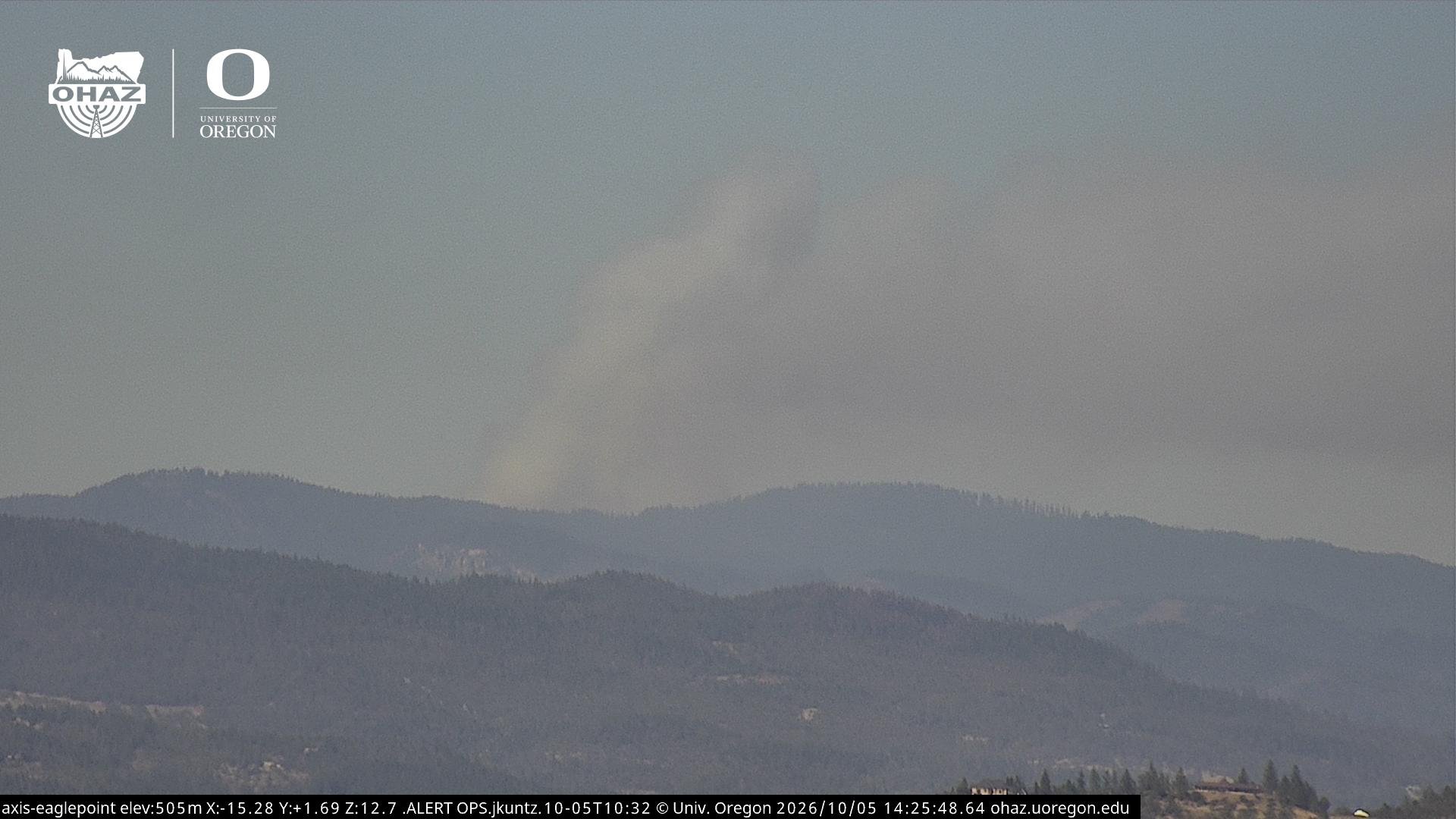
Smoke from the Evans Creek Road Fire as seen from Baldy Mountain. ans Creek Road Friday afternoon as crews continue working the incident from the ground and air. Photo: ALERTWest


By 4 p.m., Air Attack estimated the fire at 40 to 50 acres before later increasing the estimate to 75 acres.
The Oregon Department of Forestry Southwest Oregon District said the fire is burning within a previous burn scar and spreading at a moderate rate.
Multiple Type 6 engines, ground crews, a Type 2 helicopter and Air Attack are engaged in suppression efforts. A third alarm was issued as additional resources responded.
Incident Command also requested two air tankers, a bulldozer and assistance from the power company.
Map: Watch Duty
Evacuation notices
Jackson County officials have issued the following evacuations.
Level 3 GO NOW: JAC-148-A
Level 2 BE SET: JAC-016, JAC-124, JAC-148-B
Level 1 BE READY: JAC-003, JAC-004, JAC-017, JAC-026, JAC-036, JAC-109, JAC-126, JAC-147, and JAC-149-B
Residents in JAC-148-A should leave immediately and follow instructions from emergency officials.
[Interactive Evacuation Map - Genasys]
Residents in the affected areas should monitor Jackson County Alerts, prepare people, pets and essential belongings, and be ready to leave if evacuation levels increase.
The fire remains active, and acreage estimates may change as aircraft and firefighters obtain more accurate information.
Jefferson Firewatch will continue updating this story as new information becomes available.
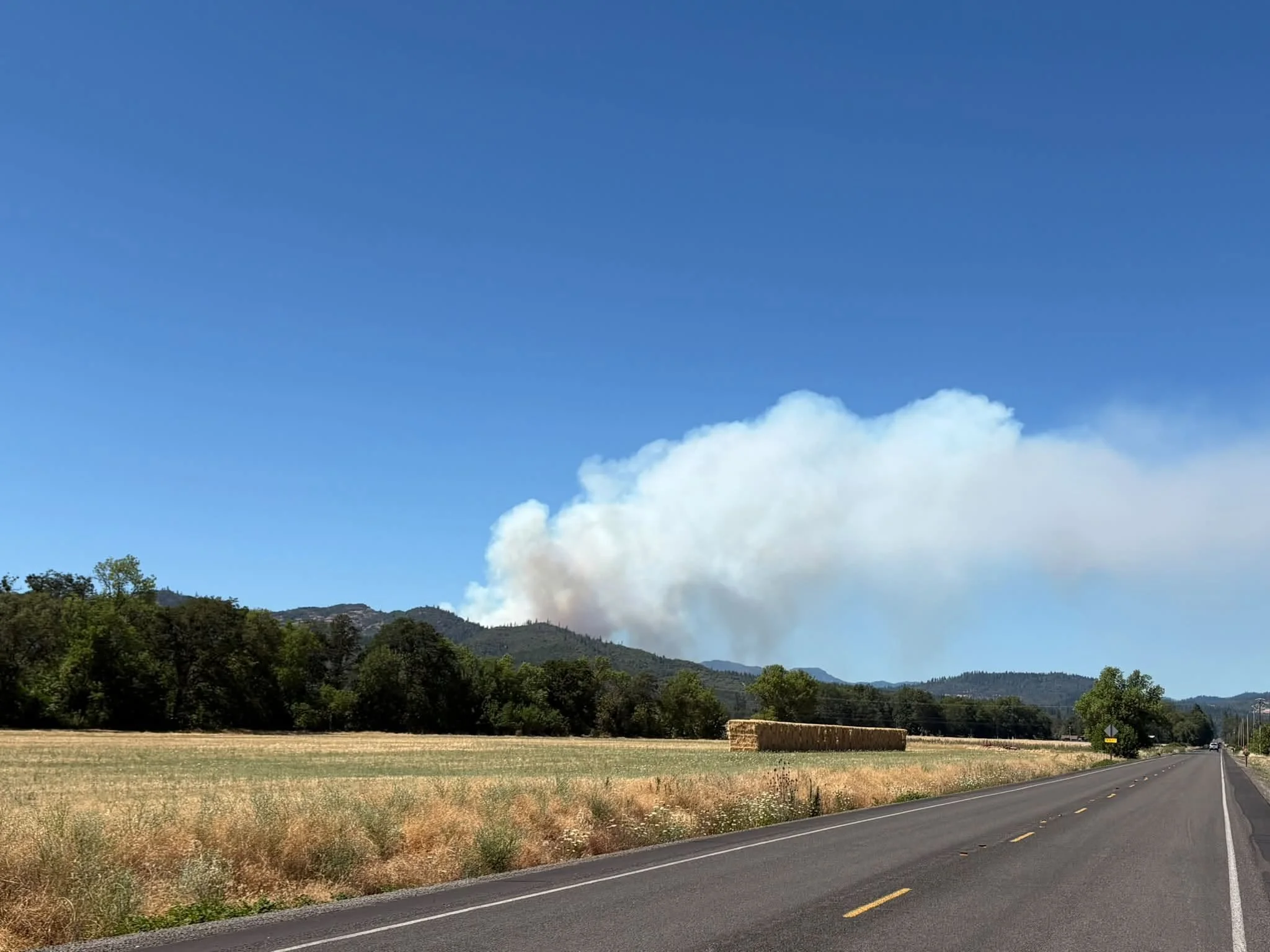
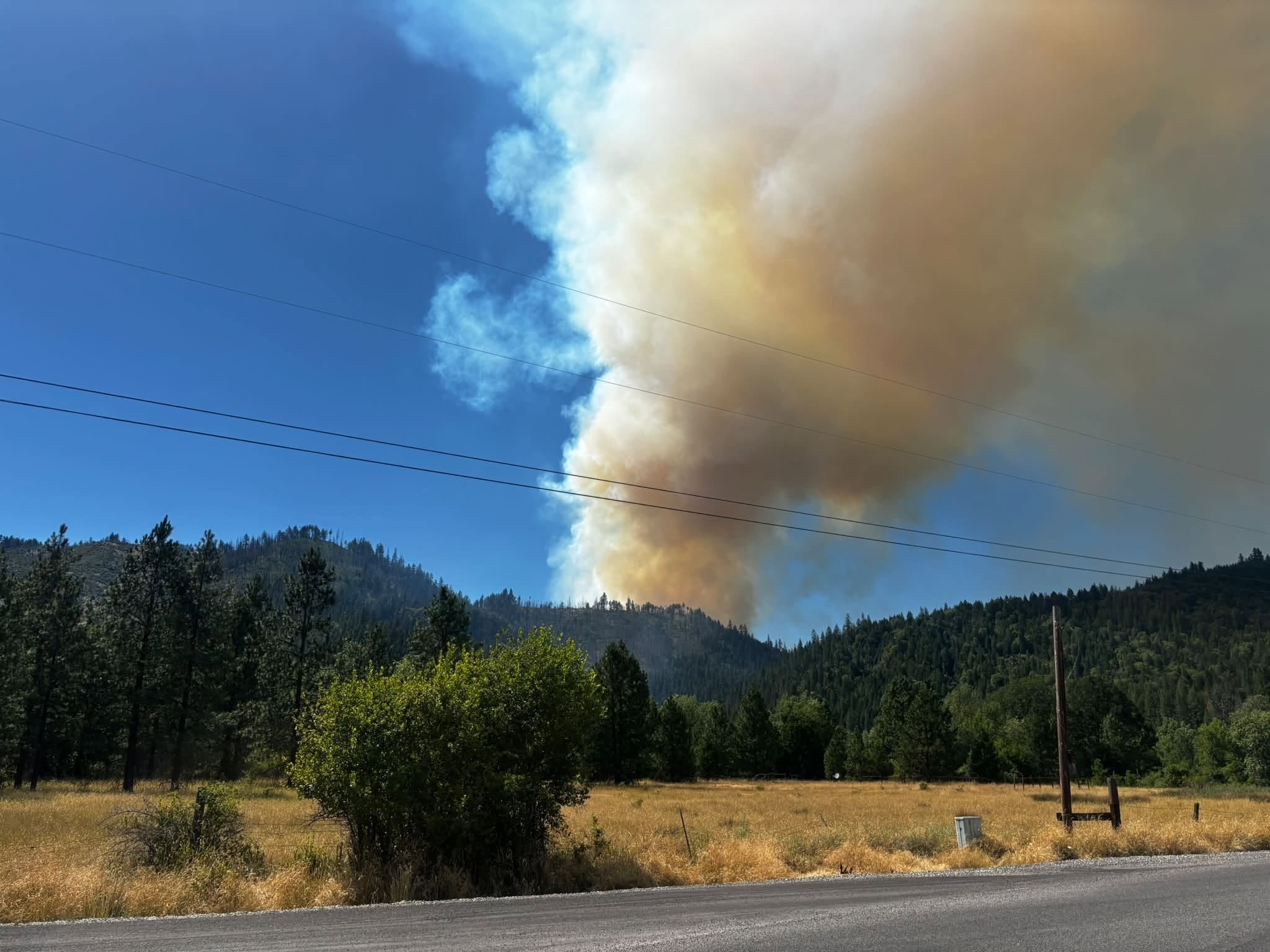
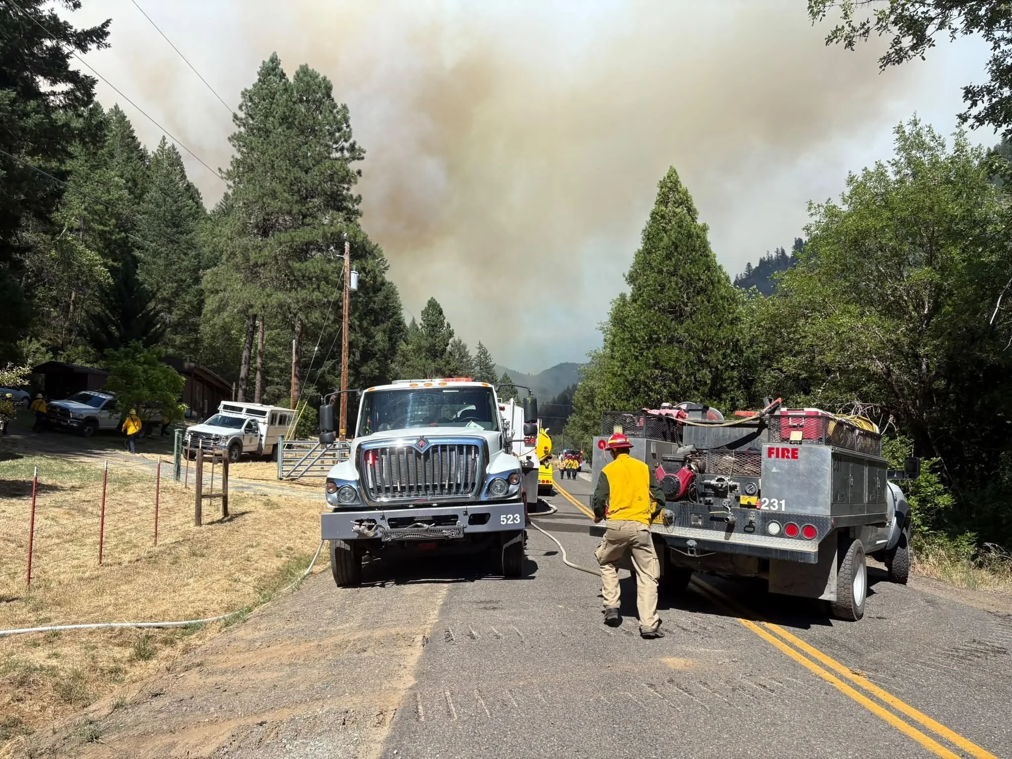
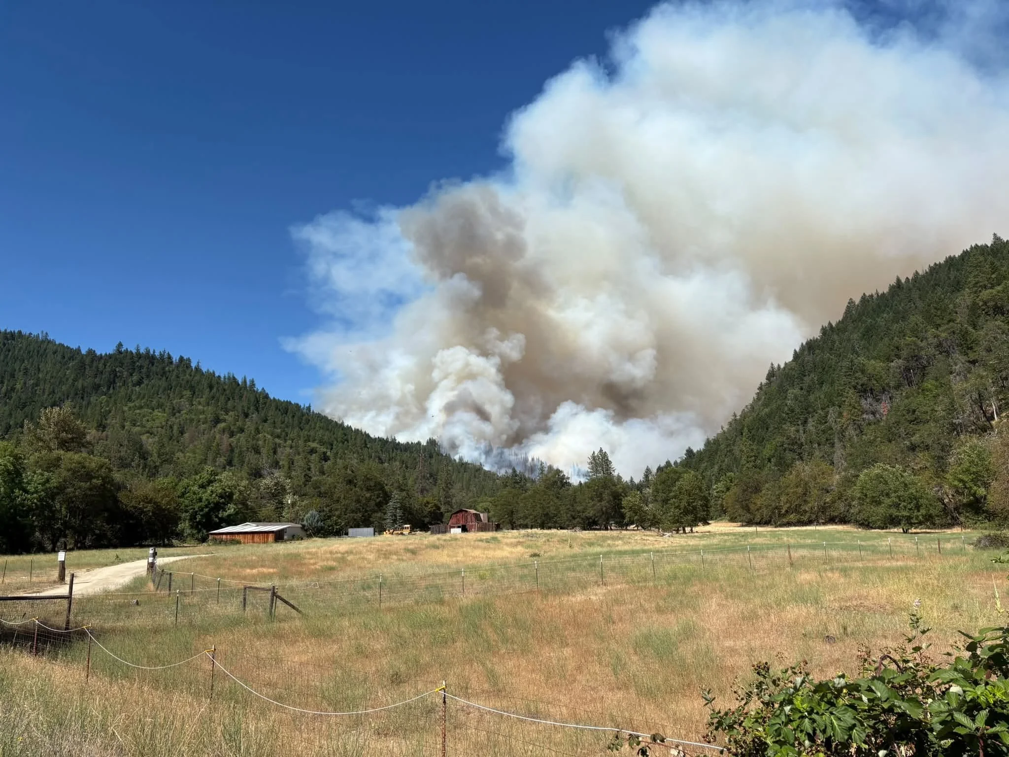

Cover image: Smoke from the Evans Creek Road Fire rises above the hills near East Evans Creek Road Friday as firefighters continue an aggressive initial attack. Photo: ALERTWest


More Firewatch





ODF Southwest Oregon’s 4 Alpha Fox helicopter has completed its 75-day seasonal contract after introducing approved night-vision wildfire flights this year. One recent after-dark mission located three lightning-caused fires.