
New Spot Fire Prompts Evacuation Changes on East Evans Creek Fire
Extreme Fire Behavior Continues Across Northern Half as 63 Agencies Support Structure Protection

FAST FIRE FACTS
Name: East Evans Creek Fire
Location: Approximately seven miles west of Shady Cove
Acres: 5,370, latest mapped estimate
Containment: 5%, latest reported
Current activity: Extreme fire behavior across the northern half, including running, torching and spotting
New development: Spot fire east of the main perimeter prompted evacuation changes
Evacuations: JAC-124 remains at Level 3; multiple surrounding zones at Level 1 and Level 2
Structure response: Personnel from 63 fire agencies representing 16 Oregon counties
Community meeting: 6:30 p.m. Wednesday at Shady Cove School and online
Closures: East Evans Creek Road and nearby BLM-administered lands
Cause: Vehicle crashed into a power pole; the cause of the crash remains under investigation
Updated: Tuesday evening, July 14, 2026
Active fire burns through forested terrain on the East Evans Creek Fire overnight as crews worked to contain spot fires, cool hot areas and strengthen control lines. (Oregon Department of Forestry)
East Evans Creek Fire PM update for 7/14/26.
SAMS VALLEY, Ore. — A new spot fire east of the East Evans Creek Fire prompted expanded evacuation notices Tuesday evening as firefighters faced extreme fire behavior across the northern half of the incident.
Jackson County officials upgraded JAC-126 and JAC-149B to Level 2: Be Set, while four additional zones were raised to Level 1: Be Ready. JAC-148A was downgraded from Level 3 and recombined with JAC-148B, placing the entire JAC-148 zone at Level 2.
JAC-124 remains at Level 3: Go Now.
Oregon Department of Forestry officials said the new spot fire developed east of the main perimeter Tuesday evening. Aircraft and heavy equipment were supporting crews working to improve access, slow the fire and strengthen control lines around the area.
The fire remained last mapped at 5,370 acres, with containment last reported at 5%. No updated acreage or containment figure was released Tuesday evening.
Extreme fire behavior, including running, torching and spotting, was occurring across divisions along the northern half of the fire and was expected to continue into the early morning hours. Firefighters will work through the night to cool active areas, slow growth and establish additional fireline where conditions allow.
A community meeting is scheduled for Wednesday evening in Shady Cove and will also be streamed online.
A structural firefighter deploys a hose line near a threatened property as smoke and active fire move through the surrounding forest. (Oregon State Fire Marshal)
MORNING PROGRESS GIVES WAY TO EXTREME FIRE BEHAVIOR
Firefighters used cooler morning conditions Tuesday to establish and strengthen fireline, connect sections of line, improve access and coordinate suppression work with aircraft.
Conditions deteriorated as temperatures increased, relative humidity fell and the atmosphere became more unstable.
The thunderstorms forecast near the incident remained south and east of the fire. However, the expected monsoonal moisture did not reach the area, allowing humidity to remain lower and fuels to stay critically dry.
ODF said fire intensity changed rapidly late Tuesday afternoon.
Divisions along the northern half of the incident experienced running fire, torching trees and spotting. Officials described the East Evans Creek Fire as driven by terrain and fuels, with steep slopes and heavy vegetation continuing to complicate suppression work.
NEW SPOT FIRE PROMPTS EVACUATION CHANGES
Two spot fires identified during Monday night’s infrared flight have been mostly lined, although one remains difficult to access because of rugged terrain.
A new spot fire east of the main perimeter developed Tuesday evening and prompted Jackson County officials to expand evacuation notices in surrounding areas.
Crews are using aircraft and heavy equipment to attack the spot fire, improve access and strengthen control features.
Firefighters will continue working overnight to cool active areas, slow fire growth and build direct or indirect line where terrain and conditions permit.
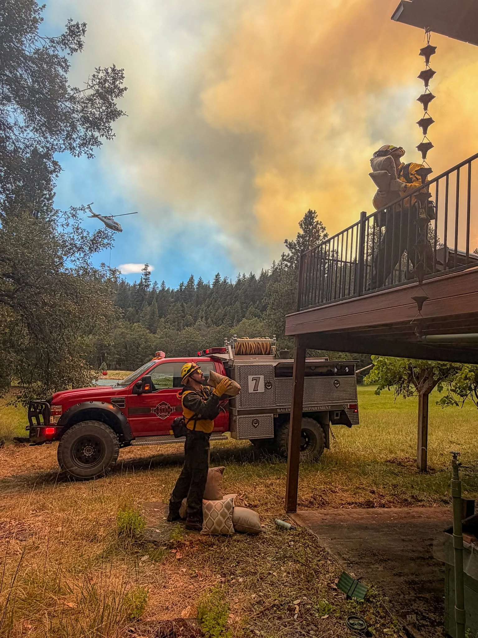
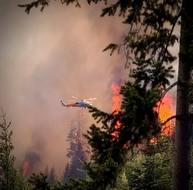
AIRCRAFT AND HEAVY EQUIPMENT SUPPORT GROUND CREWS
Aviation resources continued operating throughout Tuesday and into the evening.
Aircraft supported crews by cooling active fire, slowing movement, suppressing spot fires and assisting firefighters in areas with difficult access.
Heavy equipment is being used to open routes, improve access and reinforce firelines around priority areas.
Additional resources continue arriving and are being integrated into the response as the incident grows more complex.
Fire personnel review operational maps while coordinating structure-protection assignments on the East Evans Creek Fire. Resources from 63 agencies across 16 Oregon counties are supporting the incident. (Oregon State Fire Marshal)
63 FIRE AGENCIES SUPPORT STRUCTURE PROTECTION
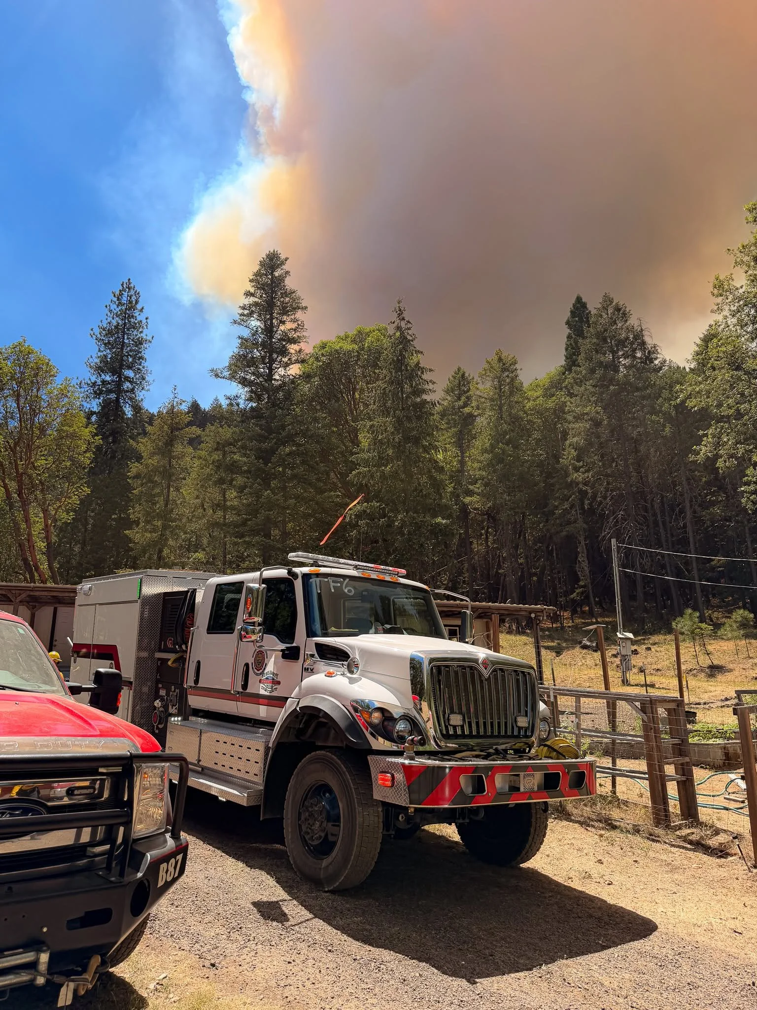
Oregon State Fire Marshal resources remain positioned in threatened areas alongside wildland firefighters.
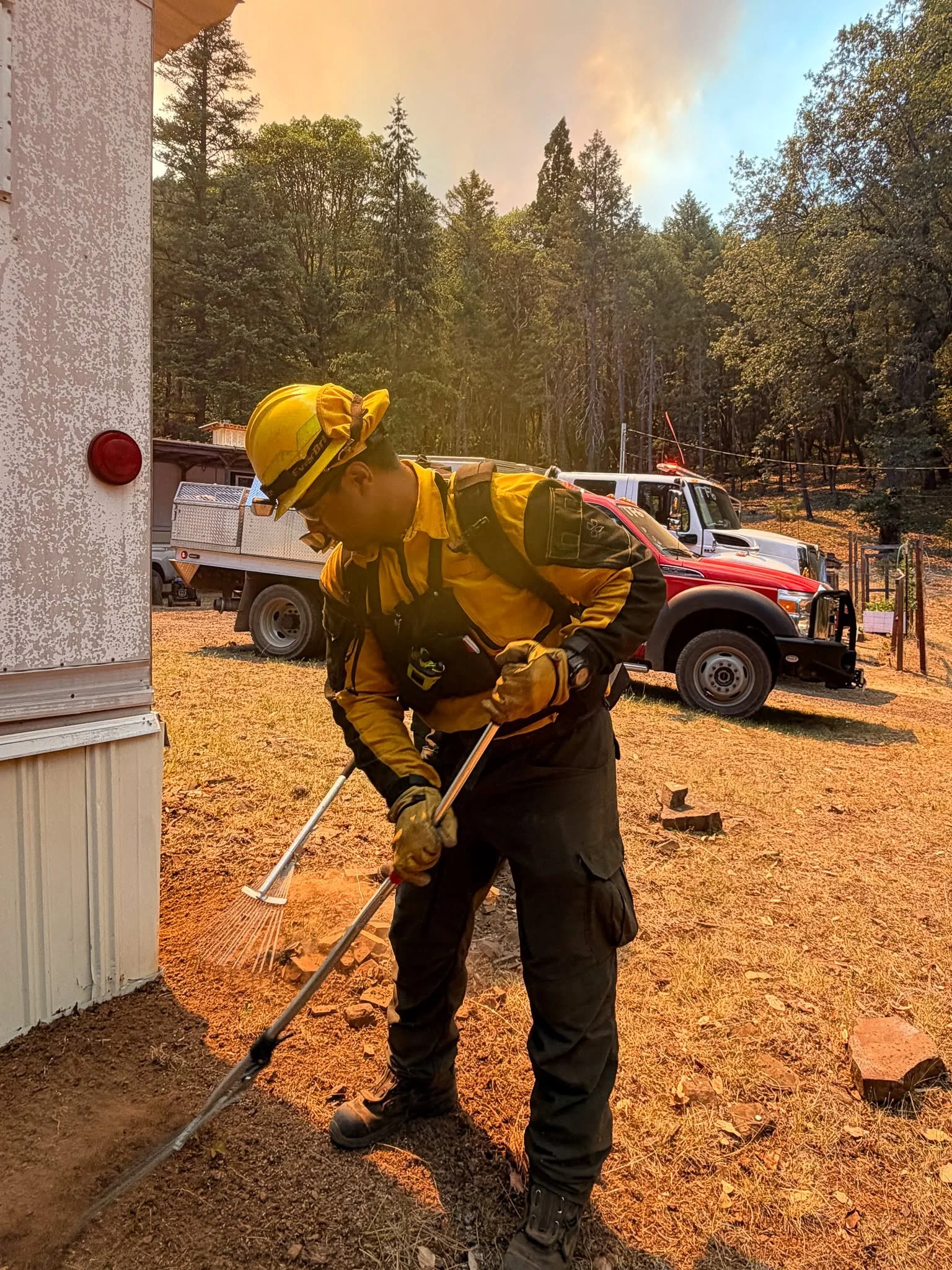
Structural crews are conducting point protection around homes, extinguishing hotspots, checking for embers and suppressing new ignitions that could threaten buildings.
Firefighters are also completing full structure preparation by removing combustible materials, identifying hazards, improving defensible space, installing hose lays and developing protection plans for individual properties.
Resources from Douglas, Klamath, Linn, Marion and Lincoln counties and South Coast agencies were initially mobilized after the Oregon Fire Service Mobilization Plan was activated July 10.
Additional personnel from Yamhill, Lane, Benton and Polk counties arrived Tuesday. OSFM said firefighters from 63 agencies representing 16 Oregon counties are now supporting the incident.
COMMUNITY MEETING PLANNED WEDNESDAY
Fire officials will hold a community meeting Wednesday, July 15, at 6:30 p.m.
In person:
Shady Cove School Gym
100 Cleveland Street, Shady Cove
The meeting will also be streamed through the ODF Southwest Oregon Facebook page.
Officials are expected to provide an operational update and discuss evacuation information, structure protection and ongoing suppression work.


BLM CLOSES PUBLIC LANDS NEAR FIRE
The Bureau of Land Management issued a closure order for BLM-administered lands near the East Evans Creek Fire.
Public entry into the closure area is prohibited, including hunting, hiking and camping.
The closure is intended to protect the public and allow firefighters and equipment to operate without interference.
SMOKE MAY SETTLE INTO VALLEYS
Smoke from the fire may settle into valleys and other low-lying areas, reducing visibility and affecting air quality in nearby communities.
Conditions can change throughout the day as winds shift. People sensitive to wildfire smoke should limit exposure and monitor current air-quality information and smoke forecasts.
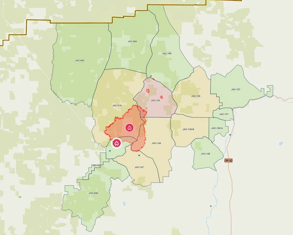
The July 14 evacuation map shows JAC-124 at Level 3, expanded Level 2 zones east and south of the fire and additional Level 1 zones surrounding the incident. Residents should use the interactive Genasys map to check current conditions for a specific address. (Jackson County Sheriff’s Office/Jackson County Emergency Management)
UPDATED EVACUATION LEVELS
Jackson County Sheriff’s Office and Jackson County Emergency Management issued the following evacuation levels Tuesday evening.
Level 3: Go Now
JAC-124
Residents in a Level 3 zone should remain out of the area until officials announce it is safe to return.
Level 2: Be Set
JAC-016
JAC-126
JAC-147
JAC-148
JAC-149B
JAC-126 and JAC-149B were upgraded to Level 2.
JAC-148A was downgraded from Level 3 and is no longer separated from JAC-148B. The entire JAC-148 zone is now at Level 2.
The zone includes residences along East Evans Creek Road from addresses 19385 through 21899, along with 21612 Antioch Road and 21615 Antioch Road.
Level 1: Be Ready
JAC-003
JAC-004
JAC-017
JAC-026
JAC-036
JAC-109
JAC-127
JAC-149A
JAC-158
JAC-127, JAC-131, JAC-149A and JAC-158 were upgraded to Level 1 Tuesday evening.
Residents should continue monitoring official alerts and be prepared for evacuation levels to change quickly.

SHELTER AND LIVESTOCK INFORMATION
An evacuation shelter for residents and domestic pets remains open at:
Hanby Middle School
806 Sixth Avenue, Gold Hill
Horses and other livestock may be taken to:
Jackson County Expo
21 Peninger Road, Central Point
Owners should call 541-776-7206 before arriving to confirm space is available. Officials recommend bringing feed, water containers and necessary medications when possible.
ROAD AND AIRSPACE RESTRICTIONS
East Evans Creek Road remains closed to public traffic at Meadows Road.
Officials are asking people to avoid the fire area so firefighters, emergency vehicles and heavy equipment can operate safely.
A temporary flight restriction remains in effect over the fire 24 hours a day. Flying a drone near a wildfire is illegal and can force firefighting aircraft to suspend operations.
The fire began at approximately 2:41 p.m. Friday after a vehicle crashed into a power pole and ignited dry vegetation. The Jackson County Sheriff’s Office continues investigating the cause of the crash.
Cover image: A user-submitted photo shared through Watch Duty shows multiple smoke columns rising from the East Evans Creek Fire on Tuesday as extreme fire behavior continued across the northern half of the incident. (Courtesy photo via Watch Duty)


More Firewatch
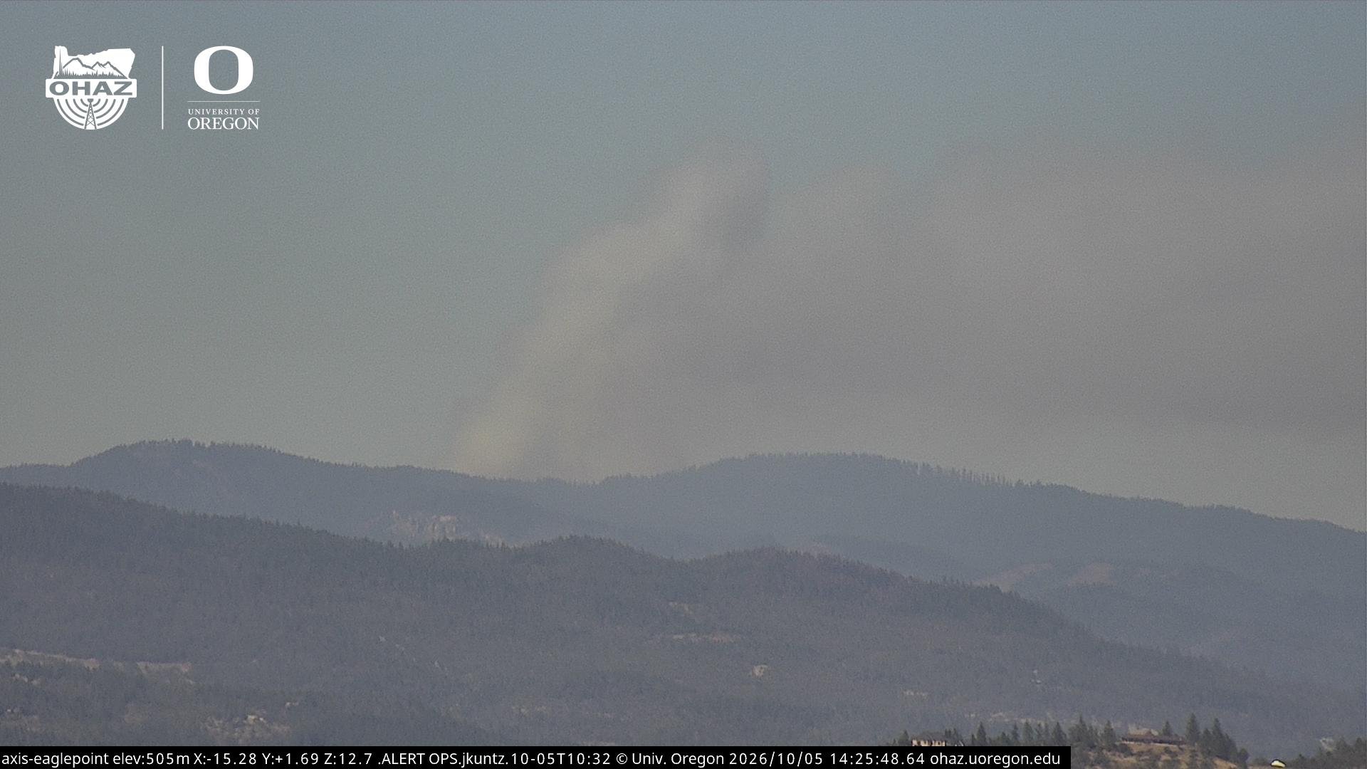





ODF Southwest Oregon’s 4 Alpha Fox helicopter has completed its 75-day seasonal contract after introducing approved night-vision wildfire flights this year. One recent after-dark mission located three lightning-caused fires.