
East Evans Creek Fire Reaches 7,843 Acres; Community Meeting Set for Wednesday
Board Mountain Spot Fire Estimated at 1,000 Acres as Crews Shift Resources Northeast

FAST FIRE FACTS
Name: East Evans Creek Fire
Location: Approximately seven miles west of Shady Cove
Total Acres: 7,843
Board Mountain spot fire: Approximately 1,000 acres
Containment: 5%, latest reported
Overnight activity: Fire remained active; crews aggressively engaged spot fires northeast of the main perimeter
Primary focus: Board Mountain, northeastern and eastern portions of the incident
Evacuations: Level 1, Level 2 and Level 3 notices remain active
Current concerns: Hot, dry weather, steep terrain, receptive fuels, rapid spread and additional spotting
Community meeting: 6:30 p.m. Wednesday, July 15
Cause: Vehicle crashed into a power pole; the cause of the crash remains under investigation
Updated: Wednesday morning, July 15, 2026
Firefighters work near active flames during overnight suppression efforts on the East Evans Creek Fire. (Oregon Department of Forestry)
EVACUATION UPDATE: JULY 15, 2026, 8:30 P.M.
Jackson County officials expanded evacuation notices around the East Evans Creek Fire Wednesday evening as conditions continued changing east and northeast of the main fire.
JAC-109, JAC-126 and JAC-149B were upgraded to Level 3: Go Now. JAC-124 also remains at Level 3. Residents in those zones should leave immediately, and Jackson County sheriff’s deputies are conducting door-to-door notifications in the newly upgraded areas.
Eight zones were upgraded to Level 2: Be Set: JAC-111, JAC-112, JAC-127, JAC-131, JAC-132, JAC-133, JAC-134 and JAC-149A.
The city of Shady Cove was also placed under a Level 1: Be Ready notice. The notice includes SHC-151, SHC-152, SHC-153, SHC-154, SHC-156, SHC-157 and SHC-158.
Residents should follow direct instructions from deputies, official Jackson County alerts and the latest information available through Genasys Protect.
Active fire glows above a forested ridge as an engine remains positioned nearby during overnight operations on the East Evans Creek Fire. (Oregon Department of Forestry)
East Evans Creek Fire AM update for 7/15/26.
SAMS VALLEY, Ore. — A major spot fire on Board Mountain is estimated at approximately 1,000 acres as firefighters continue working to contain active fire northeast of the East Evans Creek Fire’s primary perimeter.
Additional crews, engines and heavy equipment have been shifted to Board Mountain, where firefighters worked overnight to limit further spread, improve access and establish containment opportunities. Crews constructed direct fireline where terrain allowed and strengthened control lines along the spot fire’s edge.
Other spot fires established during Tuesday’s active burning period also remained a priority overnight. Firefighters reported progress while continuing suppression work across the main incident.
No updated overall acreage or containment estimate was included in Wednesday morning’s report. The East Evans Creek Fire was last mapped at 5,370 acres and 5% containment, but the growing spot fires may affect future mapping.
Evacuation notices also expanded Wednesday morning. JAC-017 is now at Level 2: Be Set, while JAC-014 entered Level 1: Be Ready. JAC-124 remains at Level 3: Go Now for the 22705 through 24100 blocks of East Evans Creek Road.
A community meeting is scheduled for 6:30 p.m. Wednesday at Shady Cove School, with additional viewing options in Gold Hill and online.
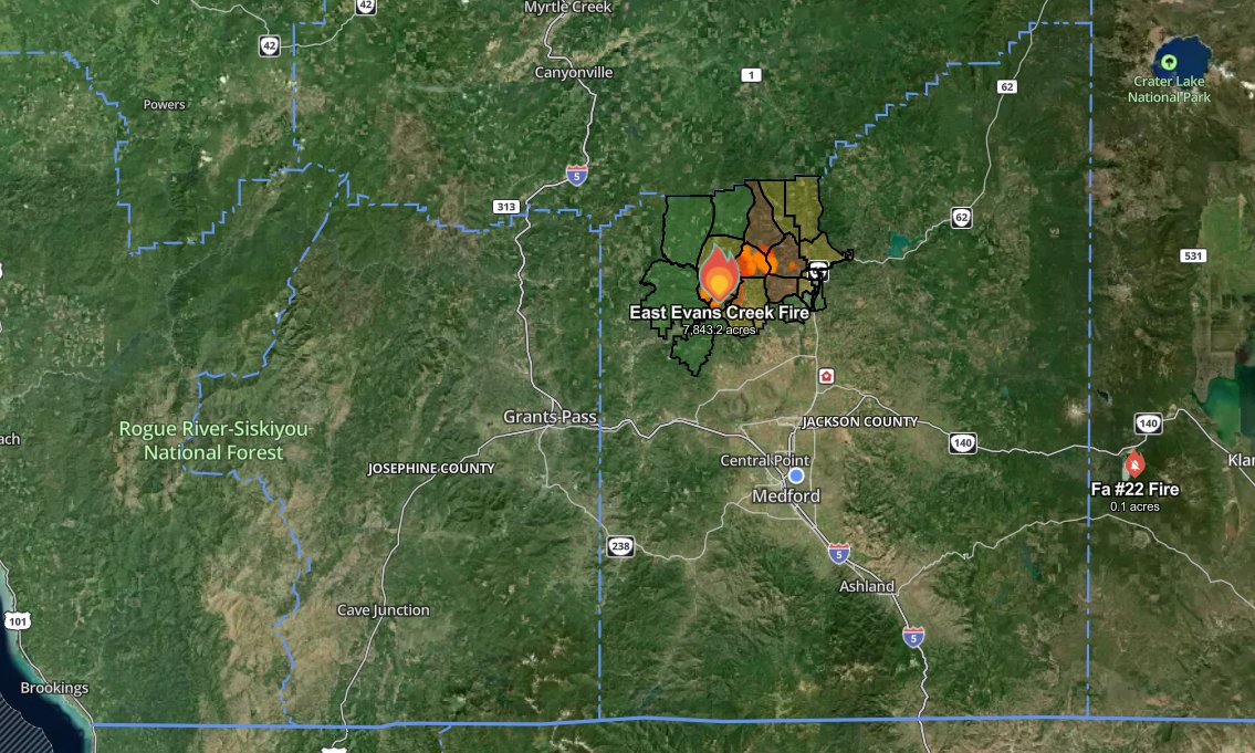
The July 15 public information map lists the East Evans Creek Fire at 7,843 acres and shows the main perimeter, Board Mountain spot fire, nearby roads, communities and public lands. View this map and the latest infrared, operations and briefing maps at https://jeffersondailynews.com/firewatch/evans-creek-fire-maps
BOARD MOUNTAIN SPOT FIRE ESTIMATED AT 1,000 ACRES
The Board Mountain spot fire is one of the larger fires established outside the East Evans Creek Fire’s primary perimeter during Tuesday’s active burning conditions.
ODF estimated the spot fire at approximately 1,000 acres Wednesday morning.
Additional firefighters, engines and heavy equipment were reassigned to Board Mountain overnight. Crews are working to slow its spread, construct direct fireline and identify areas where containment can be established.
Wildland and structural resources will continue operating around the clock with dozers, hand crews and engines across the northeastern and eastern portions of the incident.
Structure crews are also providing point protection for homes threatened by the fire.


TACTICAL FIRING OPERATION CONDUCTED OVERNIGHT
Firefighters conducted a small tactical firing operation on the western portion of the fire overnight.
The operation was used as the main fire moved uphill toward established containment features. Carefully burning vegetation between the advancing fire and those control lines can reduce available fuel and lessen the intensity of the main fire when it reaches the area.
Heavy equipment and firefighters also constructed direct line where terrain and conditions allowed.
HOMES AND INFRASTRUCTURE REMAIN A PRIORITY
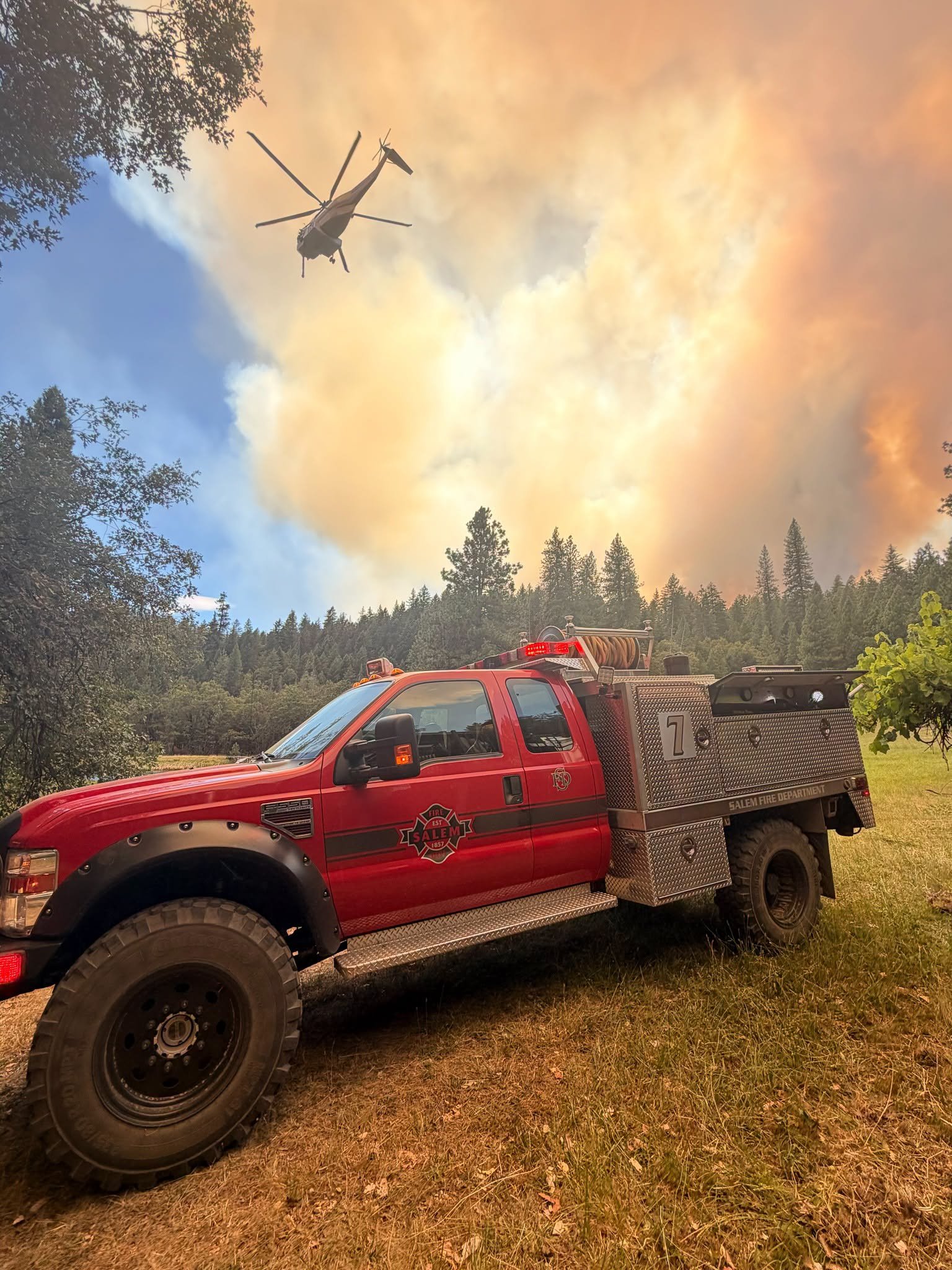
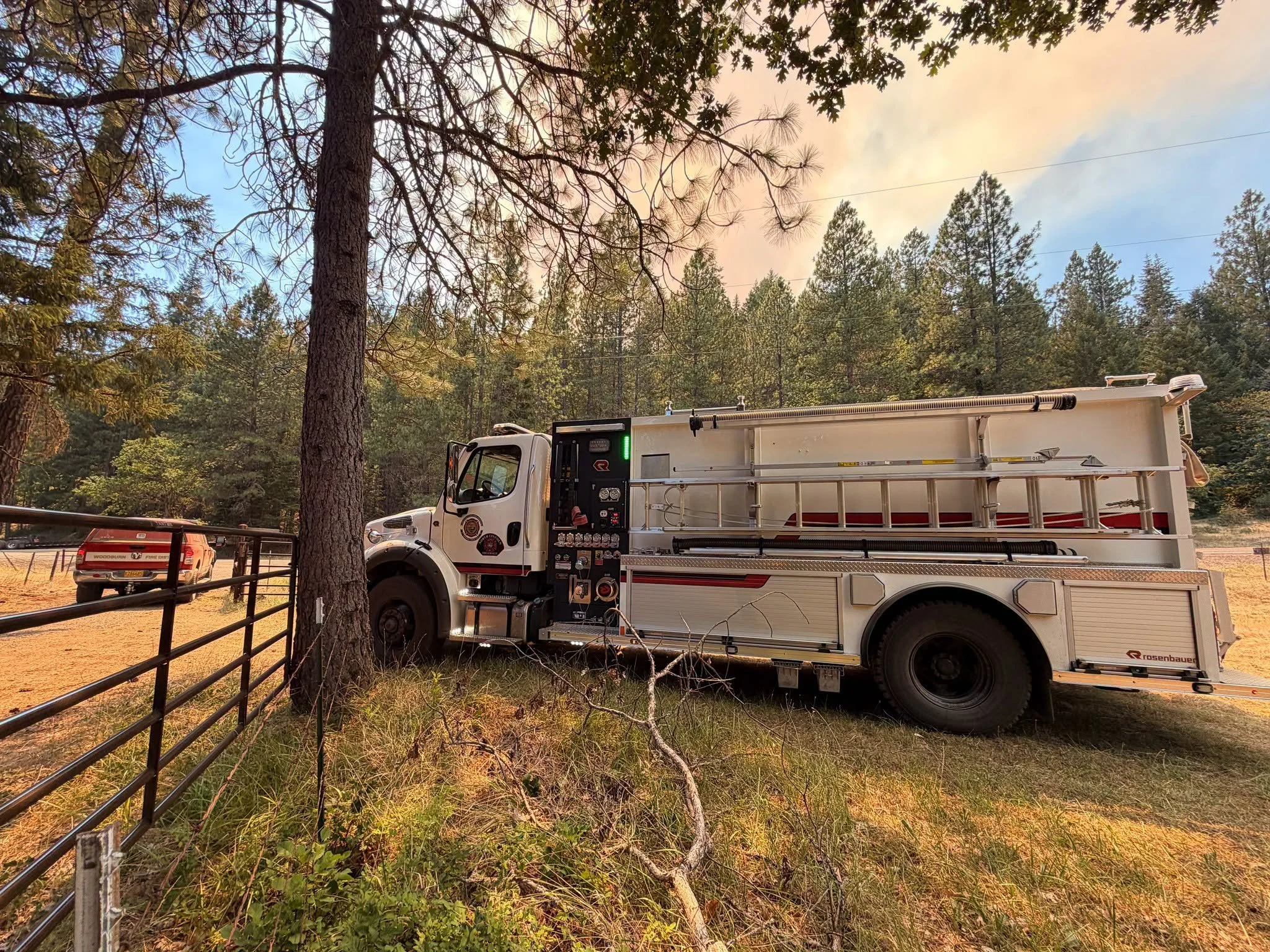
Oregon State Fire Marshal engines remain positioned along the eastern portion of the fire to protect homes and critical infrastructure.
Wildland and structural firefighters are working together to monitor threatened properties, improve defensible space and respond quickly to new spot fires.
On the southwestern edge of the incident, crews will continue clearing combustible material around structures and installing temporary water supplies to support suppression operations.
AIR AND GROUND RESOURCES WORK TOGETHER
Aircraft will continue supporting ground crews Wednesday by cooling active areas, slowing fire spread and helping firefighters construct and reinforce fireline.
Crews will aggressively engage new spot fires where conditions permit while adapting tactics to changing weather, steep terrain and limited access.
Additional resources continue arriving and are being assigned to areas where they can have the greatest effect.
Firefighters and incident management personnel gather for an early morning briefing on the East Evans Creek Fire as crews prepare for another operational period. (Oregon State Fire Marshal)
ELEVATED FIRE ACTIVITY EXPECTED WEDNESDAY
Hot, dry weather is expected to combine with local winds, steep terrain and highly receptive vegetation Wednesday afternoon.
Officials warned those conditions could produce increased fire intensity, rapid rates of spread and additional spotting during the hottest part of the day.
Firefighters will continue using direct attack where it can be performed safely while adjusting operations as conditions change.

𝘾𝙊𝙈𝙈𝙐𝙉𝙄𝙏𝙔 𝙈𝙀𝙀𝙏𝙄𝙉𝙂 𝙏𝙊𝙉𝙄𝙂𝙃𝙏: ODF CIMT 1 and OSFM Blue Team are holding a community meeting to provide an update on the East Evans Creek Fire, in-person and streamed online via Facebook.com/ODFSouthwest and posted to Youtube afterward. It will be held tonight at 6:30 p.m. at the Shady Cove School Gym, located at 100 Cleveland St, Shady Cove, OR. Parking available at the Gym, as well as the school at 37 Schoolhouse Lane.
COMMUNITY MEETING SET FOR WEDNESDAY
Fire officials will hold a community meeting at 6:30 p.m. Wednesday, July 15, to provide an update on the East Evans Creek Fire.
In-person meeting:
Shady Cove School Gym
100 Cleveland Street, Shady Cove
Hosted viewing location:
Jackson County District 1
5474 North River Road, Gold Hill
The meeting will also stream online through the ODF Southwest Oregon Facebook page.
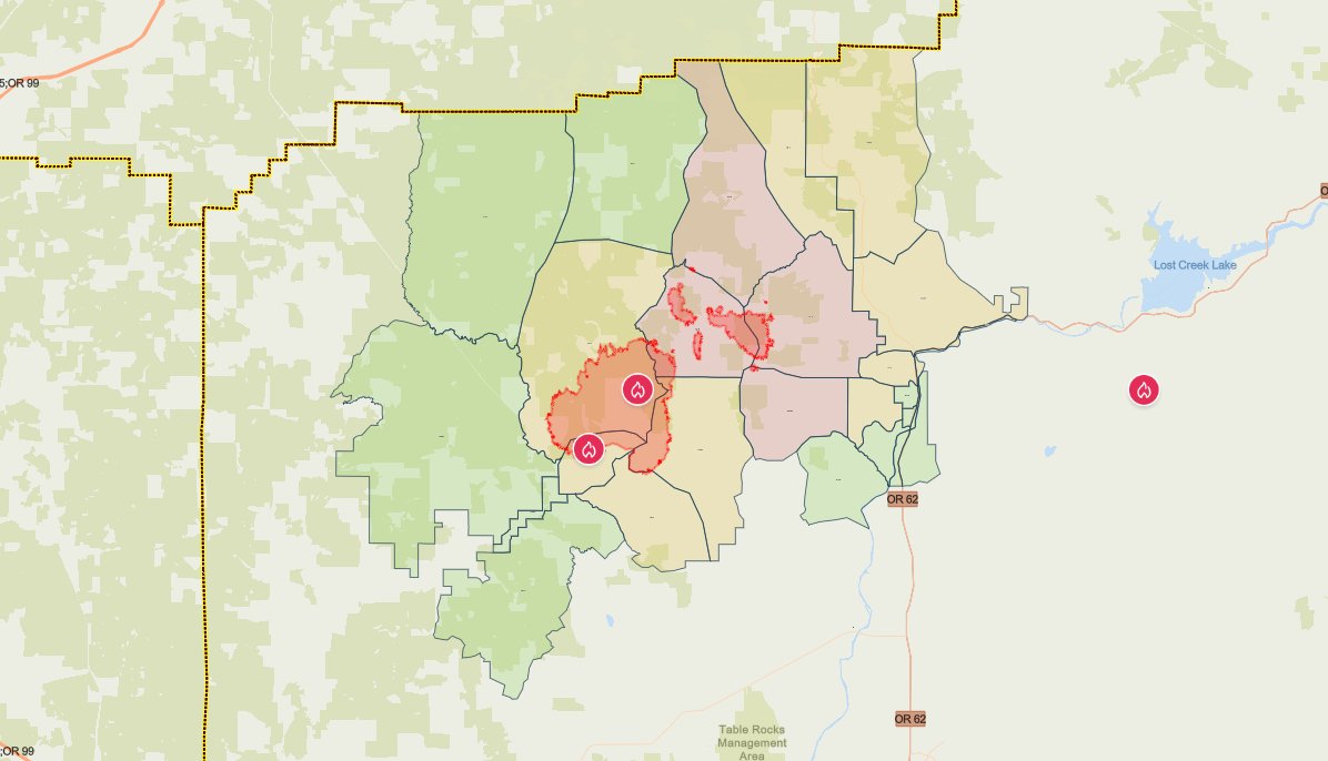
The latest evacuation map showing level 1, 2, and 3 evacuations due to the East Evans Creek Fire. Residents should use the interactive Genasys map to check current conditions for a specific address. (Jackson County Sheriff’s Office/Jackson County Emergency Management)
UPDATED EVACUATION LEVELS
Jackson County Sheriff’s Office and Jackson County Emergency Management issued several evacuation upgrades Wednesday evening.
Level 3: Go Now
JAC-109
JAC-124
JAC-126
JAC-149B
JAC-126 includes areas near West Fork Trail Creek and Cabin Creek. JAC-149B includes areas near the north end of Long Branch Road.
Residents in Level 3 zones should leave immediately. It is unsafe to remain in the area.
Level 2: Be Set
JAC-016
JAC-017
JAC-111
JAC-112
JAC-127
JAC-131
JAC-132
JAC-133
JAC-134
JAC-147
JAC-148
JAC-149A
Level 1: Be Ready
JAC-003
JAC-004
JAC-014
JAC-026
JAC-036
JAC-158
SHC-151
SHC-152
SHC-153
SHC-154
SHC-156
SHC-157
SHC-158
The SHC zones place the city of Shady Cove under a Level 1: Be Ready notice.
Residents should monitor official alerts closely. Mapping platforms may update at different times as evacuation levels change.

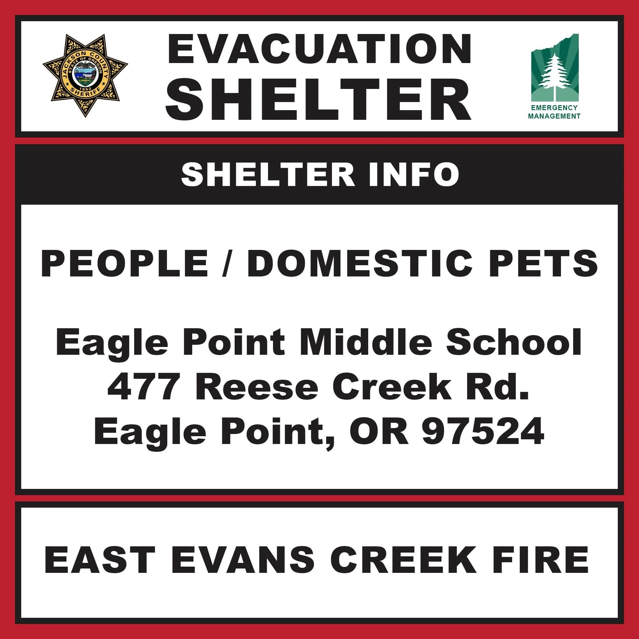
EVACUATION SHELTER MOVED TO EAGLE POINT
The evacuation shelter for residents and domestic pets affected by the East Evans Creek Fire has moved to:
Eagle Point Middle School
477 Reese Creek Road, Eagle Point, OR 97524
The previous shelter at Hanby Middle School in Gold Hill is now closed.
Pets are welcome at the new shelter but will not be allowed inside the school building. The American Red Cross will establish an area on the property to accommodate domestic pets.
Anyone needing additional medical care or assistance while sheltering should call 541-776-7206. The same number should be used for livestock sheltering assistance.

BLM LAND CLOSURE REMAINS IN EFFECT
BLM-administered lands near the East Evans Creek Fire remain closed to public entry.
The closure includes hunting, hiking and camping. The order is intended to protect the public and allow firefighters and heavy equipment to operate safely.
SMOKE, ROAD AND AIRSPACE RESTRICTIONS
Smoke may settle into valleys and other low-lying areas, reducing visibility and affecting air quality in nearby communities. Conditions may change throughout the day as winds shift.
East Evans Creek Road remains closed to public traffic at Meadows Road.
A temporary flight restriction remains in effect over the fire 24 hours a day. Flying a drone near a wildfire is illegal and can force firefighting aircraft to suspend operations.
The fire began at approximately 2:41 p.m. Friday after a vehicle crashed into a power pole and ignited dry vegetation. The Jackson County Sheriff’s Office continues investigating the cause of the crash.
Cover image: Firefighters and incident management personnel gather for an operational briefing as a large smoke column rises from the East Evans Creek Fire in the background. (Oregon State Fire Marshal)


More Firewatch




ODF Southwest Oregon’s 4 Alpha Fox helicopter has completed its 75-day seasonal contract after introducing approved night-vision wildfire flights this year. One recent after-dark mission located three lightning-caused fires.