

East Evans Creek Fire
East Evans Creek Fire Maps
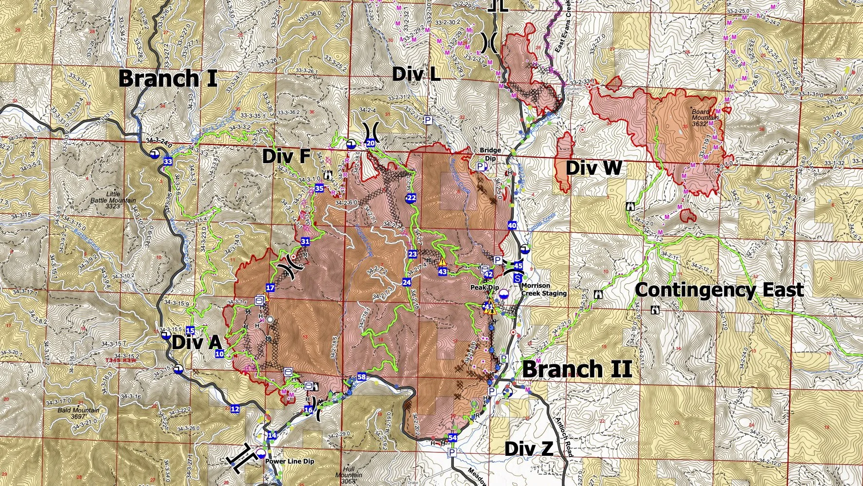
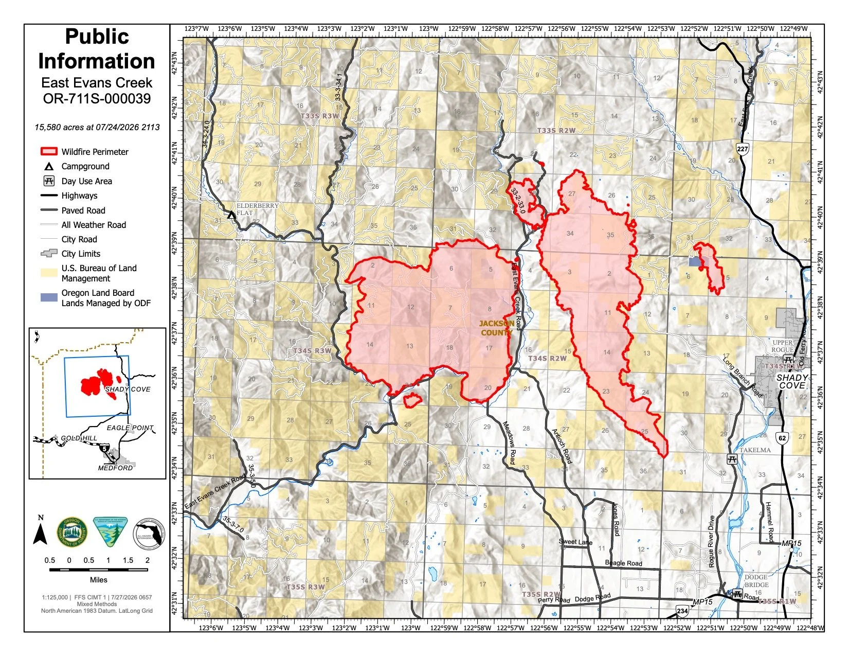
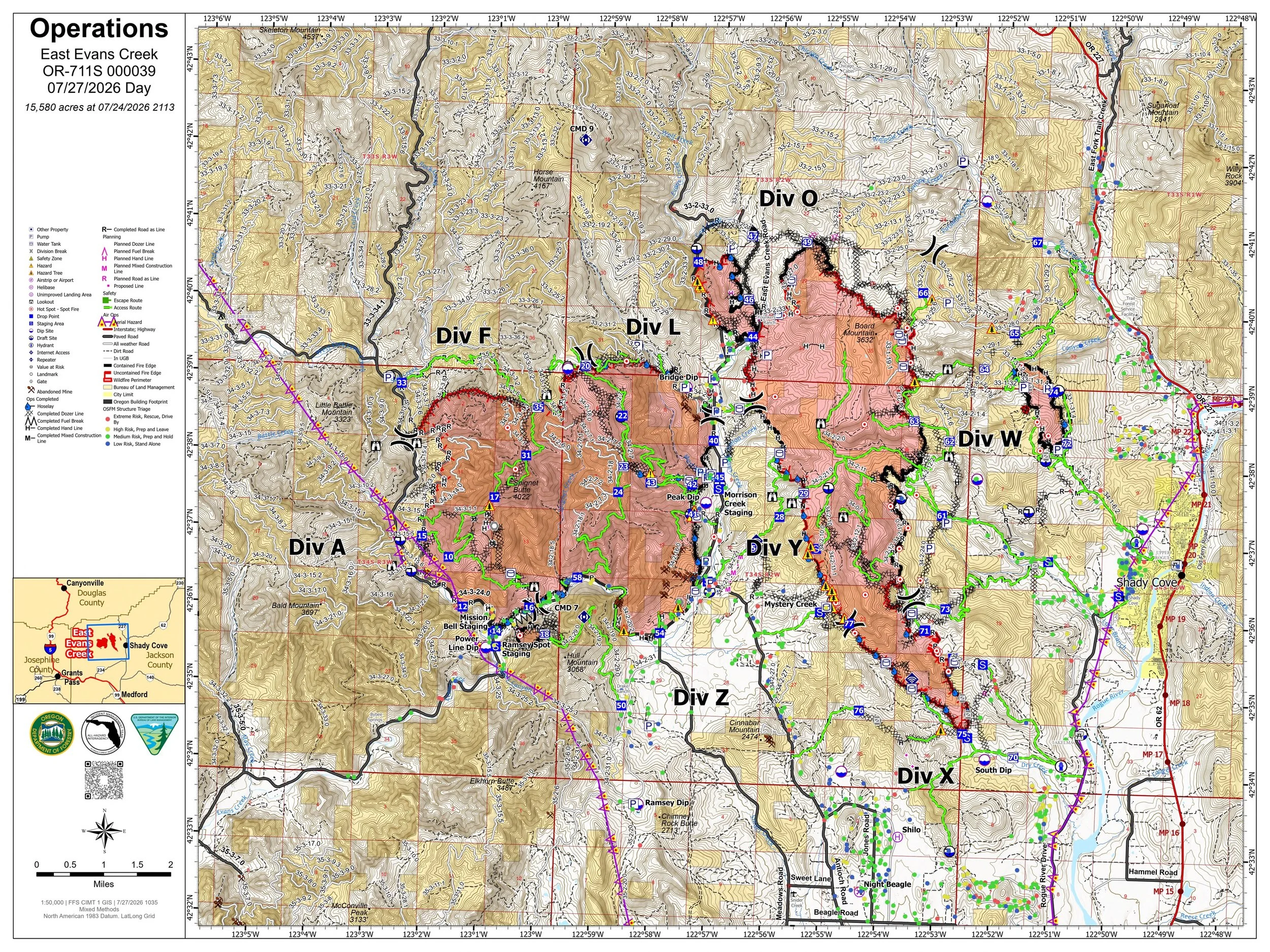
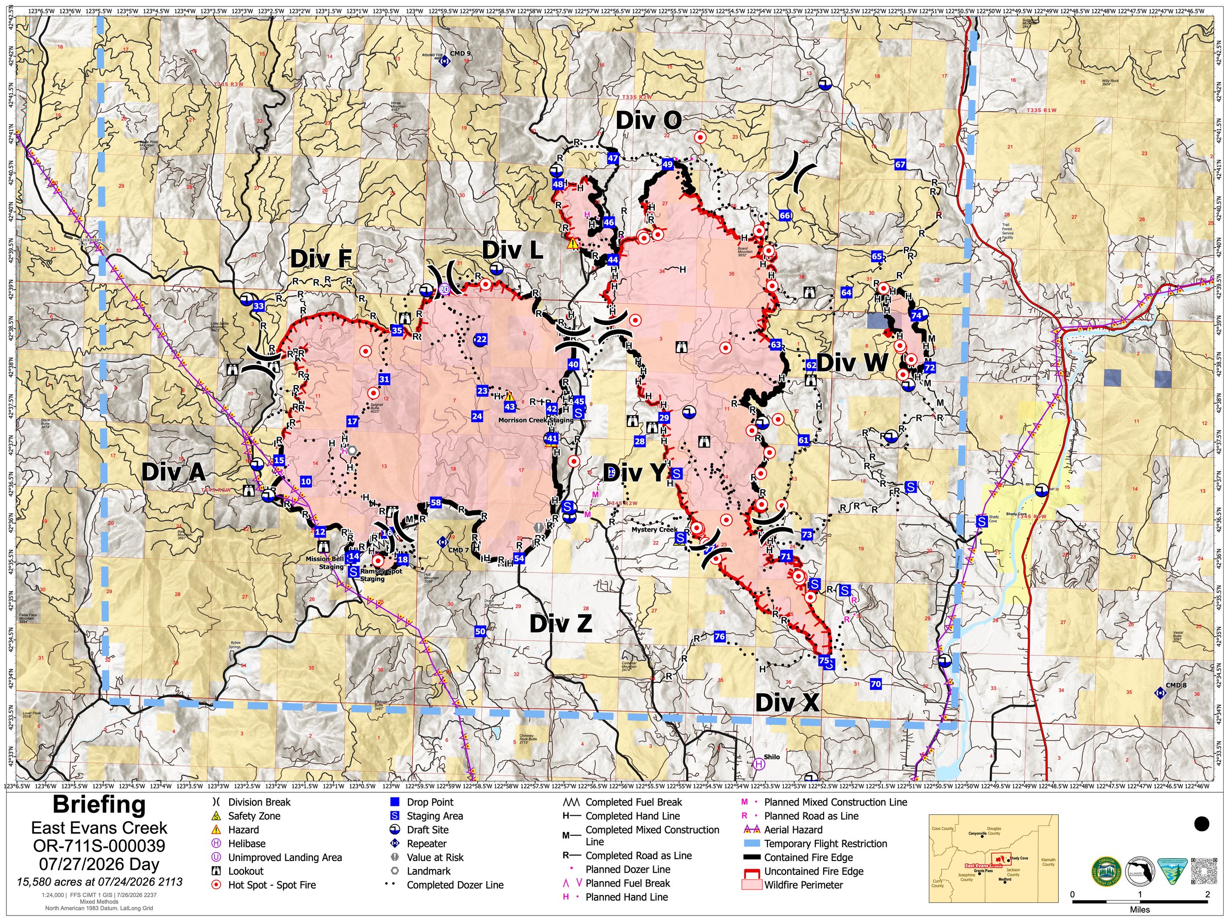
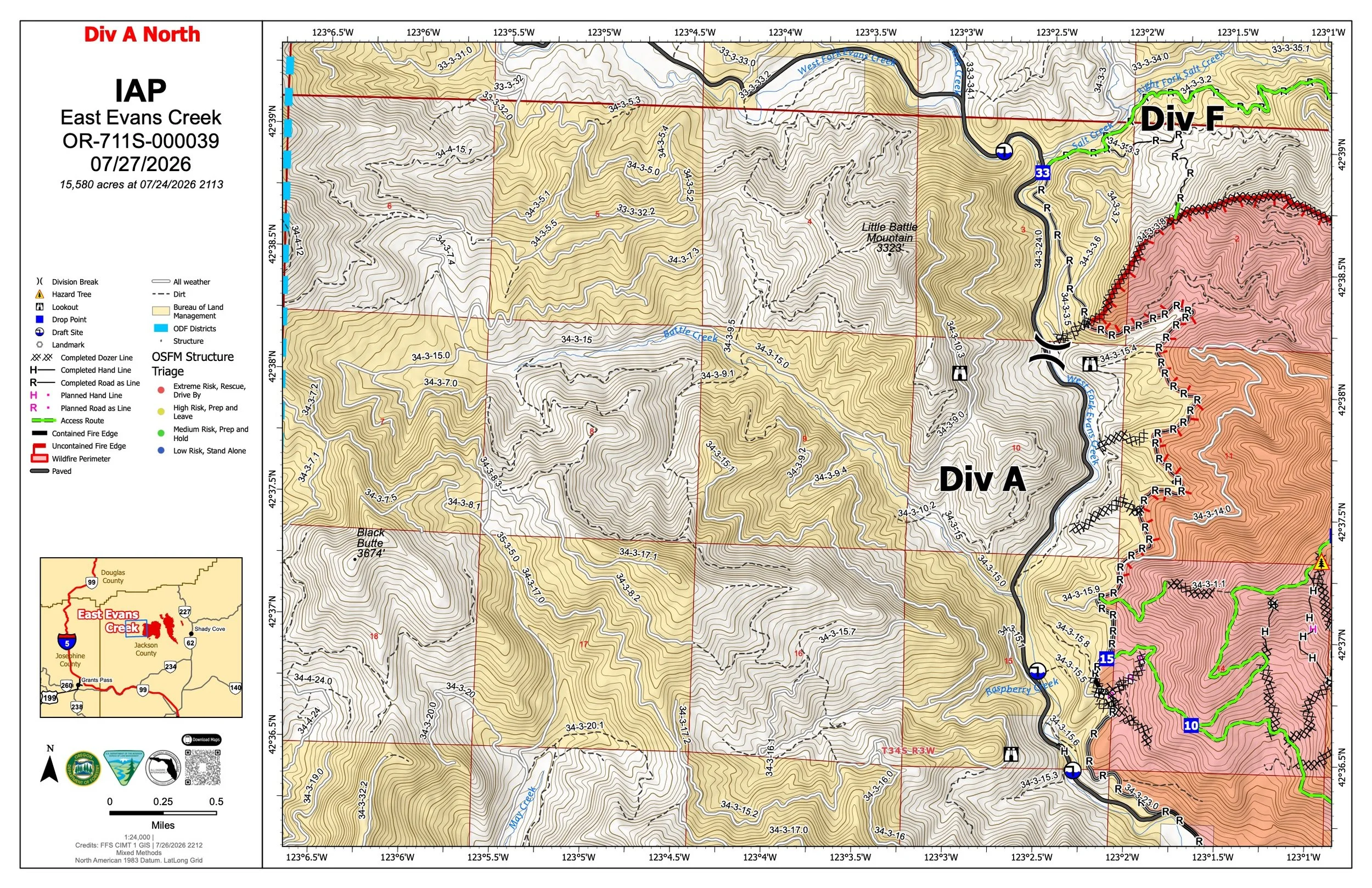
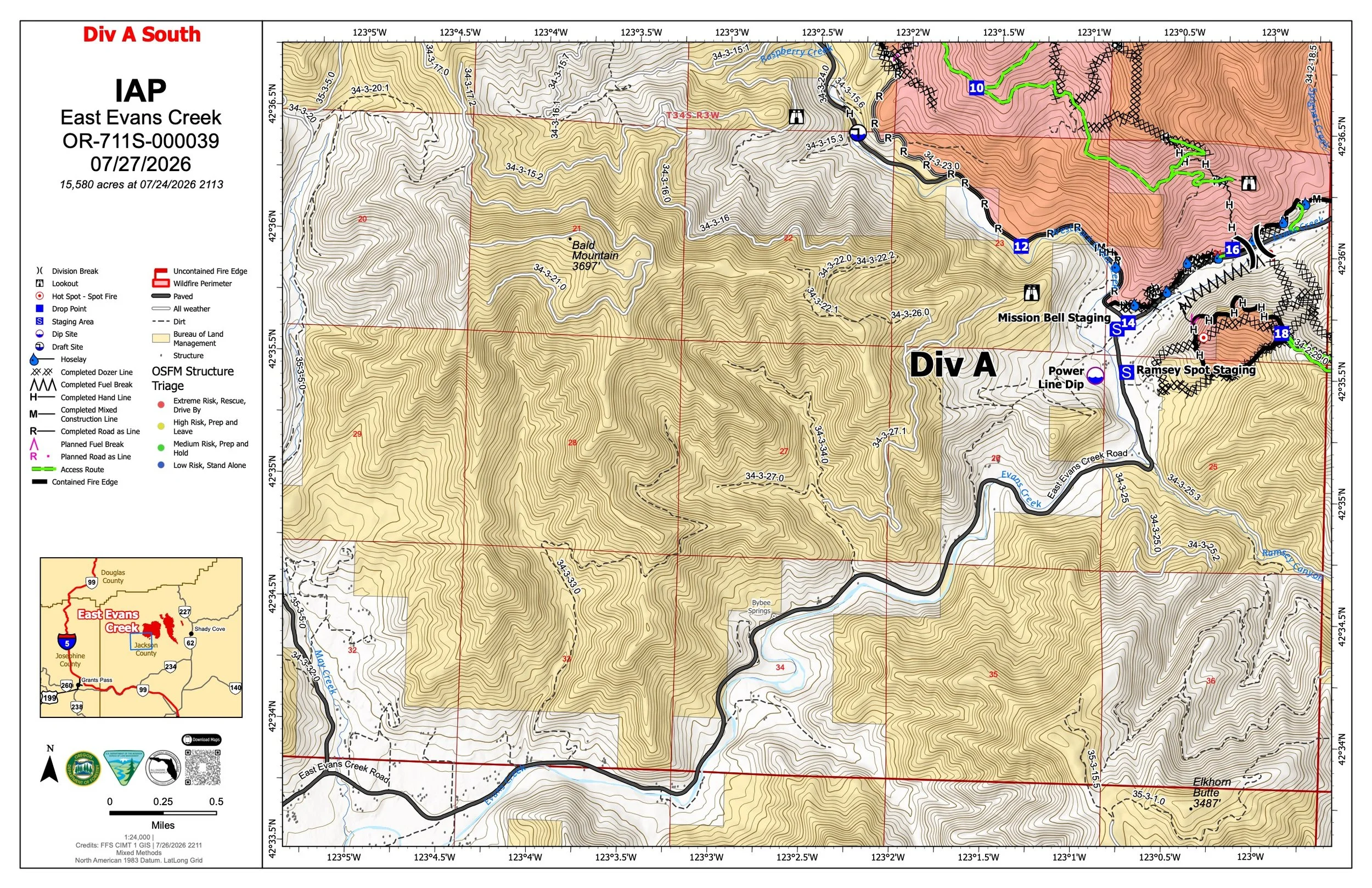
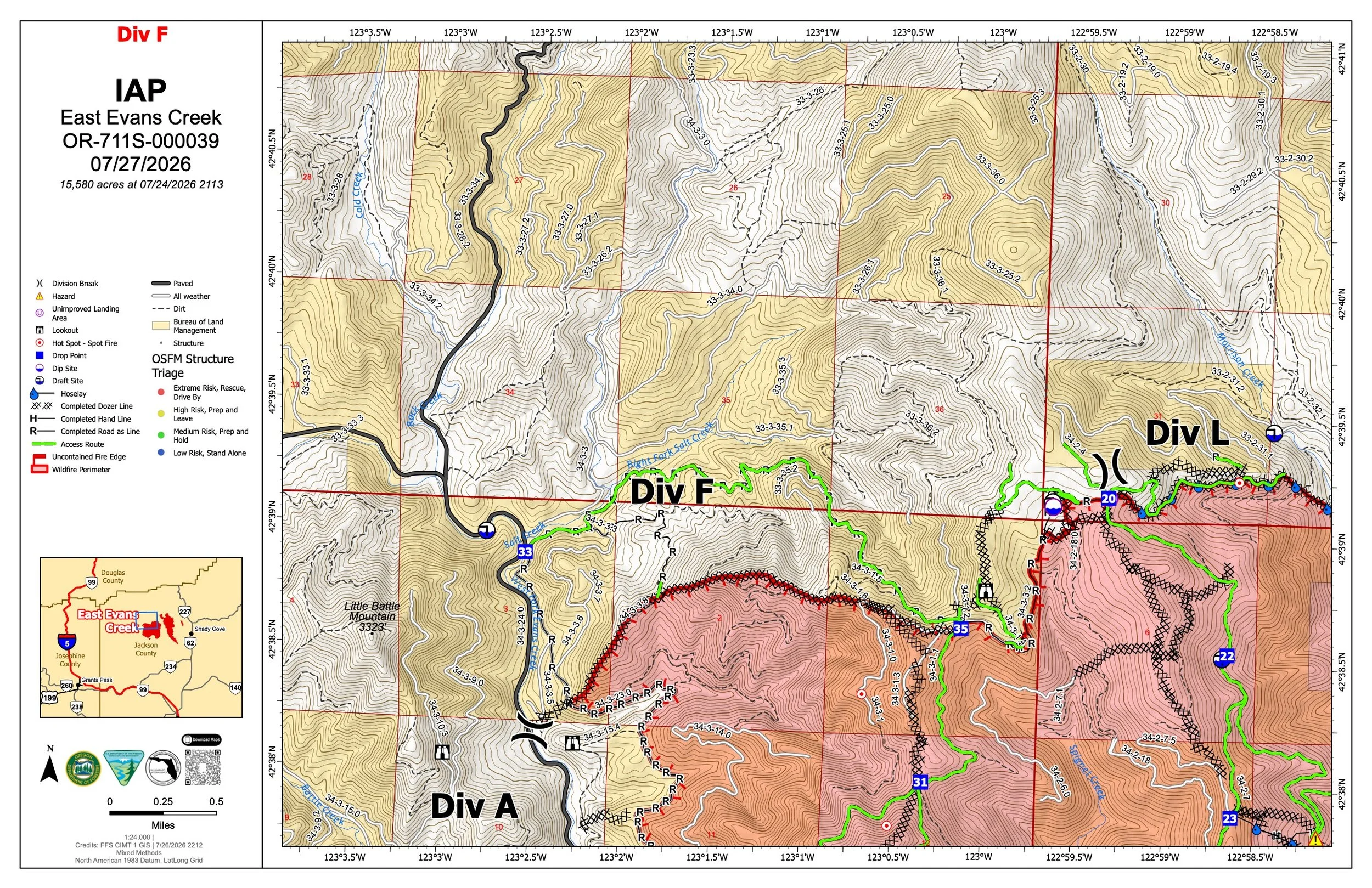
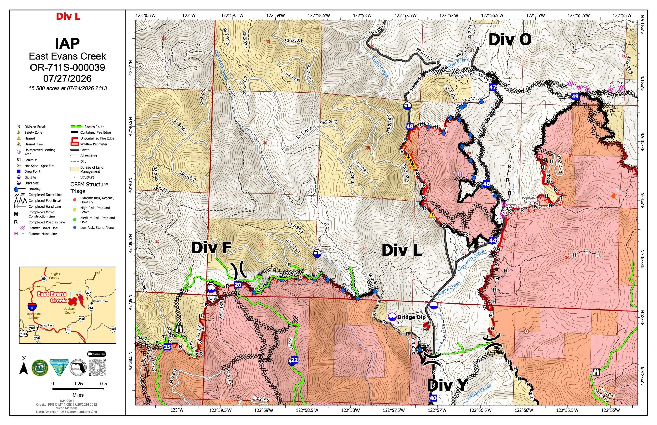
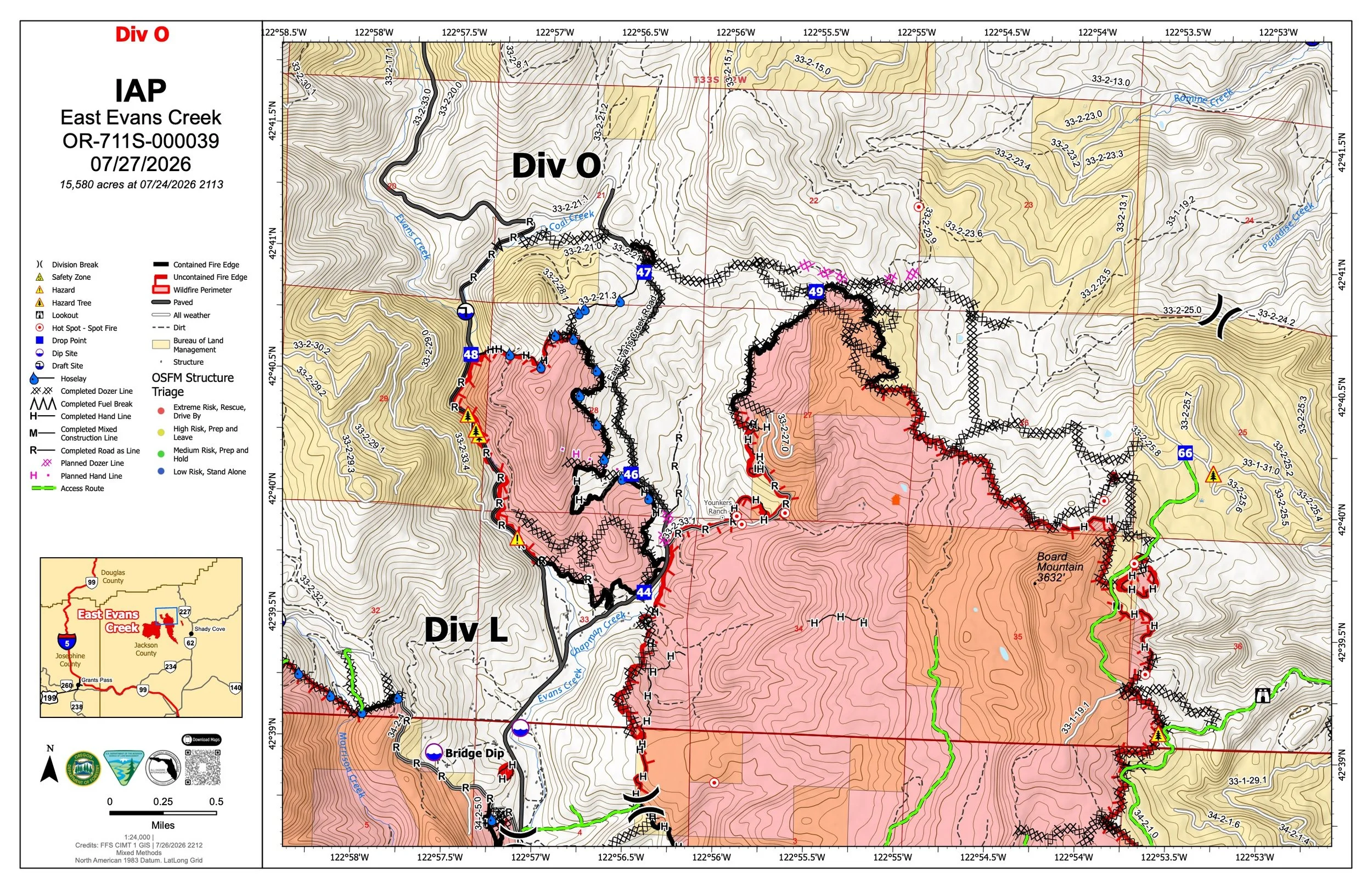
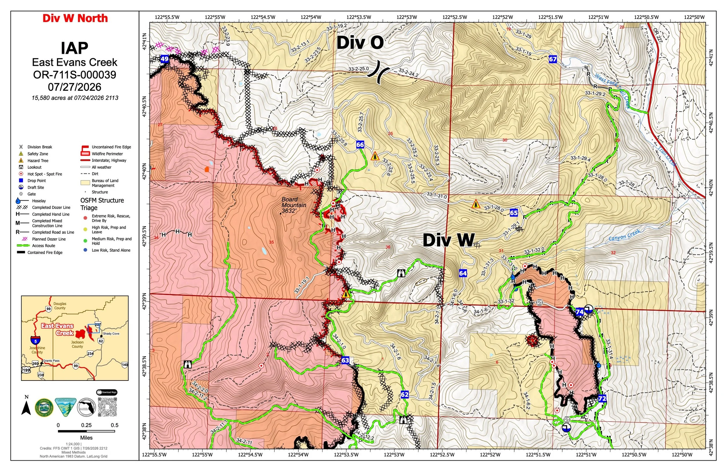
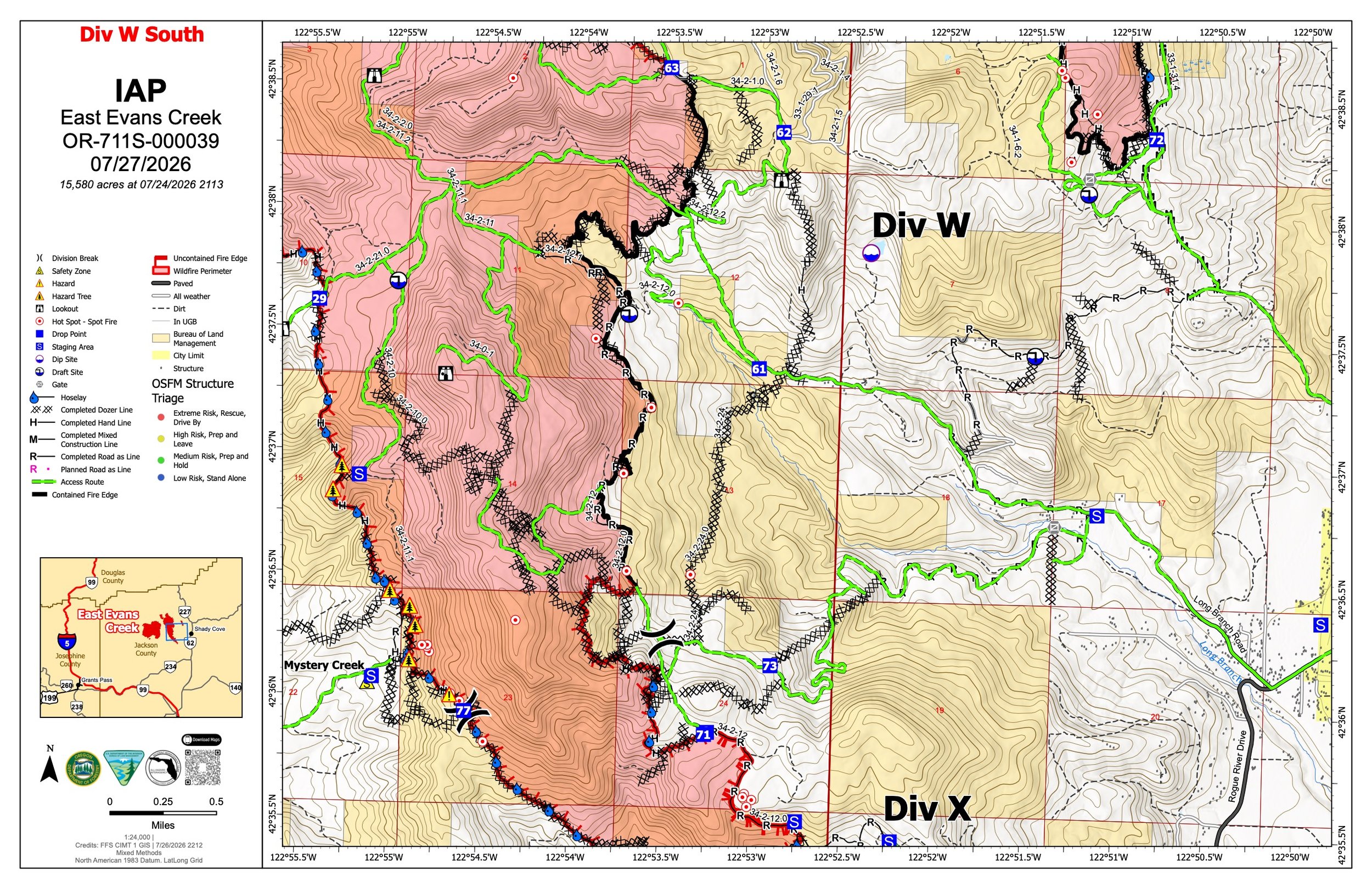
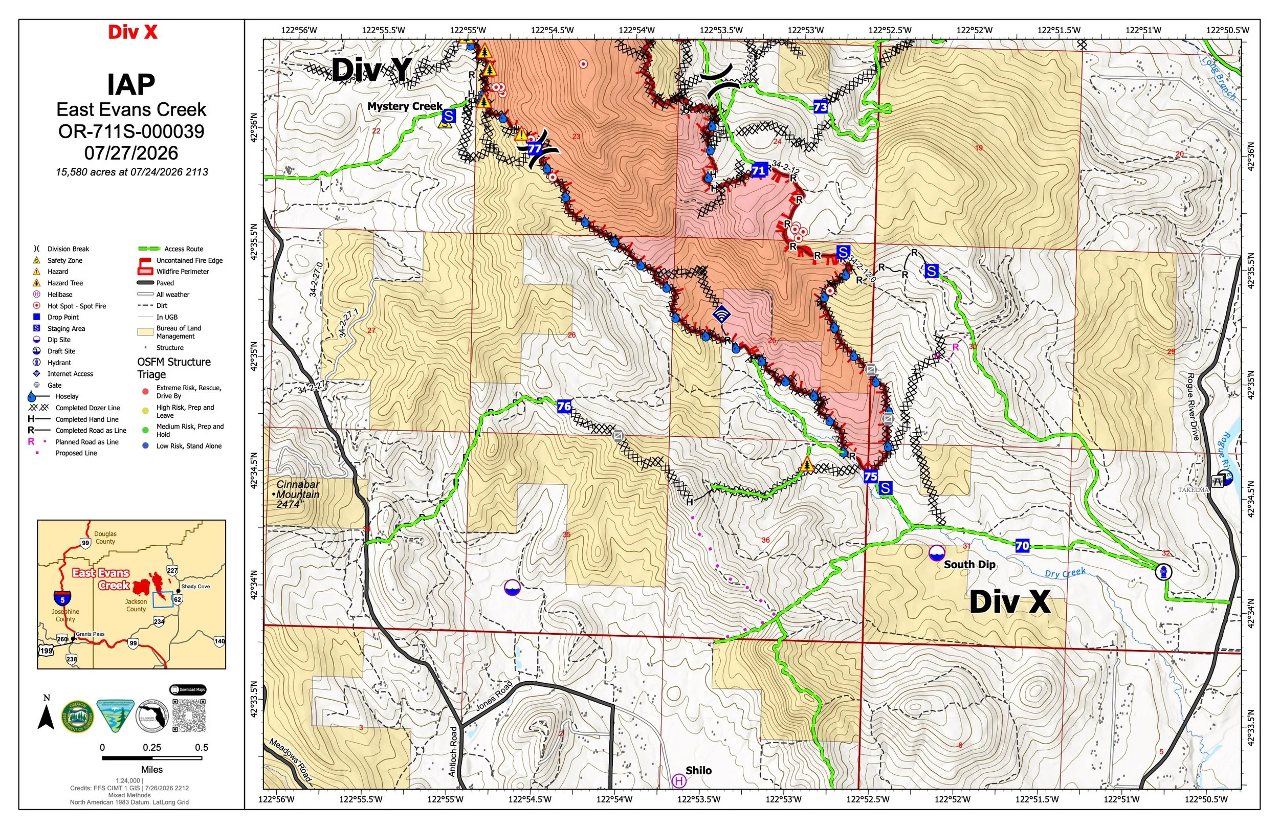
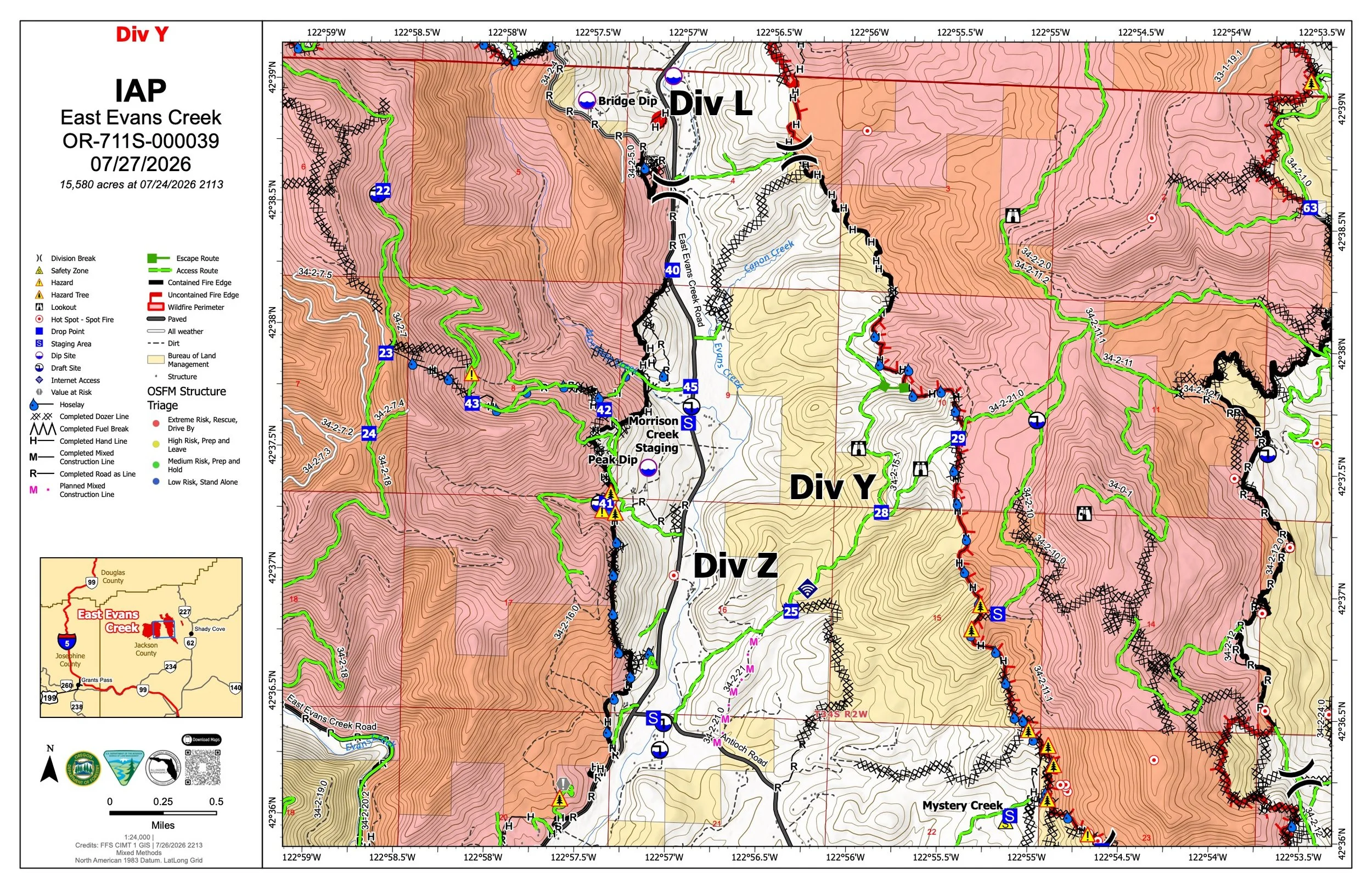
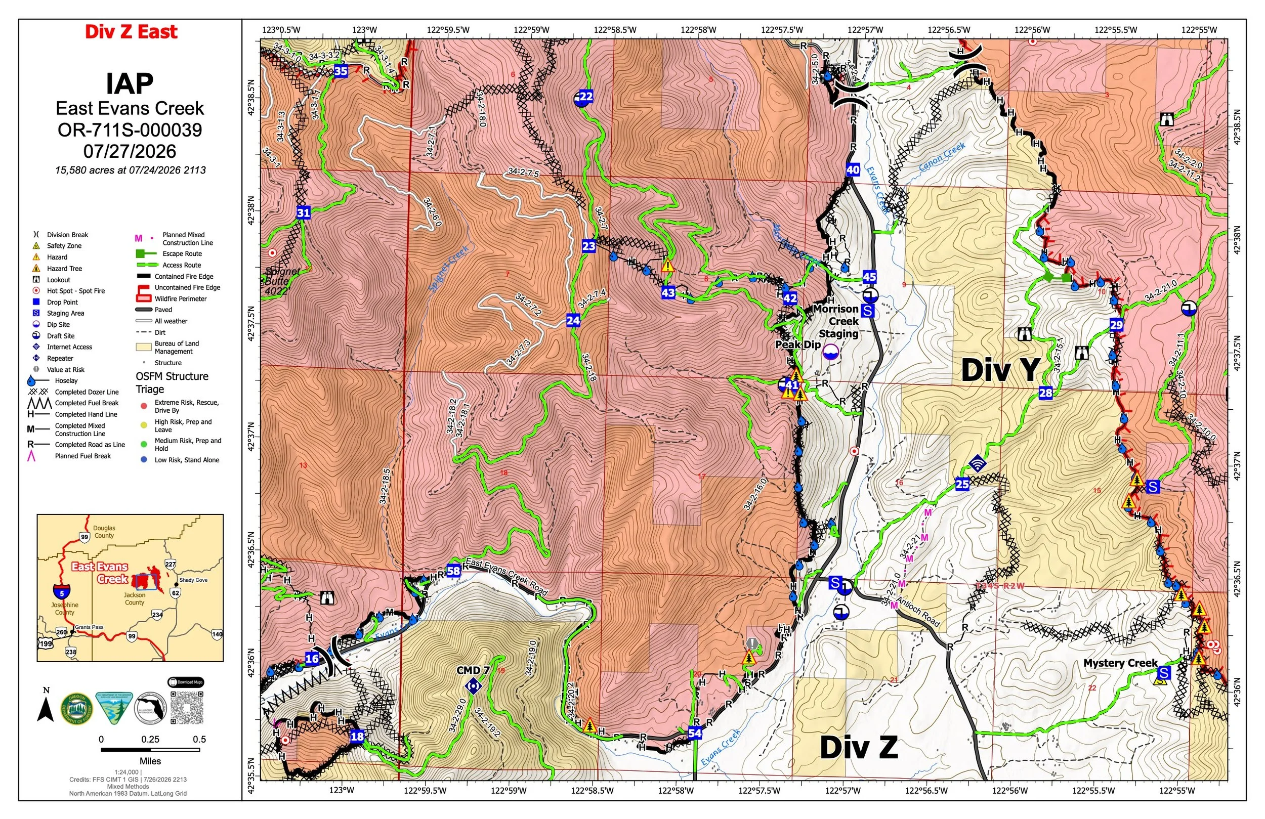
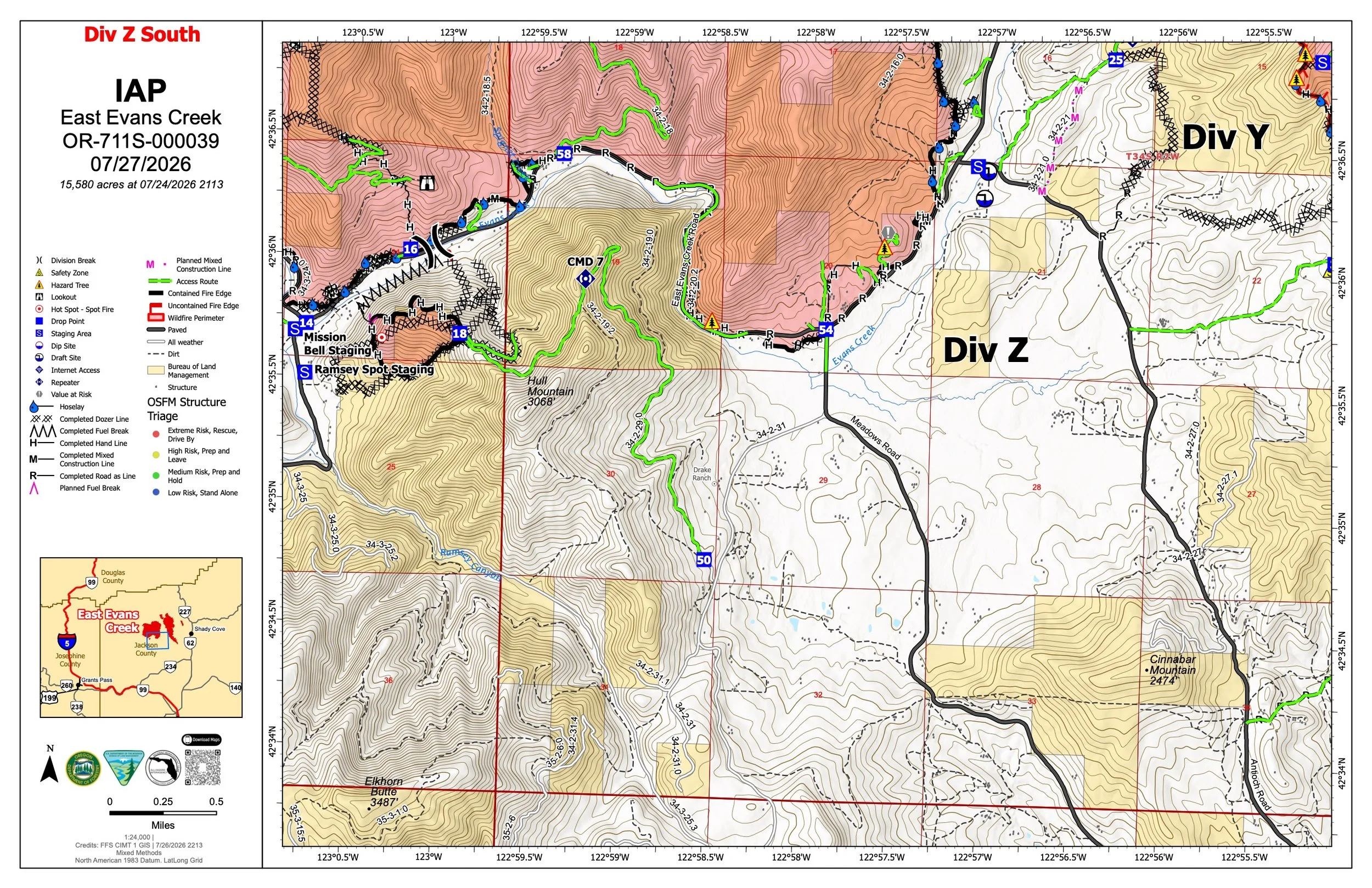
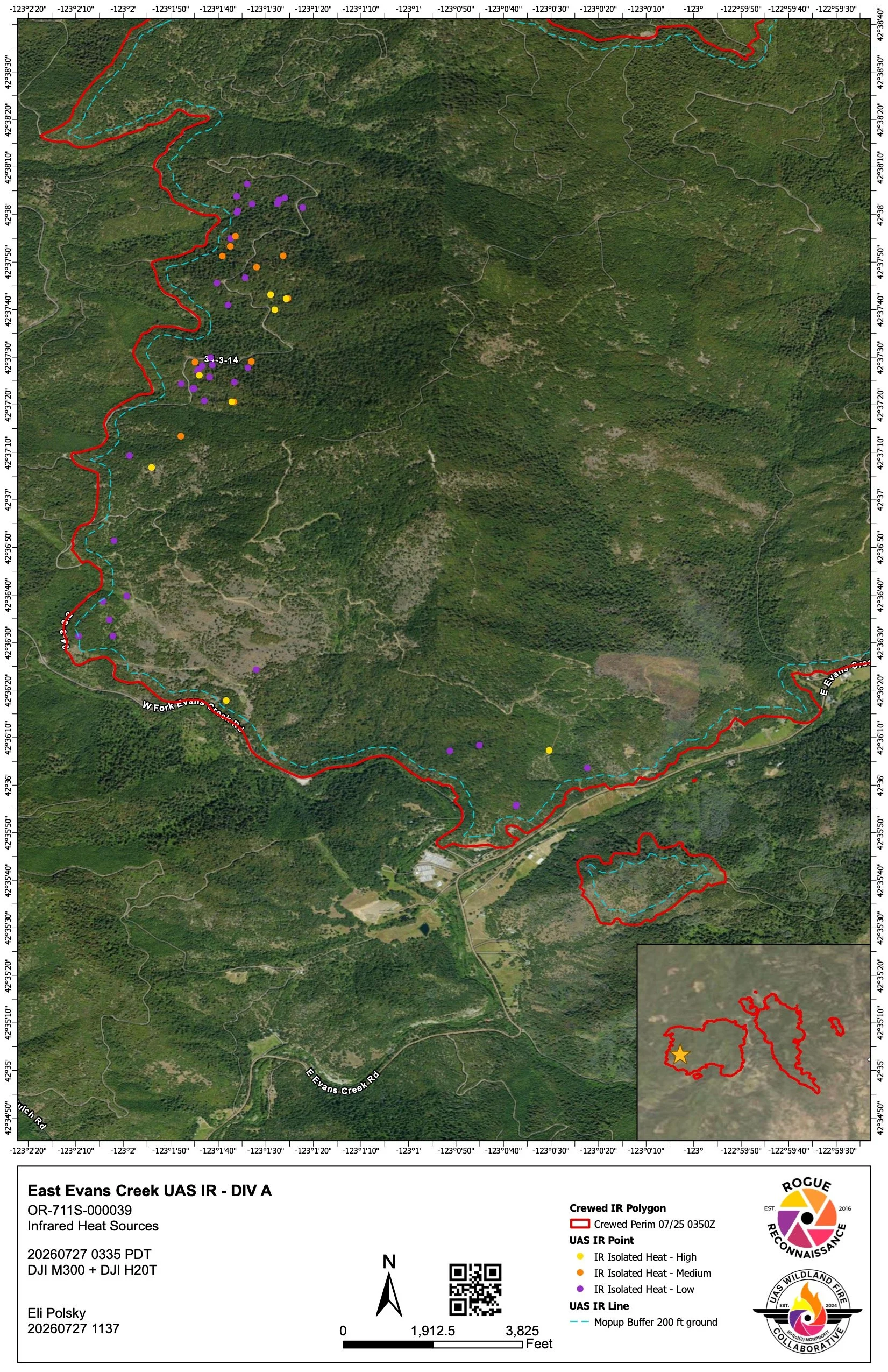
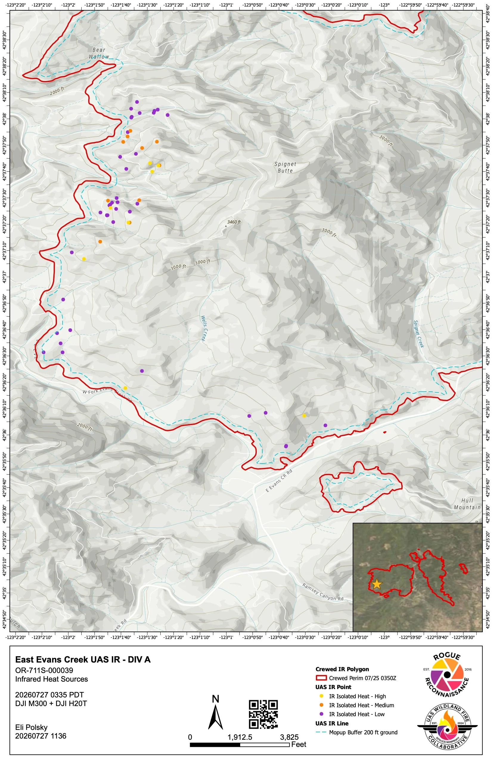
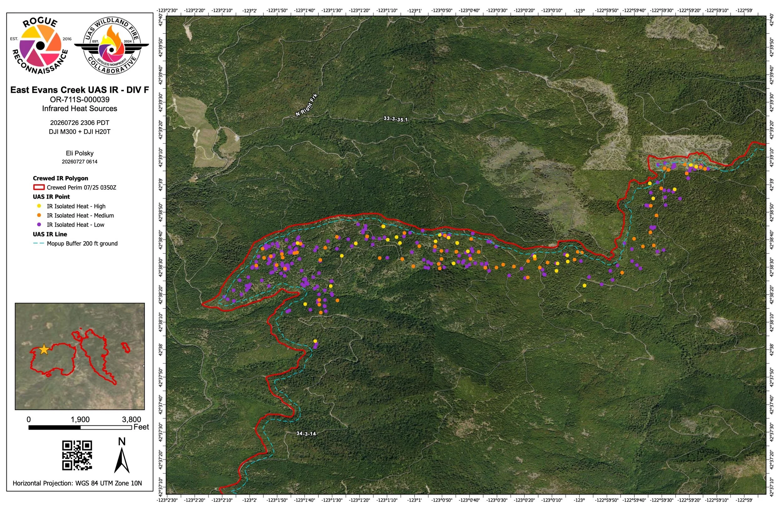
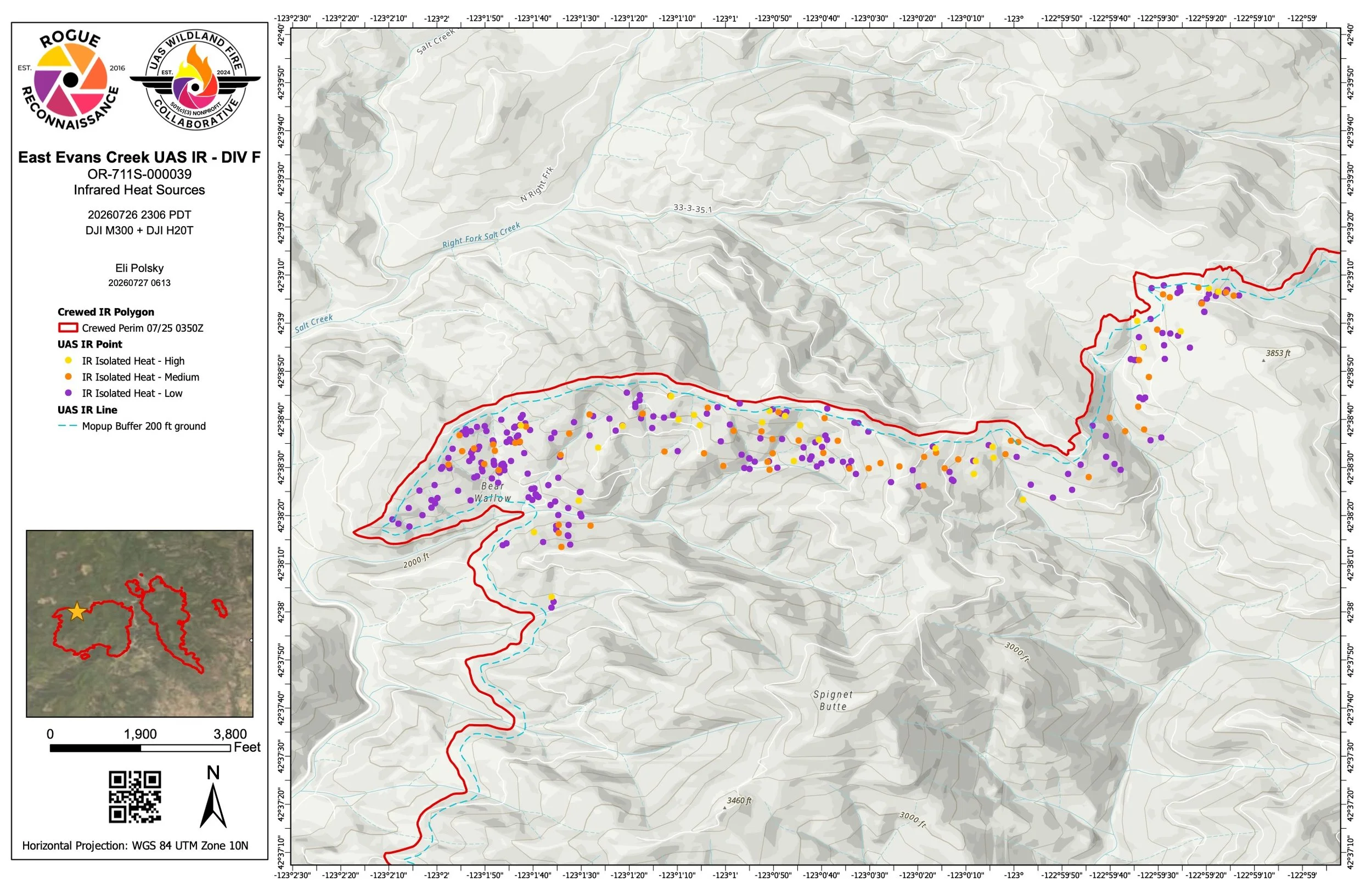
View the latest official maps for the East Evans Creek Fire in Jackson County, including infrared, operations, briefing and public information maps. Maps are updated as new products are released by fire command. Select any map to enlarge.
Fire Status
Updated: August 6, 2026
Acres: 15,580
Containment: 98%
Evacuations: All evacuation notices have been canceled.
Road Closures: All fire-related road closures have been lifted.
Current Activity: Light interior smoke may continue as isolated heavy fuels smolder within the established perimeter.
Mop-Up: Crews continue searching for hidden heat. Infrared mapping identified several hotspots near Dry Creek within the 300-foot mop-up zone, which firefighters extinguished.
Suppression Repair: Hose and equipment are being removed from secured areas. Chippers continue processing brush and small trees cut during suppression operations.
Resources: Non-local resources have been releaswed.
Weather: Warm and dry, with temperatures near 90 degrees, low humidity, and gusty afternoon breezes.
Cause: Vehicle crash into a power pole; the cause of the crash remains under investigation.
Emergency Information: Jefferson Firewatch provides news and incident information. Always follow evacuation orders and emergency instructions issued by public safety officials.