
East Evans Creek Fire Holds at 13,090 Acres as Crews Brace for Critical Weekend Weather
More than 500 personnel work overnight as strong winds fuel activity near Board Mountain and crews reinforce spot-fire lines

FAST FIRE FACTS
Name: East Evans Creek Fire
Location: Approximately seven miles west of Shady Cove
Acres: 13,090, latest mapped
Containment: 5%
Personnel: More than 500 working overnight
Perimeter: Nearly 60 miles
Primary activity: Southern Board Mountain spot fire
Canyon Creek spot fire: Fully lined; eastern edge remains active
Hull Mountain spot fire: Fireline construction progressing
Structure protection: Active throughout the incident and near previously threatened homes
Aircraft: Operations delayed by inversion Friday; helicopters resumed work late in the day
Weather concern: Hotter, drier conditions and gusty northwest winds through the weekend
Cause: Vehicle crashed into a power pole; the cause of the crash remains under investigation
Updated: Friday evening, July 17, 2026
East Evans Creek Fire PM update for 7/17/26.
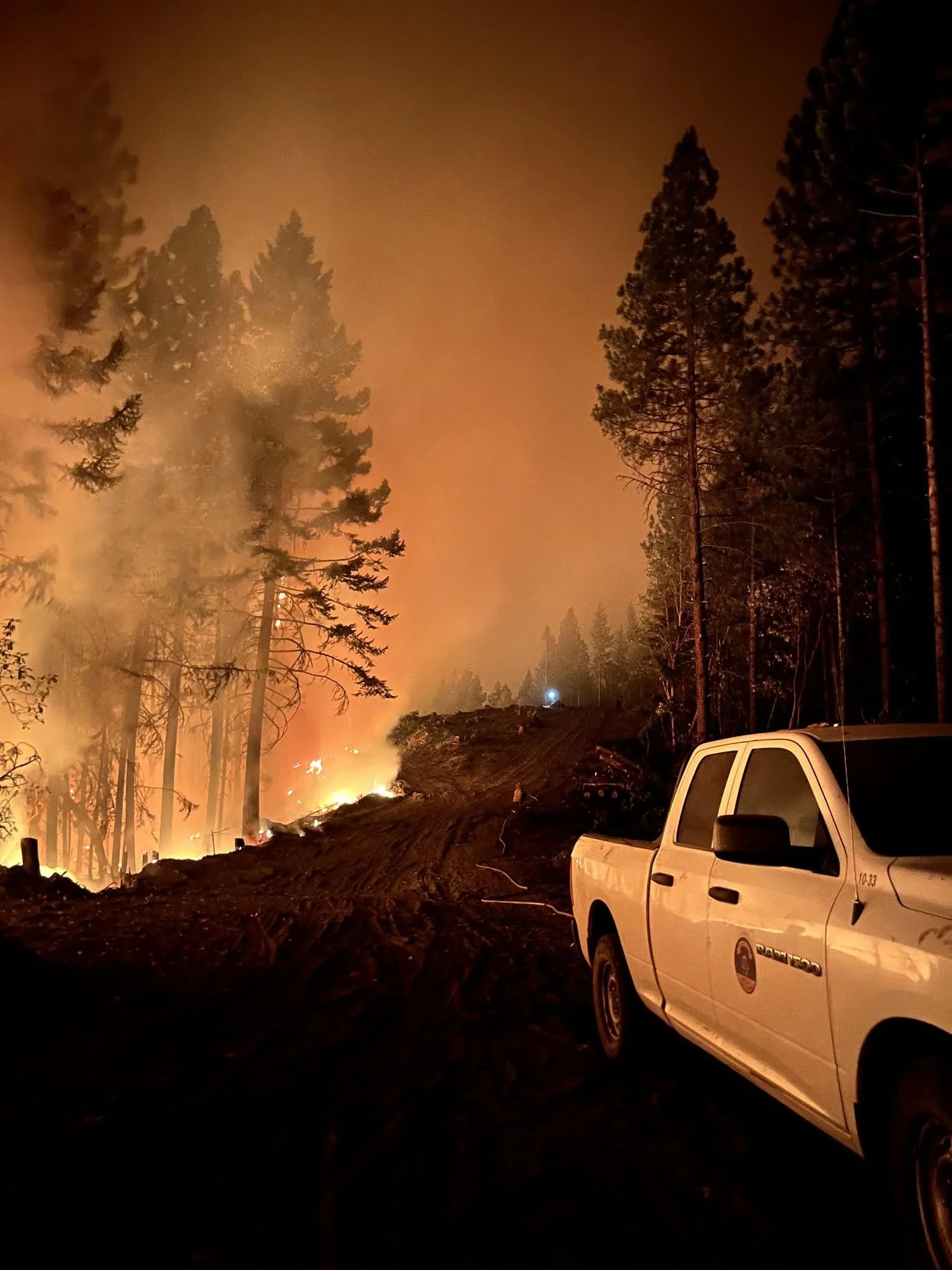
Flames burn through timber beside a newly constructed fireline as crews work overnight to hold an active edge of the East Evans Creek Fire. (Oregon Department of Forestry)
SAMS VALLEY, Ore. — Firefighters made steady progress across the East Evans Creek Fire Friday but entered the evening facing stronger northwest winds, increased activity near Board Mountain and hotter, drier weather expected through the weekend.
The fire remains mapped at 13,090 acres and 5% containment.
Crews continued strengthening containment lines, protecting homes and securing several spot fires throughout the day. Aircraft operations were delayed for much of Friday by a persistent inversion and limited visibility, but helicopters began supporting crews after conditions improved late in the afternoon.
More than 500 wildland firefighters, structural protection personnel and heavy equipment operators will remain on the incident overnight.
Fire officials will hold a community meeting Sunday, July 19, at 2 p.m. at the Shady Cove School Gym, 100 Cleveland Street. The meeting will also stream through the ODF Southwest Oregon District Facebook page.
ODF’s July 17 evening briefing provides an operational update on fire activity, containment work, structure protection and the critical weather expected through the weekend. (Oregon Department of Forestry)
The Board Mountain spot fire remains one of the most challenging portions of the incident.
Steep terrain and gusty winds increased fire activity along its southern edge Friday afternoon. Although the fire challenged established lines, firefighters already positioned in the area quickly engaged it.


Aircraft, bulldozers and hand crews worked together to slow the spread and reinforce suppression efforts. Firefighters remained actively engaged Friday evening as strong northwest winds continued pushing the fire.
Northwest of Hull Mountain, crews made progress constructing line around another spot fire despite difficult terrain. High-capacity pumping systems operated by structural engines supported extensive hose lays used to cool and hold the perimeter.
Fireline has been completed around the Canyon Creek spot fire, and hose is in place where terrain allows. The eastern edge remains active, requiring crews to continue strengthening and securing the line.
A Jackson County Roads employee staffs a closure as an electronic sign warns drivers of nearby fire activity. Crews are working day and night at closures on East Evans Creek Road, Antioch Road, Long Branch Road and Tiller-Trail Highway to protect firefighters and the public. (Courtesy Jackson County Parks)
On the western and northwestern portions of the main fire, firefighters adjusted portions of control line to use existing roads. Tactical firing operations were conducted where needed to remove unburned vegetation between the fire and established lines.
The northern perimeter remained secure through several operational periods without significant control problems. Along the eastern and southern edges, crews continued mopping up as far as 25 feet inside the perimeter to locate and extinguish hidden heat.

Structural resources remain positioned throughout the fire area. Crews continue improving defensible space, assessing additional properties and extinguishing lingering heat near homes previously affected by fire activity.
A helicopter assigned to the East Evans Creek Fire also supported the initial attack on a nearby incident Friday evening as agencies continued sharing resources across Oregon.
LATEST FIRE MAPS
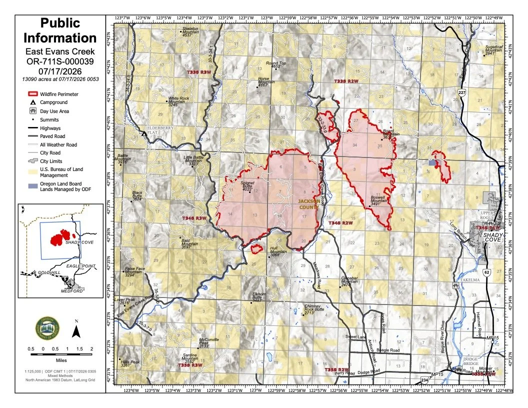
The July 17 public information map shows the East Evans Creek Fire at 13,090 acres, including the main western perimeter and associated spot fires extending east toward Board Mountain, Boswell Mountain and Canyon Creek. View all current maps on the East Evans Creek Fire Maps page. (Oregon Department of Forestry)
The latest public information and infrared maps show the East Evans Creek Fire at 13,090 acres, including the main western perimeter and separated spot fires extending east toward Board Mountain, Boswell Mountain and Canyon Creek.
The most recent infrared map identifies intense and scattered heat throughout portions of the main fire and associated spot-fire perimeters.
Select the maps below to enlarge. View the full collection of current public information, infrared, operations and briefing maps on the East Evans Creek Fire Maps page.
Fire Weather
Hotter and drier weather is expected through the weekend as humidity falls and gusty northwest winds continue across the fire area.
Friday’s persistent inversion moderated fire behavior during the morning but also limited visibility and delayed aircraft operations until late afternoon. Once the inversion lifted, stronger winds contributed to increased activity along the southern side of the Board Mountain spot fire.
Overnight crews will focus on reinforcing containment lines and positioning personnel and equipment for flare-ups before conditions become more challenging.
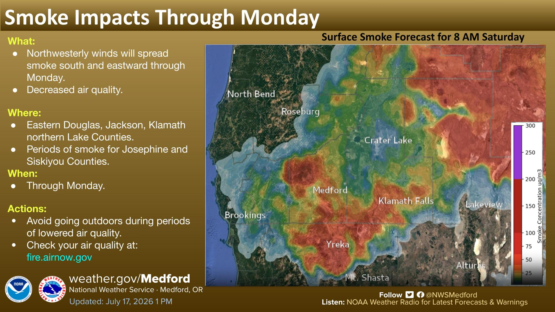
A map of Watches, Warnings, and Advisories from NWS Medford shows the region expected to experience issues with air quality.
The National Weather Service in Medford said wildfire smoke will continue reducing air quality across portions of southwest Oregon and Northern California.
Smoke is expected to spread east and southeast across eastern Douglas, Jackson, Klamath and northern Lake counties, with periods of smoke also possible in Josephine and Siskiyou counties.
Residents should monitor current conditions and avoid strenuous outdoor activity when air quality deteriorates.
FIRE DANGER
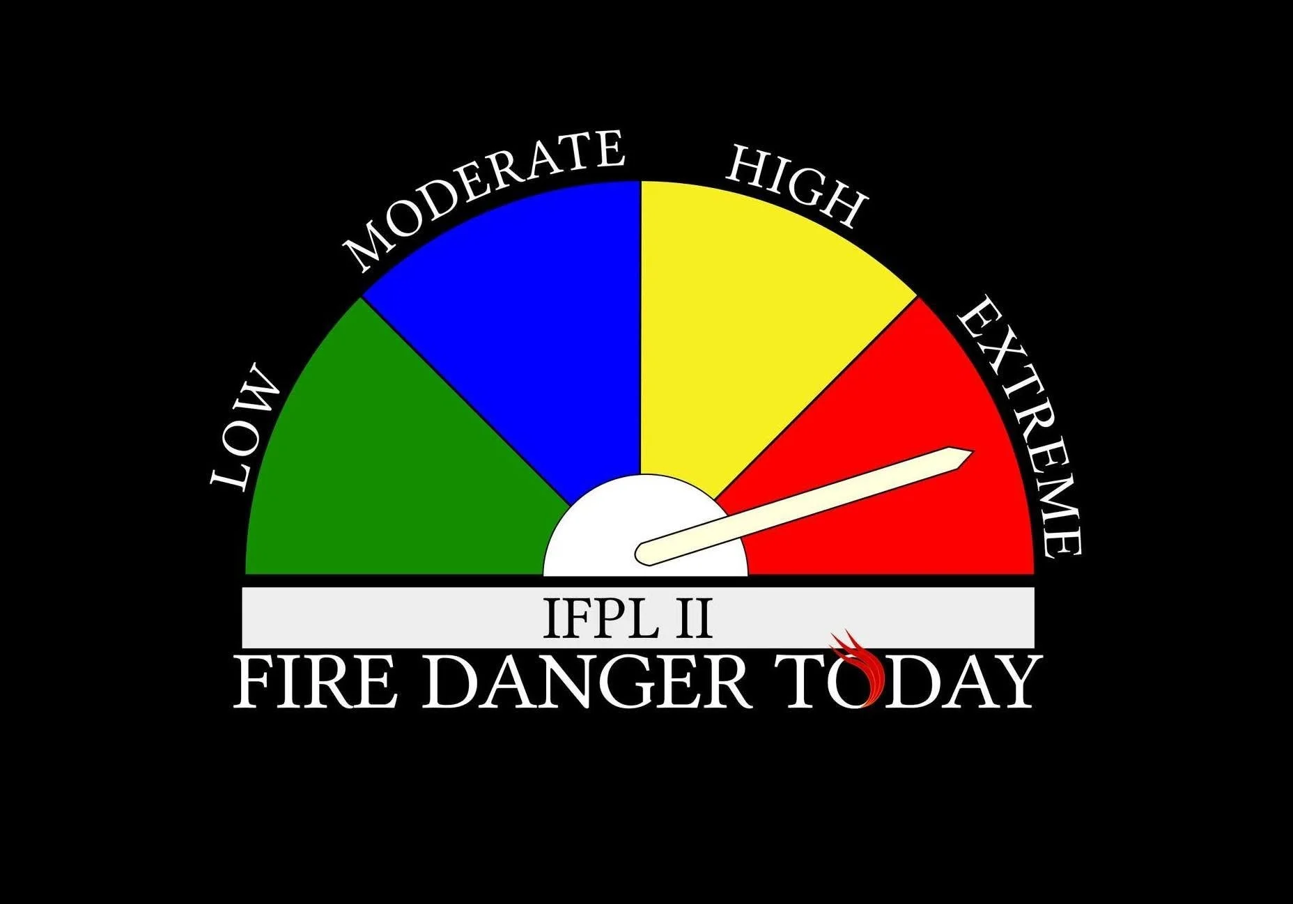
Extreme fire danger remains in effect on Oregon Department of Forestry-protected lands across Jackson and Josephine counties. The Industrial Fire Precaution Level remains at Level 2.
Activities prohibited under the Extreme designation include:
Using power saws, including battery- and electric-powered chainsaws
Cutting, grinding or welding metal
Mowing dried or cured grass
Operating other spark-emitting internal-combustion equipment
Mowing green, irrigated lawns and harvesting agricultural crops remain exempt.
Debris burning, fireworks, tracer ammunition and exploding targets remain prohibited. Campfires and charcoal fires are allowed only in designated campgrounds.
Motor vehicles must remain on improved roads free of flammable vegetation, with limited exceptions. Anyone traveling away from state highways, county roads or driveways must carry a shovel and either one gallon of water or an approved fire extinguisher.
ODF is urging residents and visitors to avoid any activity that could spark a wildfire and report new fires immediately by calling 911.
EVACUATION LEVELS
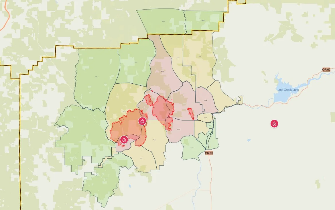
The latest evacuation map showing level 1, 2, and 3 evacuations due to the East Evans Creek Fire. Residents should use the interactive Genasys map to check current conditions for a specific address. (Project Genasys)
Evacuation notices remain active in Jackson and Douglas counties.
Level 3: Go Now
JAC-017
JAC-109
JAC-124
JAC-126
JAC-127A
JAC-149B
Residents in Level 3 zones should remain out of the area until officials announce it is safe to return.
Level 2: Be Set
JAC-016
JAC-026
JAC-111
JAC-112
JAC-127B
JAC-131
JAC-132
JAC-133
JAC-134
JAC-147
JAC-148
JAC-149A
Level 1: Be Ready
JAC-003
JAC-004
JAC-014
JAC-036
JAC-158
DOU-1012
DOU-1015
SHC-151
SHC-152
SHC-153
SHC-154
SHC-156
SHC-157
SHC-158
The SHC zones place Shady Cove under a Level 1: Be Ready notice.
Evacuation levels and boundaries may change as conditions develop. Residents should continue monitoring county alerts and verify their address through the official evacuation map.
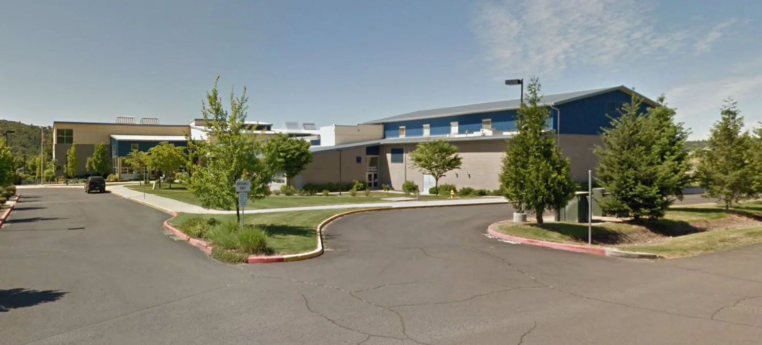
Eagle Point Middle School at 477 Reese Creek Road is serving as the evacuation shelter for residents and domestic pets affected by the East Evans Creek Fire. (Google Street View)
EVACUATION SHELTER
The evacuation shelter for residents and domestic pets remains open at:
Eagle Point Middle School
477 Reese Creek Road, Eagle Point, OR 97524
Pets are welcome on the shelter property but cannot enter the school building. The American Red Cross has established a designated area for domestic pets.
Livestock sheltering remains available through the Jackson County Expo:
Jackson County Expo
21 Peninger Road, Central Point
Owners should call 541-776-7206 before arriving to confirm space is available. The same number may be used for medical or livestock sheltering assistance.
CLOSURES
The following closures remain in effect:
Tiller-Trail Highway from the Jackson County line to Highway 62
East Evans Creek Road at Meadows Road
West Fork Evans Creek Road
Rock Creek Road
Rogue Elk Park, including the campground, day-use area and boat ramp
Dodge Bridge Boat Ramp, currently used as a firefighting water-supply site
BLM-administered lands near the fire remain closed to public entry, including hunting, hiking and camping.
A 24-hour Temporary Flight Restriction remains in effect over the fire. Flying a drone near the incident is illegal and may force firefighting aircraft to stop operating.
Cover photo: A helicopter conducts bucket operations over steep terrain as firefighters continue working around active portions of the East Evans Creek Fire. (Oregon Department of Forestry)


More Firewatch
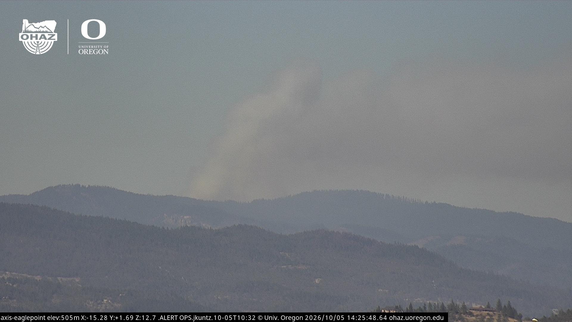



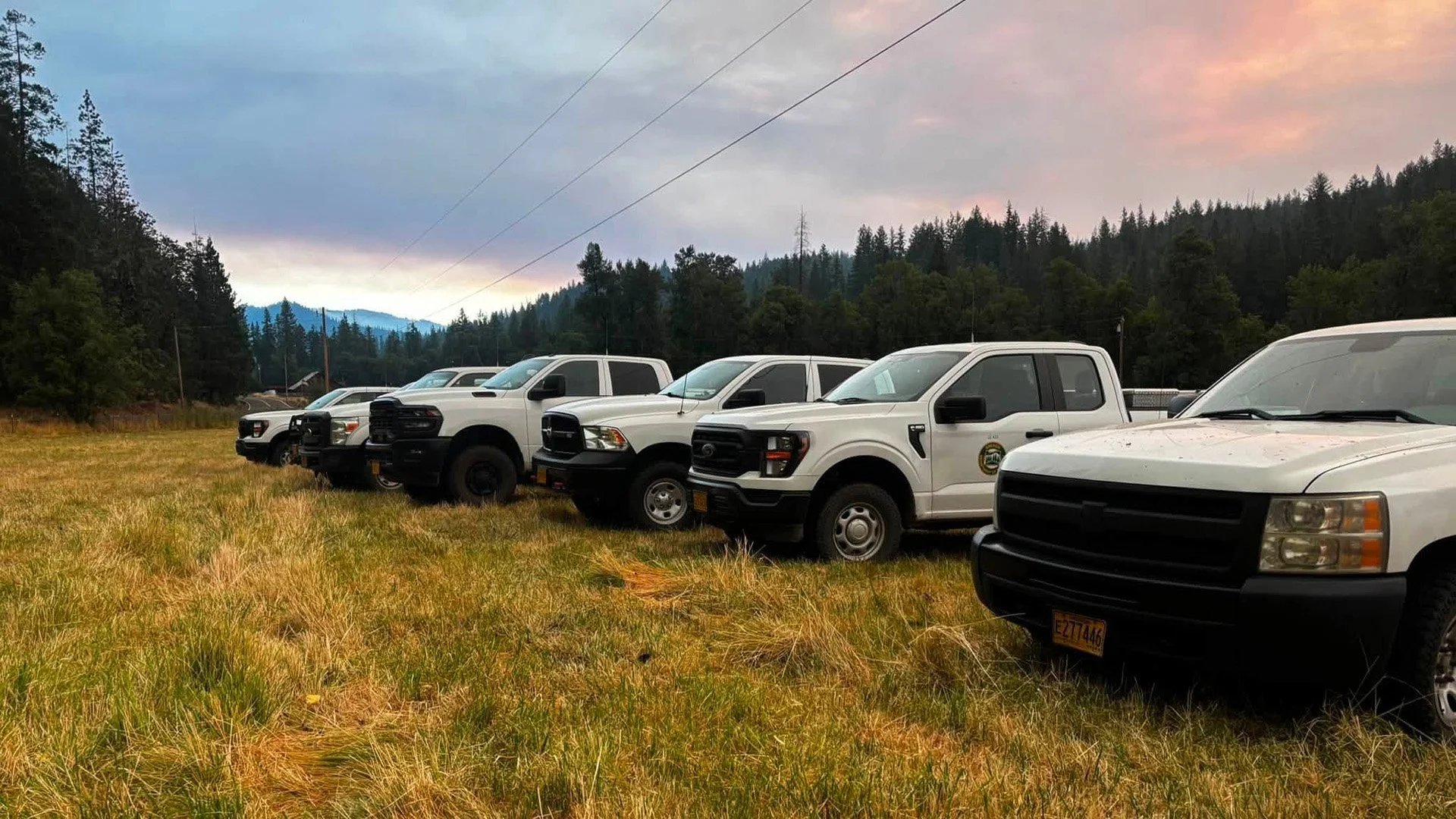

ODF Southwest Oregon’s 4 Alpha Fox helicopter has completed its 75-day seasonal contract after introducing approved night-vision wildfire flights this year. One recent after-dark mission located three lightning-caused fires.