
Fire Weather Watch Issued as Lightning Threat Builds Across Southern Oregon
Thunderstorms, lightning and gusty winds could increase wildfire risk across the region Wednesday.
FAST FACTS
Wednesday is shaping up to be the most active weather day of the week, with thunderstorms, abundant lightning, gusty outflow winds and critically dry fuels creating concern for new wildfire starts across a broad portion of Southern Oregon.
Alert: Fire Weather Watch
Timing: Late Wednesday morning through Wednesday evening
Primary Threat: Abundant lightning over critically dry fuels
Storm Motion: North to northeast at 15 to 20 mph
Outflow Winds: Isolated gusts up to 45 mph
Highest Storm Chances: Wednesday afternoon and evening
Affected Areas: Siskiyou Mountains, eastern Rogue Valley, southern Oregon Cascades, Klamath Basin, Fremont-Winema National Forest and portions of Lake County
Additional Concerns: New wildfire starts, holdover fires, wildfire smoke and localized heavy rainfall
Rogue Valley: Hot through midweek, with Medford near 102 Wednesday
Klamath Basin: Slight chance of thunderstorms Wednesday, with highs in the low 90s
Coast: Much cooler with stronger marine influence and little inland thunderstorm impact
MEDFORD, Ore. — A surge of monsoonal moisture moving into Southern Oregon and Northern California is bringing a changing mix of heat, wildfire smoke and thunderstorms this week, with forecasters increasingly concerned about lightning over critically dry vegetation by Wednesday.
The National Weather Service in Medford has issued a Fire Weather Watch from late Wednesday morning through Wednesday evening for a broad area stretching from the Siskiyou Mountains and eastern Rogue Valley across the southern Oregon Cascades, Klamath Basin and into Lake County.


Forecasters say abundant lightning could ignite numerous new fires, potentially putting heavy pressure on initial-attack resources already responding to wildfires across the region.
Thunderstorms are expected to move north to northeast at 15 to 20 mph. Most storms are expected to be relatively wet, but lightning may occur outside the rain cores, where dry fuels could still ignite.
Outflow winds from thunderstorms could also produce isolated gusts up to 45 mph, creating the potential for sudden changes in fire behavior.
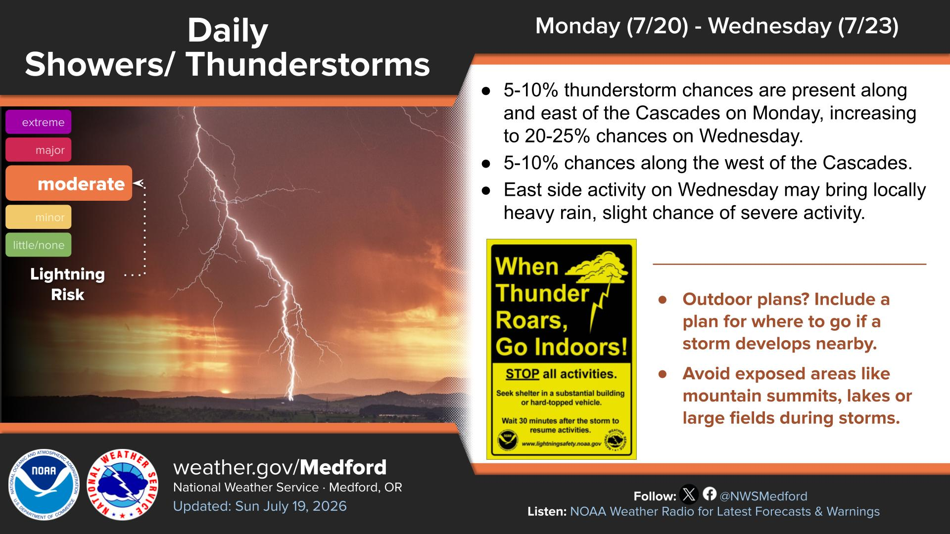
Thunderstorm Chances Increase Wednesday
Thunderstorm chances remain very slight Monday before increasing Tuesday and Wednesday as monsoonal moisture moves farther north.
By Wednesday, chances generally increase to around 20% to 25%, especially east of the Cascades. A few storms could also develop west of the Cascades, including portions of the Rogue Valley, Siskiyous and western Cascade foothills.
Locally heavy rain and stronger storms are possible Wednesday, though widespread severe weather is not expected.
The primary fire concern is lightning striking dry fuels outside the wetter portions of storms, potentially creating new starts that may not immediately become visible.
Rogue Valley and Klamath Basin
The Rogue Valley will remain hot through midweek.
Medford is forecast to reach around 98 degrees Monday, 101 Tuesday and 102 Wednesday, with a slight chance of thunderstorms arriving Wednesday.
The Klamath Basin will be somewhat cooler but closer to the center of the expected thunderstorm activity. Klamath Falls is forecast to reach the upper 80s to low 90s through Wednesday, with a slight chance of afternoon and evening thunderstorms.
Lake and Modoc counties will also see increasing thunderstorm potential Wednesday, while Josephine and Siskiyou counties could see more isolated activity.
Coastal areas in Curry, Coos and Del Norte counties will remain much cooler under stronger marine influence, generally avoiding the inland heat.
Smoke Remains a Concern
Wildfire smoke continues to affect portions of Southern Oregon and Northern California, with conditions varying significantly depending on wind direction and nearby fire activity.
Smoke may settle into valleys overnight and during the morning before improving somewhat with afternoon mixing.
Residents can reduce exposure by keeping windows and doors closed when smoke is heavy, using HEPA filtration when available and identifying cleaner indoor spaces such as libraries or other public buildings.
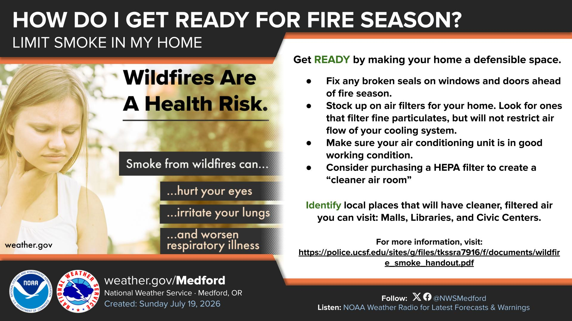
Fire Risk Could Continue After Storms Pass
Even where storms produce rain Wednesday, lightning could still ignite dry vegetation outside the wettest areas.
Some lightning-caused fires can smolder unnoticed before becoming visible hours or even days later, meaning firefighters may continue watching for new starts well after the storms move through.
Residents across Southern Oregon and Northern California should monitor changing weather and fire conditions, avoid activities that could create sparks and make sure emergency supplies are ready as the region moves into a potentially active fire-weather period.

Weather Messages & Alerts
Fire Weather Watch
URGENT - FIRE WEATHER MESSAGE
National Weather Service Medford OR
1240 PM PDT Mon Jul 20 2026


ORZ617-621>625-211215-
/O.NEW.KMFR.FW.A.0004.260722T1800Z-260723T0600Z/
Umpqua National Forest-Siskiyou Mountains-Eastern Rogue Valley-
Southern Oregon Cascades-Klamath Basin and the Fremont-
Winema National Forest-
South Central Oregon Desert including the BLM Land in Eastern
Lake and Western Harney Counties-
1240 PM PDT Mon Jul 20 2026

...FIRE WEATHER WATCH IN EFFECT FROM LATE WEDNESDAY MORNING
THROUGH WEDNESDAY EVENING FOR ABUNDANT LIGHTNING ON DRY FUELS FOR
FIRE WEATHER ZONES 617, 621, 622, 623, 624, AND 625...

The National Weather Service in Medford has issued a Fire Weather
Watch, which is in effect from Wednesday morning through
Wednesday evening.

* IMPACTS...Abundant lightning on dry fuels will likely create
  new ignitions across the region. Any fires that develop could
  spread rapidly. Numerous new fire starts could overwhelm
  initial attack.

* AFFECTED AREA...Areas in southern Oregon along and east of the
  Cascades, along the western foothills and slopes of the
  Cascades, and over the Siskiyous, including Fire Weather Zones
  617...621...622...623...624 and 625.

* THUNDERSTORMS...Moving roughly north to northeast around 15 to
  20 mph. Storm mode will be mostly wet thunderstorms, but dry
  lightning strikes can occur outside of wet cores.

* OUTFLOW WINDS...Isolated gusts up to 45 mph.

* DETAILED URL...View the hazard area in detail at
  https://weather.gov/wrh/hazards?wfo=mfr

PRECAUTIONARY/PREPAREDNESS ACTIONS...

Follow all fire restrictions. Avoid activities that could cause
sparks. Visit weather.gov/medford/wildfire for links to fire
restrictions in your area.

If you have not packet your go kit yet, now is the time to do so.
This includes items like important documents and essentials you
cannot live without. Fill your vehicle`s fuel tank. Visit
ready.gov/kit for more information.

A Fire Weather Watch means that critical fire weather conditions
are possible during the valid watch time. These conditions could
promote the rapid spread of wildfires which could become life-
threatening. Check weather.gov/medford for forecast updates and a
possible upgrade of the this watch to a Red Flag Warning.
Cover image: Lightning strikes near Crater Lake during a summer thunderstorm. Thunderstorms expected across Southern Oregon this week could bring abundant lightning over critically dry fuels, increasing the risk of new wildfire starts. (Photo by Jeremy Howard via Flickr)


Recent Weather News

The National Weather Service has issued frost advisories and freeze warnings across parts of Southern Oregon and Northern California as the coldest temperatures of the season arrive. Frost and freezing conditions are expected Sunday and Monday mornings, with possible slick roads in Lake and Modoc counties and sneaker wave danger along the coast.