Smoke visible across Rogue Valley from prescribed burn near Tiller
Umpqua National Forest crews are conducting a prescribed burn at Long Prairie, with smoke visible from parts of Jackson County
FAST FIRE FACTS
Incident:
Long Prairie prescribed burn, Unit 710
Location:
Tiller Ranger District, Umpqua National Forest, west of Threehorn Campground
Type:
Planned prescribed burn, not a wildfire
Smoke:
Visible from parts of Medford, Central Point, Eagle Point, White City, Shady Cove, and surrounding areas
Burn Window:
Operations may continue through the weekend as weather, fuel conditions, and smoke impacts allow
Closures:
Temporary closures are in place around Unit 710 for firefighter and public safety
Long Prairie Prescribed Burn Map: Unit 710 on the Tiller Ranger District, west of Threehorn Campground, with temporary road closures marked around the burn area. U.S. Forest Service, Umpqua National Forest.
TILLER, Ore. — A large smoke column visible Monday afternoon from portions of the Rogue Valley is coming from a prescribed burn underway on the Tiller Ranger District of the Umpqua National Forest.
Smoke from the burn has been visible from areas including Medford, Central Point, Eagle Point, White City, and Shady Cove.
The U.S. Forest Service said crews are conducting prescribed burning in Unit 710 at Long Prairie, along National Forest Service Road 3201-300 west of Threehorn Campground.
The operation is a planned prescribed fire, not a wildfire.
Forest officials said favorable weather and fuel conditions lined up Monday, Oct. 5, allowing crews to begin burning. Additional prescribed burning may continue through the weekend depending on weather, fuel conditions, and potential smoke impacts.
Prescribed fires are conducted under carefully monitored conditions to reduce hazardous fuels and meet broader forest management objectives.
Smoke from Long Prairie Burn: Smoke from the Unit 710 prescribed burn near Tiller is visible from the Long Mountain ALERTWest camera Monday afternoon. ALERTWest / University of Oregon.
Smoke may remain visible
The Forest Service advised residents and visitors that smoke may be visible from surrounding areas during and after the burn.
Officials specifically asked the public not to call 911 solely because of smoke associated with the prescribed fire.
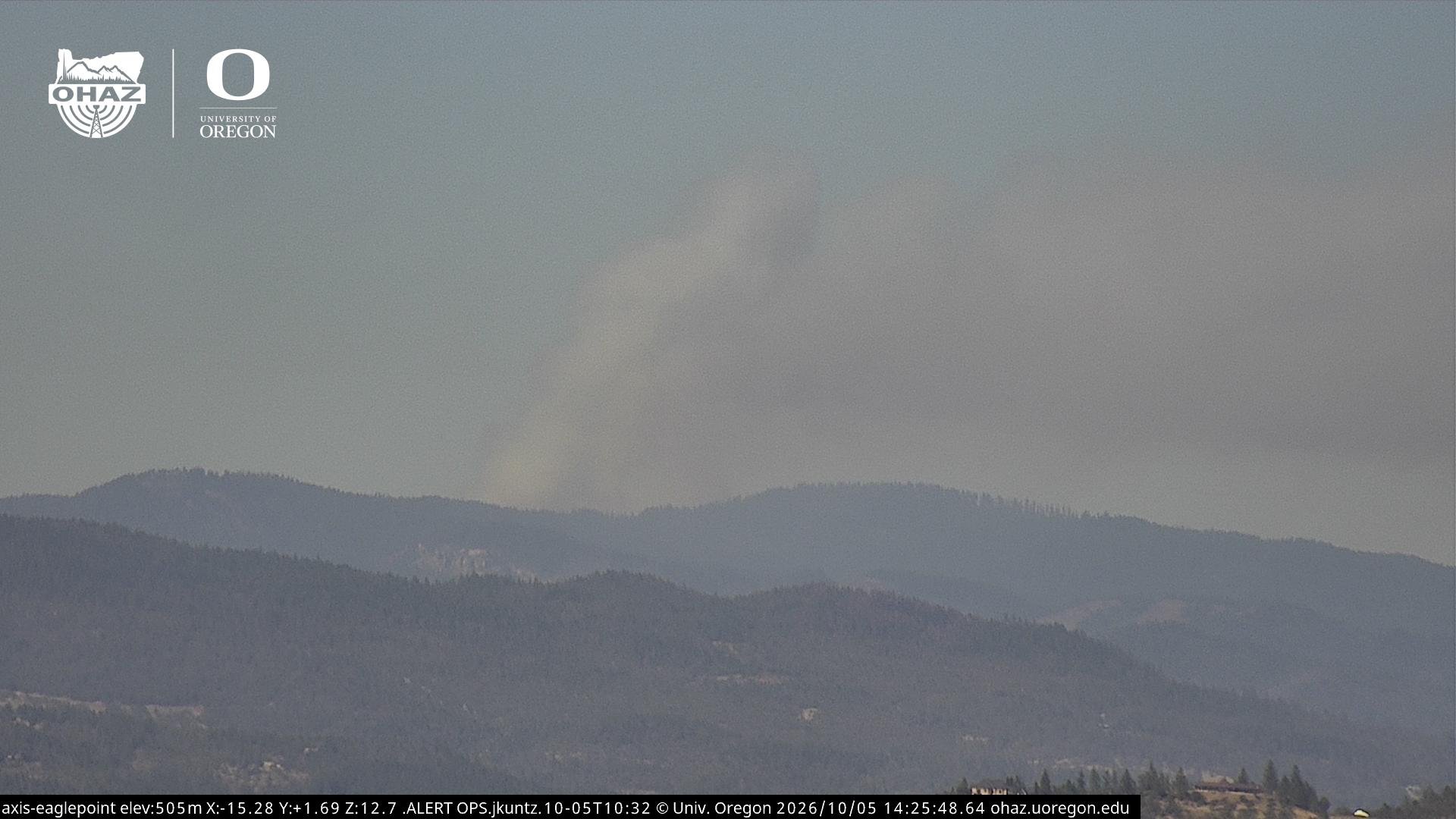
Smoke from the Long Prairie burn was visible Monday afternoon on ALERTWest cameras looking north from portions of Jackson County, with a distinct column rising beyond the mountains north of the Rogue Valley.
Conditions can change throughout a prescribed burn, and crews continually evaluate weather, fuels, and smoke before continuing ignition operations.
Smoke Visible from Eagle Point: A smoke column from the Long Prairie prescribed burn near Tiller is visible looking north from the Eagle Point ALERTWest camera Monday afternoon. ALERTWest / University of Oregon.
Temporary closures in place
A closure has been established around Unit 710 for public and firefighter safety.
Closed access points include:
NFSR 32-300 junction
NFSR 600-620 junction
NFSR 300-330 junction near Diamond Rock
NFSR 1616-205 junction
Visitors traveling in the area should use caution and watch for firefighters, vehicles, and equipment.
Multiple agencies assisting
The prescribed burn is being conducted by the Umpqua National Forest in partnership with the Cow Creek Band of Umpqua Tribe of Indians, Oregon Department of Forestry, Douglas Forest Protective Association, and Tiller Volunteer Fire Department.
The Long Prairie project is part of ongoing efforts to reduce accumulated vegetation and other fuels that can contribute to more intense wildfire behavior.
Smoke may continue to be visible from parts of southern Oregon while burning and mop-up operations continue.


Keep Reading