
Firefighters deepen mop-up across the incident as some resources begin reassignment and ODF ends routine evening updates unless conditions change

FAST FIRE FACTS
Name: East Evans Creek Fire
Location: About 7 miles west of Shady Cove
Acres: 15,705
Containment: 26%
Current Focus: Deep mop-up and securing remaining heat
Evacuations: Level 1 and 2 remain in Jackson County; none in Douglas County
Shelter: No longer accepting new evacuees
Weather: Hotter conditions and thunderstorm threat Wednesday
Cause: Vehicle crash into a power pole
Latest Maps: View current fire maps
East Evans Creek Fire PM update for 7/21/26
Smoke rises from lingering heat in burned vegetation as crews continue mop-up operations and search for hot spots on the East Evans Creek Fire. (Oregon Department of Forestry)
SAMS VALLEY, Ore. — Containment on the East Evans Creek Fire increased to 26% Tuesday as firefighters continued securing control lines, expanding mop-up and reducing remaining threats around nearby communities.
The fire remains mapped at 15,705 acres based on the latest official perimeter information.
Progress across the incident has allowed evacuation levels to be reduced significantly in Jackson County, while all evacuation notices associated with the fire have now been lifted in Douglas County.
Some firefighting resources are also beginning to be released for assignment to other incidents across Oregon as conditions stabilize.
ODF announced Tuesday evening that this will be the final routine evening update on the East Evans Creek Fire unless conditions change. Morning updates and twice-daily operational briefing videos are expected to continue.
CONTAINMENT CLIMBS TO 26%
Firefighters gained another significant measure of containment Tuesday as crews strengthened lines and continued extinguishing remaining heat.
Across the main fire, mop-up has reached an average depth of approximately 50 feet behind control lines.
That work creates a wider buffer between lingering heat and the perimeter, reducing the chance that burning material could rekindle fuels outside established lines.
Structure protection crews also continued finishing work around homes and other structures where protection measures remain necessary.


AIRCRAFT SUPPORT BOARD MOUNTAIN OPERATIONS
The Board Mountain spot fire remains an important operational focus.
Aircraft worked along the southern and eastern flanks Tuesday, cooling active areas and helping slow remaining fire spread while ground crews continued strengthening the perimeter.
Firefighters pushed mop-up as far as approximately 50 feet in some portions of the area while working through pockets of heat and unburned vegetation.
Steep terrain continues to make aviation particularly valuable in places where firefighters and heavy equipment have limited access.
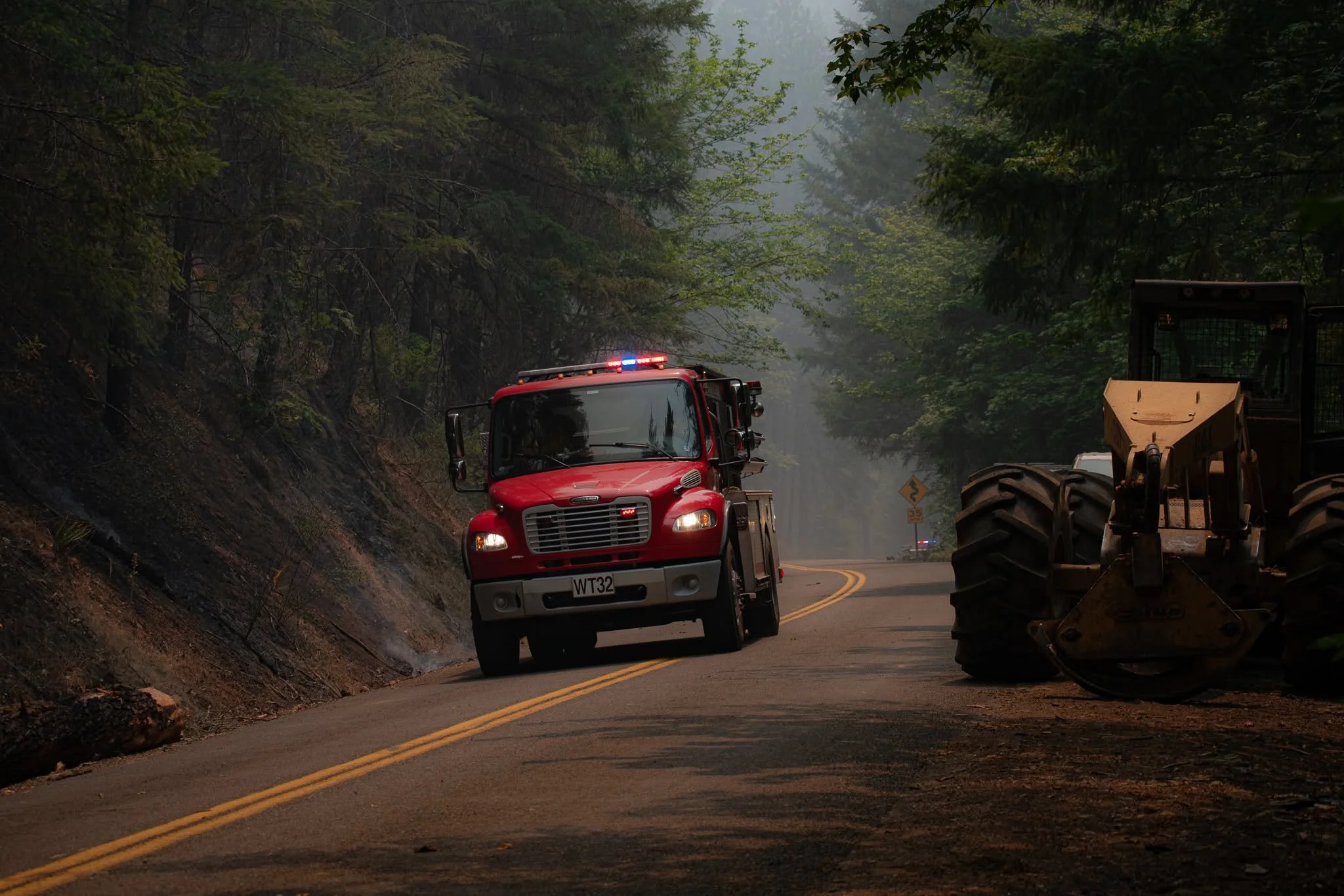
A firefighting water tender moves through smoky conditions as heavy equipment remains staged along a roadway near the East Evans Creek Fire. (Oregon Department of Forestry)
DEEPER MOP-UP CONTINUES ACROSS SPOT FIRES
Around the Canyon Creek spot fire west of Shady Cove, firefighters continue targeting scattered heat remaining inside the perimeter.
Structure protection crews have expanded mop-up around homes in the Long Branch area while maintaining resources around Shady Cove, Trail and Dry Creek.
Northwest of Hull Mountain, crews have pushed substantially farther into the burned area, reaching approximately 200 feet of mop-up behind control lines.
Structural engines continue helping move water into the steep terrain around Ramsey Canyon Road.
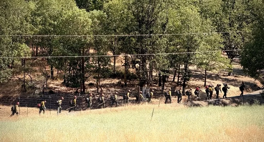
Cover image: Firefighters move along a burned area while continuing mop-up and patrol operations on the East Evans Creek Fire. (Oregon Department of Forestry)
INFRARED WORK CONTINUES OVERNIGHT
Night crews will continue using handheld infrared equipment to locate hidden heat near control lines.
Firefighters will then extinguish identified hot spots and continue increasing mop-up depth throughout the incident.
Warmer overnight temperatures could keep some heat more active than during previous nights, while a slight chance of thunderstorms remains in the forecast.
HOTTER WEATHER AND THUNDERSTORMS AHEAD
Firefighters are preparing for hotter conditions and a greater thunderstorm threat Wednesday.
A Fire Weather Watch remains in effect for the potential for abundant lightning over dry fuels.
Any thunderstorms that produce lightning without substantial rainfall could create new fire starts across the region.
Fire managers are maintaining enough resources on the East Evans Creek Fire to respond if conditions change while also positioning personnel and equipment to support initial attack elsewhere if new fires develop.

SOME RESOURCES BEGIN REASSIGNMENT
Improved containment and reduced threats to structures are allowing additional resources to transition away from the incident.
Some crews and equipment will be reassigned to other fires across Oregon, increasing statewide firefighting capacity.
Incident managers said resources will remain strategically positioned on the East Evans Creek Fire to maintain suppression capability and respond if fire behavior increases again.
Firefighters and incident personnel gather for an operational briefing at East Evans Creek Fire camp before heading out for their assignments. (Oregon Department of Forestry)
SHELTER NO LONGER ACCEPTING NEW EVACUEES
As evacuation levels continue to decrease, the American Red Cross shelter at Eagle Point Middle School is no longer accepting new evacuees.
The Red Cross will continue assisting people currently staying at the shelter as they transition to other arrangements or return home.
Anyone who still needs sheltering assistance should contact Non-Emergency Dispatch at 541-776-7206.
LATEST FIRE MAPS
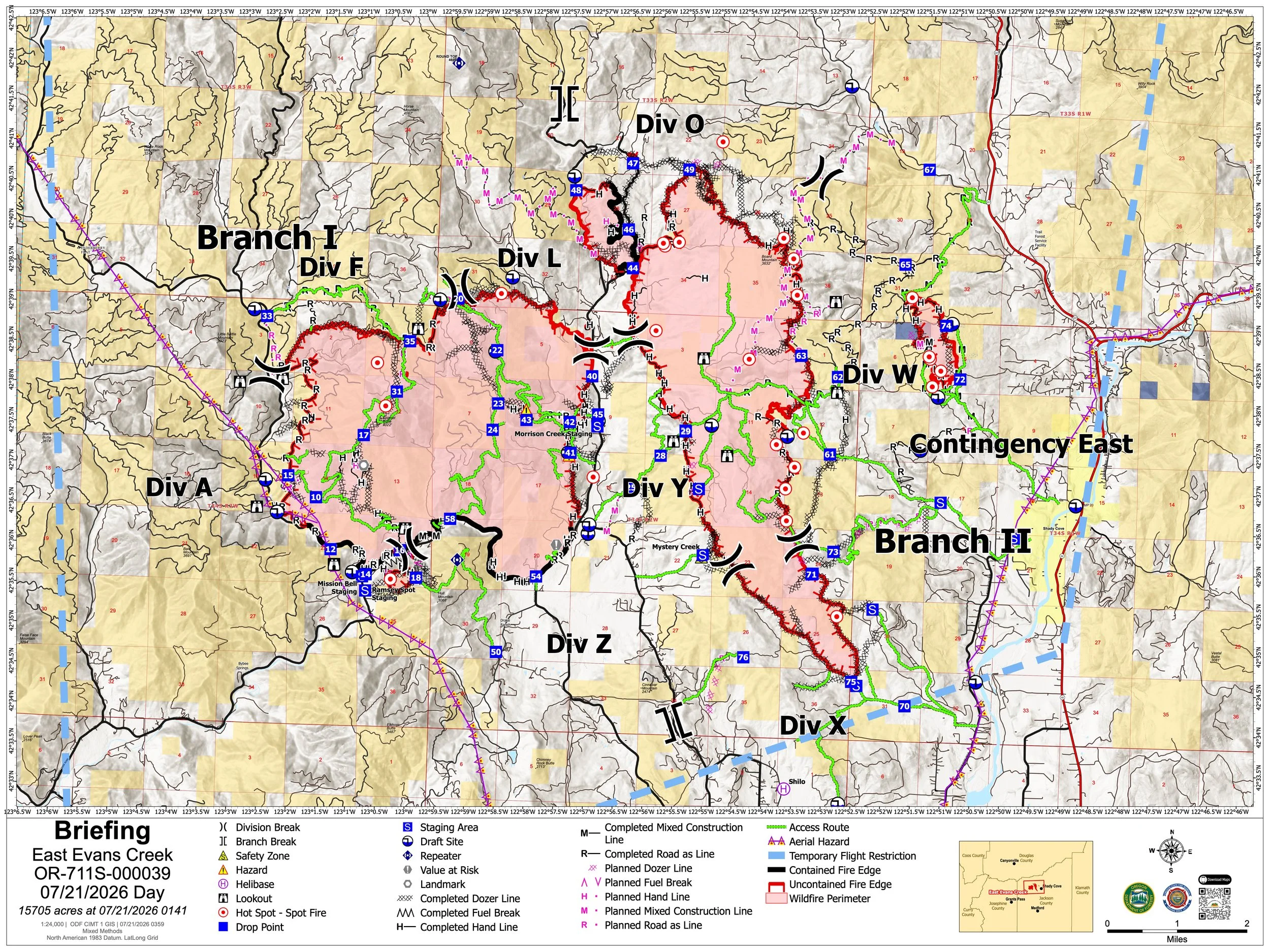
The July 21 briefing map places the East Evans Creek Fire at 15,705 acres and shows the main fire, associated spot-fire areas and the extensive network of control lines established around the incident. (Oregon Department of Forestry) View all current maps on the East Evans Creek Fire Maps page.
The latest official mapping places the East Evans Creek Fire at 15,705 acres.
Tuesday’s maps show the main fire and associated spot-fire areas around Board Mountain, Canyon Creek and northwest of Hull Mountain, along with an extensive network of completed control lines.
As suppression increasingly shifts toward deeper mop-up, firefighters continue using infrared technology to identify lingering heat that may not be visible from the surface.
View the complete collection of current public information, operations, briefing, infrared, evacuation and incident action maps on the East Evans Creek Fire Maps page.
FIRE WEATHER
Conditions are expected to become more challenging Wednesday.
Firefighters are preparing for:
Hotter temperatures
Lower relative humidity
Potential thunderstorms
Abundant lightning over dry fuels
The possibility of new lightning-caused fires
A Fire Weather Watch remains in effect Wednesday.
Thunderstorms may produce little or uneven rainfall, meaning lightning could ignite new fires despite localized precipitation.
Hot, dry and breezy conditions are expected to return later in the week.
FIRE DANGER

Extreme fire danger remains in effect on Oregon Department of Forestry-protected lands across Jackson and Josephine counties. The Industrial Fire Precaution Level remains at Level 2.
Activities prohibited under Extreme fire danger include:
Using power saws, including battery- and electric-powered chainsaws
Cutting, grinding or welding metal
Mowing dried or cured grass
Operating other spark-emitting internal-combustion equipment
Mowing green, irrigated lawns and agricultural harvesting remain exempt.
Debris burning, fireworks, tracer ammunition and exploding targets remain prohibited. Campfires and charcoal fires are allowed only in designated campgrounds.
The threat of lightning this week also increases concern for new fire starts across the region.
EVACUATION LEVELS
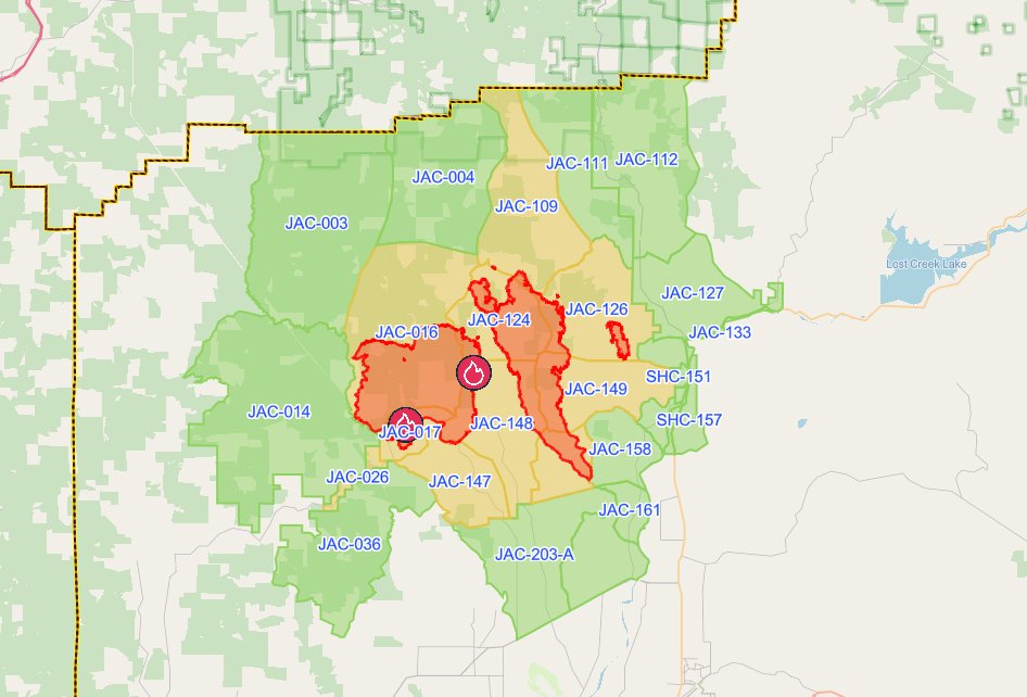
The latest evacuation map showing level 1, 2, and 3 evacuations due to the East Evans Creek Fire. Residents should use the interactive Genasys map to check current conditions for a specific address. (Project Genasys)
There are no longer any Level 3 “Go Now” evacuation zones associated with the East Evans Creek Fire.
The following Jackson County zones remain at Level 2 “Be Set”:
JAC-016
JAC-017
JAC-026
JAC-109
JAC-124
JAC-126
JAC-147
JAC-148
JAC-149
JAC-203-B
Additional areas remain at Level 1 “Be Ready.”
Douglas County has lifted all remaining evacuation notices associated with the fire.
Evacuation levels can still change quickly if fire behavior increases.
Residents returning to fire-affected areas should remain alert for hazards including damaged trees, downed utilities, ash pits, debris and hidden hot spots.
EVACUATION SHELTER
The American Red Cross shelter at Eagle Point Middle School is no longer accepting new evacuees as evacuation levels continue to decrease.
The Red Cross will continue assisting current shelter residents with their transition.
Anyone who still needs sheltering assistance should contact:
Non-Emergency Dispatch: 541-776-7206
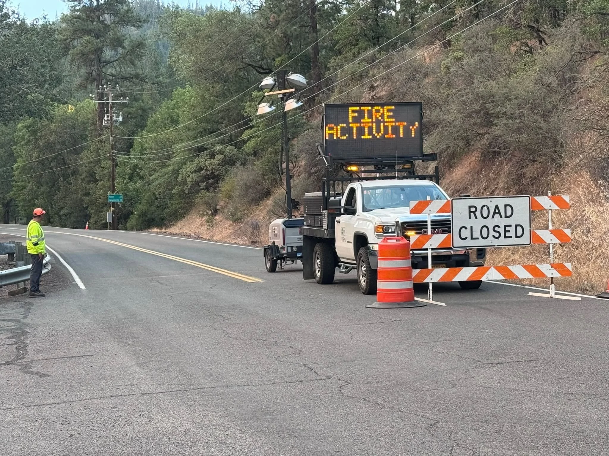
A Jackson County Roads employee staffs a closure as an electronic sign warns drivers of nearby fire activity. (Courtesy Jackson County Parks)
CLOSURES
Fire-related closures remain in effect.
ODF continues to list:
East Evans Creek Road at Meadows Road
West Fork Evans Creek Road
Rock Creek Road
Long Branch Road and portions of East Evans Creek Road also remain restricted to residents and personnel working the fire.
BLM-administered lands near the East Evans Creek Fire remain closed to public entry, including hunting, hiking and camping.
A 24-hour Temporary Flight Restriction remains in effect over the incident.
Flying a drone near the fire is illegal and can force firefighting aircraft to suspend operations.


More Firewatch
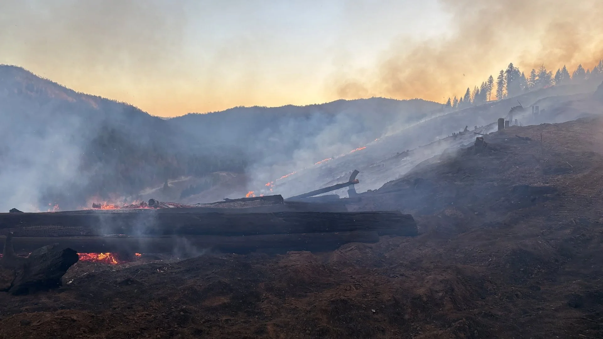
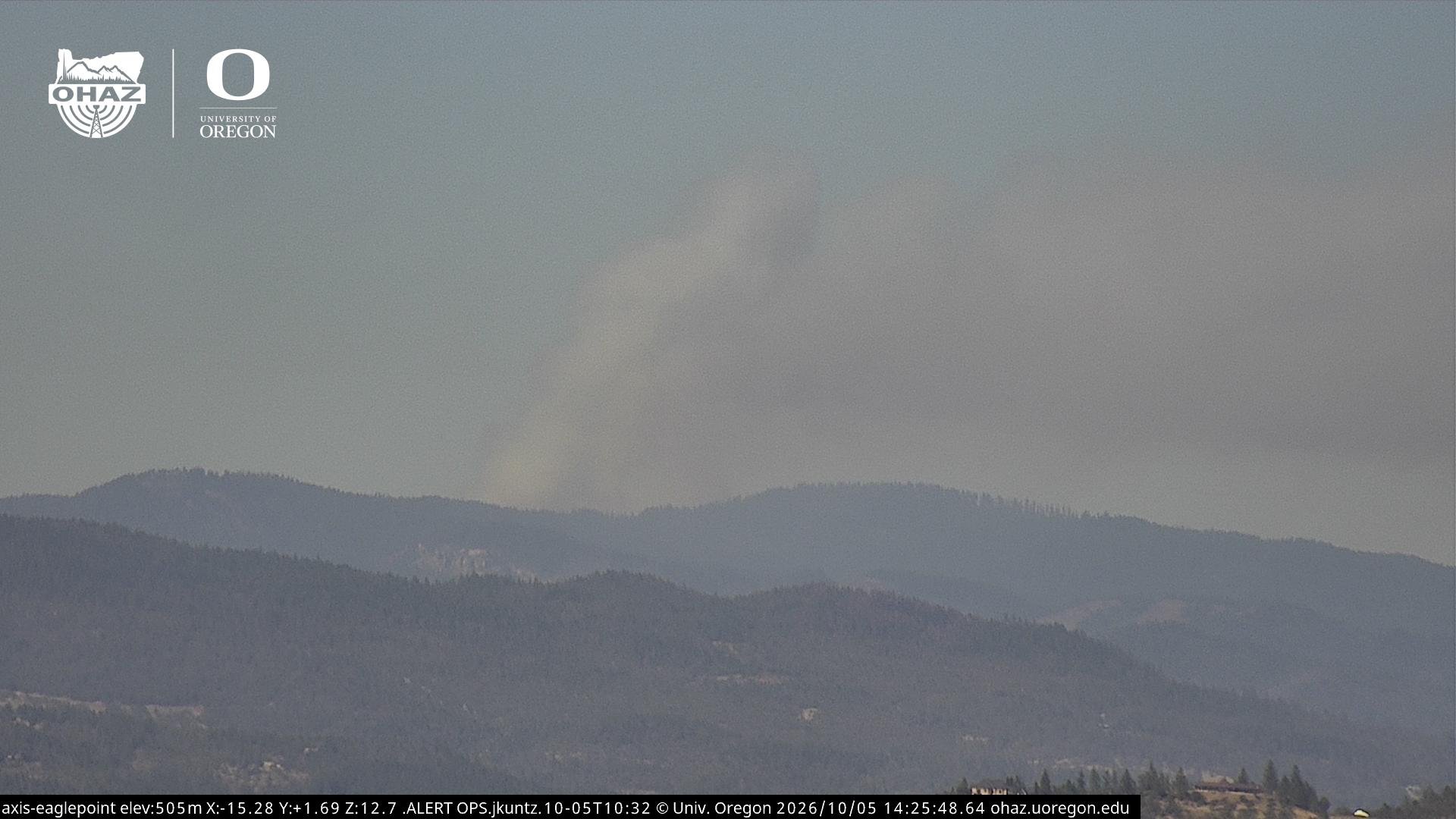




ODF Southwest Oregon’s 4 Alpha Fox helicopter has completed its 75-day seasonal contract after introducing approved night-vision wildfire flights this year. One recent after-dark mission located three lightning-caused fires.