
Woodrat Fire Reaches 300 Acres, 50% Lined Near Ruch
Night crews take over as firefighters work to protect Sterling Creek Road.
Fire Facts
Name
Woodrat Fire
Location
Woodrat Mountain, south of Jacksonville near Ruch
Acres
Estimated at 200 acres
Containment
No containment estimate has been released.
Evacuations
Level 3, Go Now: JAC-428A and JAC-436
Level 2, Be Set: JAC-428B
View the current evacuation map on Genasys Protect
Equipment
Multiple hand crews, dozers, engines, water tenders, overhead personnel, Type 1, Type 2, and Type 3 helicopters, and Air Attack
Activity
The fire is burning uphill as crews continue an aggressive initial attack.
UPDATE: 8:00 P.M.
The Woodrat Fire has grown to approximately 300 acres and is now 50% lined as firefighters continue working to limit its movement toward Sterling Creek Road.
Night resources are on scene and being briefed before taking over overnight operations. The night shift includes six hand crews with 20 firefighters each, four dozers, six water tenders, three falling modules, seven Type 6 engines, and one Type 3 engine.
Firefighters are making strong progress with support from dozers, according to the Oregon Department of Forestry. The right shoulder and head of the fire remain active.
Aircraft will continue supporting crews with retardant and water drops for as long as daylight allows. The fire is 50% lined, but ODF has not released a containment estimate.
—
UPDATE: 6:38 P.M.
Level 3, Go Now, evacuations are now in place for Zones JAC-428A and JAC-436 as the Woodrat Fire continues burning toward the Sterling Creek area.
The Jackson County Sheriff’s Office has upgraded Zone JAC-428A from Level 2 to Level 3. The zone includes Sterling Creek Road from the 6100 block south to Buncom and Upper Applegate roads, extending to Little Applegate Road.
Residents within the Level 3 areas should leave immediately. Deputies are conducting door to door notifications in the affected area.
Zone JAC-428B remains under a Level 2, Be Set, evacuation notice.
Current evacuation levels include:
Level 3, Go Now: JAC-428A and JAC-436
Level 2, Be Set: JAC-428B
Level 1, Be Ready: JAC-421, JAC-422, JAC-423, JAC-427, JAC-429, JAC-434, JAC-437, and JAC-438
Residents should check Genasys Protect for the latest evacuation boundaries and leave immediately when directed.
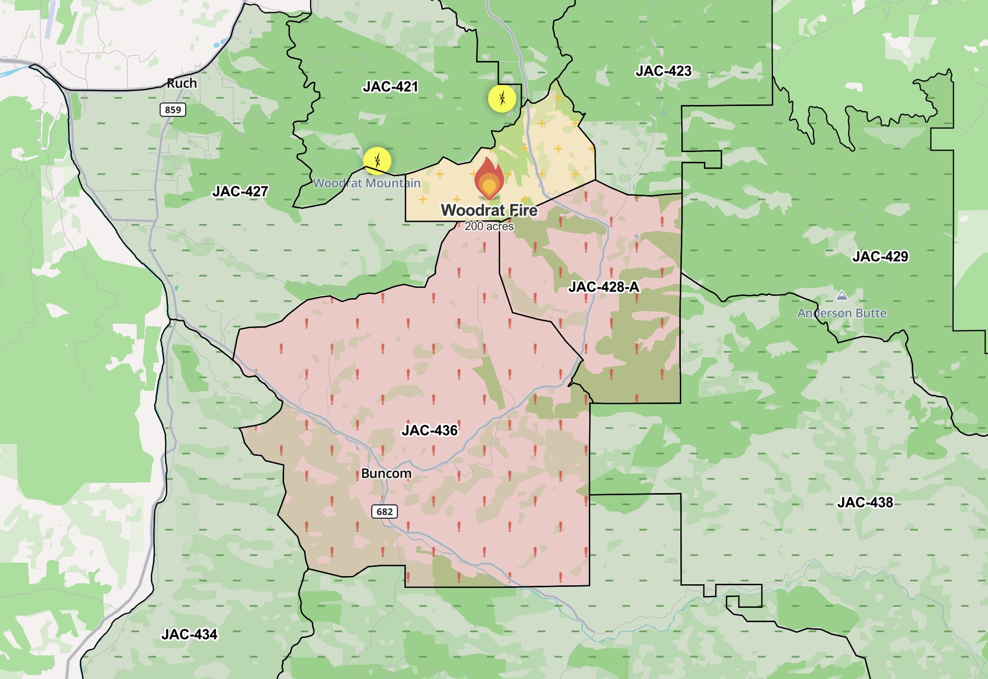
Evacuation Map: Updated evacuation boundaries show Level 3, Go Now, zones JAC-428A and JAC-436 south and southeast of the Woodrat Fire, with Level 2, Be Set, and Level 1, Be Ready, areas surrounding the incident. Jackson County Sheriff’s Office / Genasys Protect.
—
UPDATE: 6:00 P.M.
The Woodrat Fire has reached approximately 200 acres as firefighters respond to multiple spot fires burning southeast from the head of the fire in the direction of Sterling Creek.
Crews continue making steady progress across much of the incident. The right flank is now halfway lined with dozer line, while fire activity remains most active at the head.
Aircraft remain heavily engaged. Two additional large air tankers and a lead plane are joining the existing aviation response, working alongside the air tankers and helicopters already assigned to the fire.
Aircraft are using retardant and water bucket drops to support firefighters working below.
Multiple hand crews, dozers, engines, and water tenders continue strengthening control lines and working to check the fire’s spread through steep and challenging terrain.
Additional resources are expected to continue working through the evening as firefighters build on the progress made throughout the day.
—-
UPDATE: 4:45 P.M.
The Woodrat Fire is now estimated at 130 to 150 acres as additional resources continue arriving to support suppression efforts.
Firefighters are making good progress despite hot temperatures, steep terrain, hazardous snags, and dense timber. Crews continue working aggressively to limit additional growth.
Ground and aviation resources remain actively engaged across the incident, with more personnel and equipment arriving to support operations through the evening.
RUCH, Ore. — The Woodrat Fire has grown to an estimated 100 to 120 acres as firefighters continue an aggressive ground and air attack south of Jacksonville near Ruch.
The latest estimate from Incident Command is roughly double the 50 to 60 acres reported at 2:05 p.m.
The grass fire is burning uphill along Woodrat Mountain, where crews are working to slow its spread, establish containment, and limit additional growth.
In its first acreage estimate at 12:40 p.m., the Oregon Department of Forestry Southwest Oregon District placed the fire at approximately 5 acres.
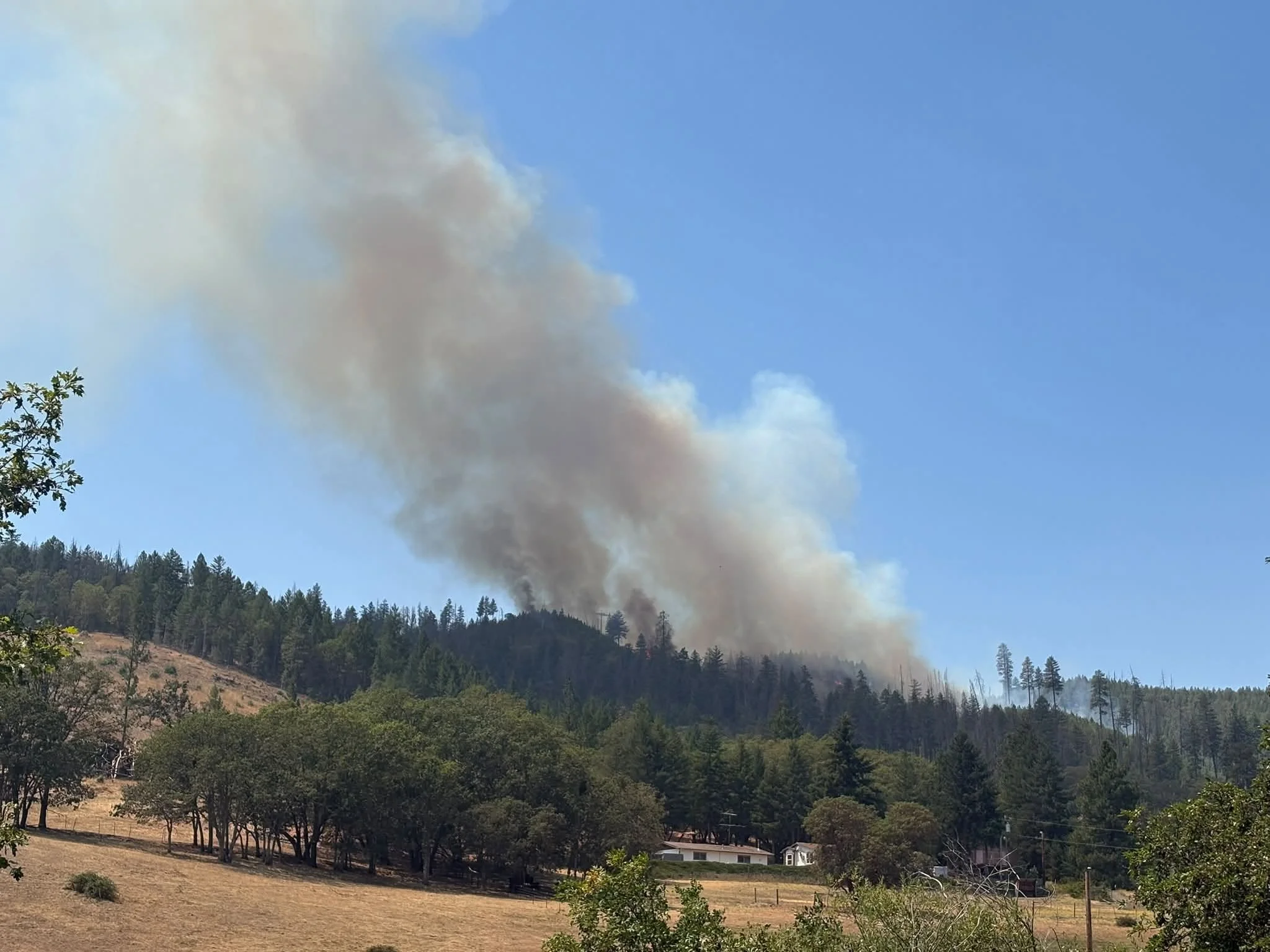
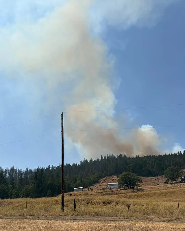
Woodrat Fire: A large smoke column rises from the Woodrat Fire as it burns along a forested ridge south of Jacksonville near Ruch. Oregon Department of Forestry Southwest Oregon.


By 12:55 p.m., the estimate had increased to between 20 and 30 acres. At 2:05 p.m., the fire was estimated at 50 to 60 acres.
ODF is continuing an aggressive initial attack as additional firefighters and equipment arrive at the incident.
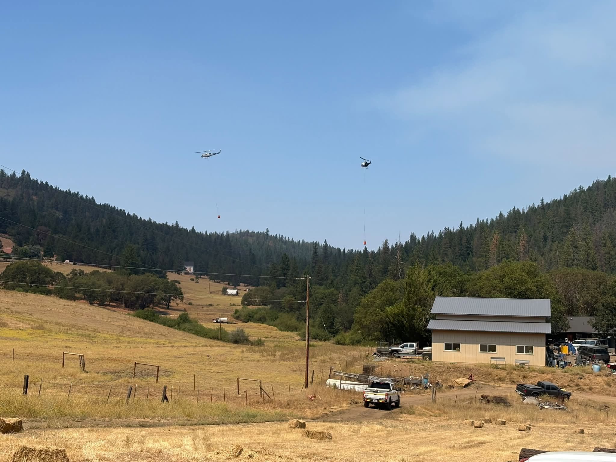
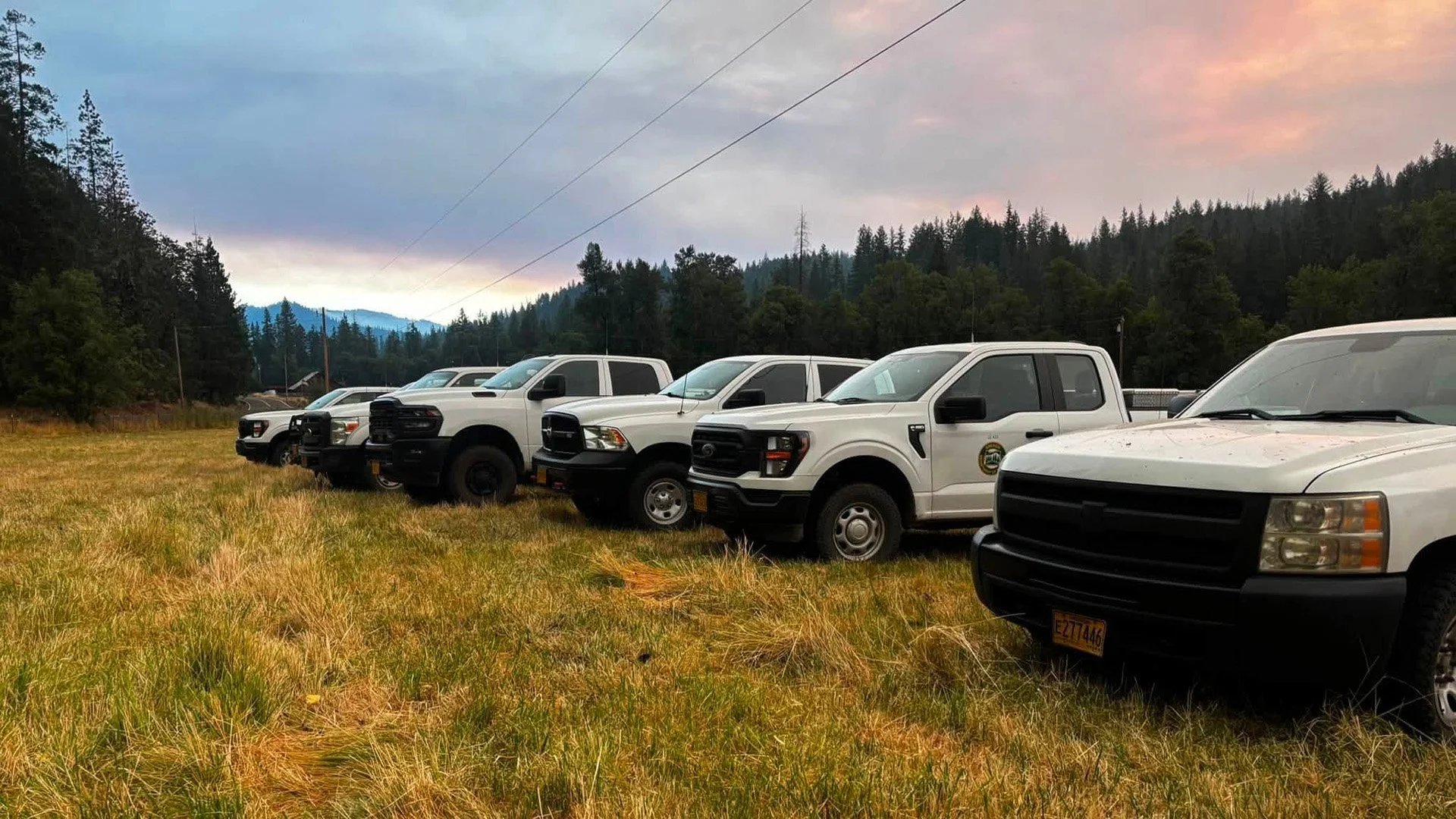
“Firefighters continue an aggressive initial attack, with additional resources being ordered to strengthen suppression efforts,” ODF Southwest Oregon said in a statement. “Incoming resources include multiple hand crews, dozers, engines, water tenders, and additional overhead personnel from the Oregon Department of Forestry and our agency partners.”
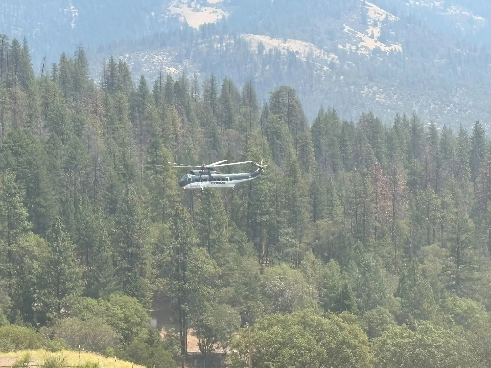
Aviation resources remain heavily engaged. Type 1, Type 2, and Type 3 helicopters are supporting firefighters with water bucket drops, while an Air Attack aircraft coordinates operations from above. Additional aviation resources are also on scene.
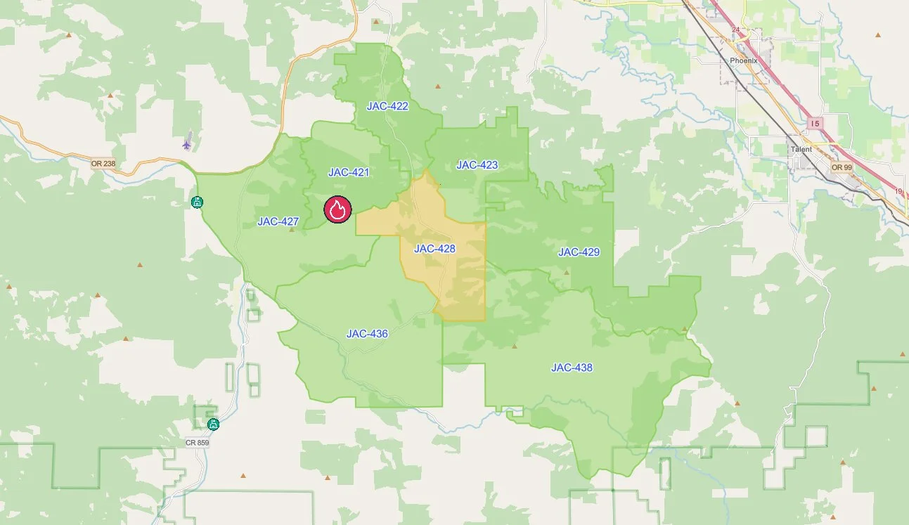
Evacuation Areas: A Genasys Protect map shows a Level 2, Be Set, evacuation for Zone JAC-428 and Level 1, Be Ready, notices for surrounding areas near the Woodrat Fire. Jackson County Sheriff’s Office / Genasys Protect.
Evacuations are in place near the fire, including a Level 2, Be Set, notice for Zone JAC-428. Residents can check their evacuation zone and current status through the Jackson County Sheriff’s Office and Genasys Protect at protect.genasys.com.

Officials are asking the public to avoid the Woodrat Mountain area and watch for emergency vehicles traveling to and from the incident.
No containment estimate or information about the cause of the fire has been released.

Keep Reading



ODF Southwest Oregon’s 4 Alpha Fox helicopter has completed its 75-day seasonal contract after introducing approved night-vision wildfire flights this year. One recent after-dark mission located three lightning-caused fires.