
Fielder Mountain Fire 18% Contained as Mop-Up Deepens
Improved mapping puts fire at 573 acres; footprint has not changed.
Fire Facts
Fire Name:
Fielder Mountain Fire
Location:
West of Rogue River, Ore.
Size: 573 acres
Containment: 18%
Activity:
Control line is complete around the entire perimeter. Crews are focused on mop-up, with work reaching up to 300 feet around homes.
Start Date:
Thursday, Aug. 13, 2026, shortly after 3 p.m.
Cause:
Vehicle-related; specific circumstances remain under investigation.
Personnel:
697 firefighters and support personnel
Resources:
23 hand crews
26 engines
10 pieces of heavy equipment
14 water tenders
8 aircraft
Evacuations:
1 Level 2 (Be Set)
1 Level 1 (Be Ready)
No Level 3 (GO NOW) zones remain.
Night Operations / Cover Photo: Firefighters continue overnight mop-up and water-support operations on the Fielder Mountain Fire as crews work to extinguish remaining heat along the perimeter. Oregon Department of Forestry.
ROGUE RIVER, Ore. — With control line now completed around the entire Fielder Mountain Fire, firefighters are shifting deeper into mop-up Sunday as they search for remaining heat and strengthen the perimeter west of Rogue River.
The fire is now mapped at 573 acres and remains 18% contained. The increase from Saturday’s 548-acre figure is the result of improved mapping and overnight infrared information, according to the Oregon Department of Forestry. Fire officials say the actual footprint of the fire has not changed.
Near homes, firefighters have worked approximately 300 feet into the burned area, checking for heat or flames that could threaten structures. Elsewhere around the perimeter, mop-up has reached approximately 25 to 50 feet, with crews working farther into the interior Sunday.


An overnight infrared flight identified pockets of heat that may not be visible from the ground. Firefighters are using that information to methodically grid the fire and expand the amount of cold, black ground behind the control line.
Difficult Terrain Still Shapes the Work
Steep and rugged terrain continues to complicate suppression even as the fire moves into a mop-up phase.
Rolling rocks, logs, and other debris remain hazards for firefighters. In some areas, crews have constructed fireline with a cupped shape designed to catch rolling material before it can carry heat or fire across the perimeter.
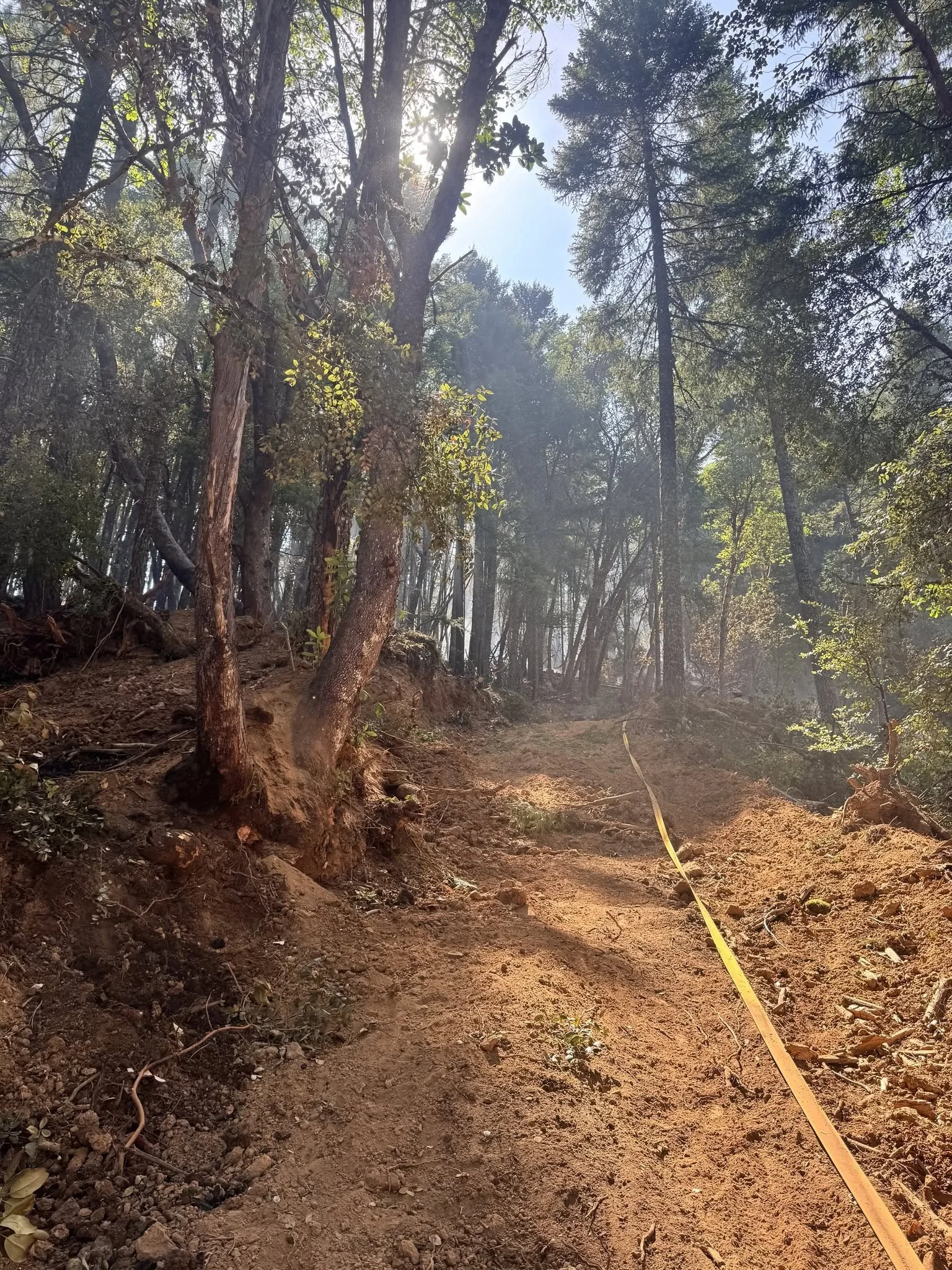
Hazardous trees and snags are also being removed as crews spend more time working inside the burned area.
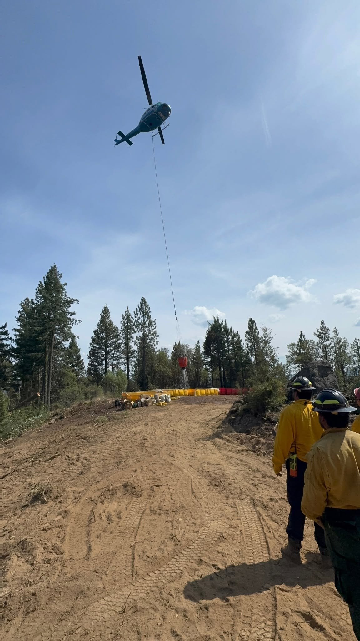
Getting water into the upper portions of the fire remains difficult because of poor road access. Helicopters are being used to fill portable tanks that feed hose lays in areas water tenders cannot reach.
Saturday, helicopters delivered approximately 20,000 gallons of water to portable tanks supporting firefighters on the ground.
A total of 697 personnel are assigned to the incident Sunday, including 23 hand crews, 26 engines, 10 pieces of heavy equipment, 14 water tenders, and eight aircraft.
Temperatures are expected to reach the low 90s, with lower humidity and light winds increasing later in the afternoon. Fire managers are also watching the potential for stronger winds and thunderstorms later in the week.
Evacuations and Roads
Evacuations have been substantially reduced as firefighters continue securing the fire.
Level 2 (Be Set): JAC-052
Level 1 (Be Ready): ROR-053
All road closures associated with the Fielder Mountain Fire have been lifted. Fire personnel and equipment remain active in the area, and drivers should continue watching for emergency traffic.

Livestock assistance remains available at 541-864-0546.
The Fielder Mountain Fire began Thursday afternoon near northbound Interstate 5 at Mile Marker 51. The fire is classified as vehicle-related, with the specific circumstances of the ignition still under investigation.
For Sunday, the focus is no longer on building perimeter line. Firefighters are now working to find and extinguish remaining heat, deepen mop-up around the fire, and turn completed line into increased containment.
Briefing Map: ODF Complex Incident Management Team 1’s Aug. 16 briefing map shows operational divisions, completed control lines, access routes, and contained and uncontained portions of the Fielder Mountain Fire perimeter. Oregon Department of Forestry.


Keep Reading




