
Evacuations Issued as Crescent Butte Fire Burns Near Gilchrist (UPDATED)
Level 2 BE SET evacuations are in effect closest to the fire, with Level 1 notices covering a broader surrounding area.
At a Glance
Fire Name:
Crescent Butte Fire
Location:
Near Crescent and Gilchrist in northern Klamath County
Reported:
Shortly after 2 p.m. Saturday
Size:
80 acres (WildCAD)
Evacuations:
Level 2 BE SET and Level 1 BE READY notices are in effect
Temporary Evacuation Point:
La Pine High School
Cause:
Not yet announced
UPDATE, 7:30 PM:
All Level 2 evacuation orders have been downgraded to Level 1.
—
UPDATE, 6:15 PM:
WildCAD is now reporting the Crescent Butte Fire at approximately 80 acres. Evacuation levels and the temporary evacuation point remain unchanged. No other significant changes have been reported.
GILCHRIST, Ore. — A new wildfire burning near Crescent and Gilchrist is sending a large column of smoke over northern Klamath County Saturday afternoon and has prompted evacuation notices for residents surrounding the fire.
The Crescent Butte Fire was reported shortly after 2 p.m. east of U.S. Highway 97. By mid afternoon, smoke was clearly visible from the Crescent and Gilchrist area and could also be seen from the Willamette Pass wildfire camera farther to the northwest.


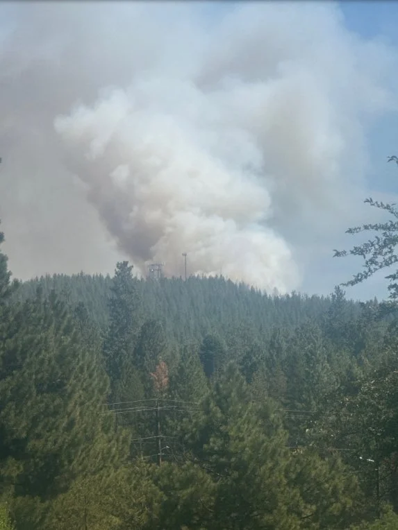
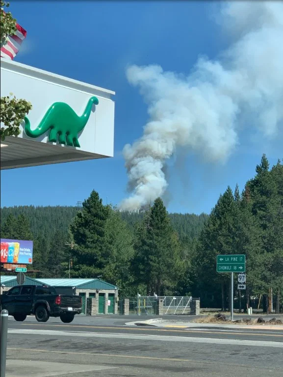
Photos from the area show a thick column rising above the timber east of the highway as firefighters respond to the new start.
Evacuation Map: Evacuation zones surround the Crescent Butte Fire near Crescent and Gilchrist in northern Klamath County Saturday afternoon. Watch Duty.
Residents closest to the fire have been placed under Level 2 BE SET evacuation notices. The affected areas are zones KLA-0216, KLA-0206, and KLA-0221.
A much larger area surrounding Crescent and Gilchrist has been placed under Level 1 BE READY notices, including areas extending north and south along the Highway 97 corridor.
Under a Level 2 evacuation notice, residents should be prepared to leave at a moment's notice and should consider voluntarily relocating people with special needs, pets, livestock, and other valuables.
A temporary evacuation point has also been established at La Pine High School, according to information from Klamath County relayed Saturday afternoon by Watch Duty.
Willamette Pass View: The Crescent Butte Fire smoke column is visible from the Willamette Pass wildfire camera northwest of the fire Saturday afternoon. Oregon Hazards Lab, University of Oregon.
WildCAD identified the incident as the Crescent Butte Fire, Incident 694, and initially listed the fire at four acres. That acreage was reported early in the incident and may not reflect current fire growth as crews continue their response.

The cause of the fire has not been announced.
Jefferson Daily News is following the Crescent Butte Fire and will update this story as new information becomes available.
Gilchrist View / Cover Photo: Smoke from the Crescent Butte Fire rises above the forest east of Gilchrist as crews respond to the new wildfire Saturday afternoon. Via Watch Duty.


Keep Reading




