Fire holds at 15,705 acres through another round of strong winds as crews tackle a 2,300-acre mop-up goal and begin transitioning toward suppression repair

FAST FIRE FACTS
Name: East Evans Creek Fire
Location: About 7 miles west of Shady Cove
Acres: 15,705
Containment: 33%
Overnight Growth: None reported
Fireline: More than 63 miles
Hose: More than 80 miles
Mop-Up Goal: About 2,300 acres
Current Focus: Deep mop-up, hidden heat and suppression repair
Evacuations: Level 1 and 2 remain in Jackson County; none in Douglas County
Cause: Vehicle crash into a power pole
Latest Maps: View current fire maps
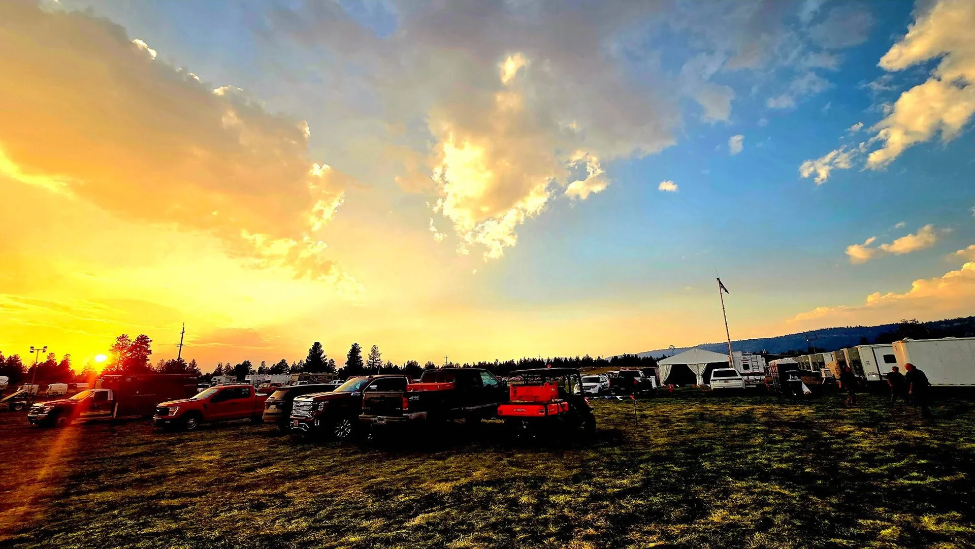
Cover image: Helicopters stand ready to support the East Evans Creek Fire as changing weather moves across the region, with aircraft continuing to provide reconnaissance, crew support and water drops where needed. (Oregon Department of Forestry)
SAMS VALLEY, Ore. — Containment on the East Evans Creek Fire has increased to 33% after firefighters held established lines through another round of strong winds and continued pushing mop-up deeper into the burned area.
The fire remains at 15,705 acres with no new overnight growth, according to fire officials and updated mapping released Thursday morning.
After nearly two weeks of suppression work, the incident is increasingly shifting from building and defending control lines toward the enormous task of extinguishing remaining heat throughout the fire’s interior.
Firefighters have constructed more than 63 miles of fireline and laid more than 80 miles of hose across the incident.
Their ultimate mop-up target extends approximately 300 feet inside those 63 miles of perimeter — an area fire officials estimate represents roughly 2,300 acres of ground that must be systematically checked, cooled and secured.
“We’re probably going to keep doing that for the next couple of days,” ODF Operations Trainee Leo Williamson said during Thursday morning’s operational briefing, describing the scale of the mop-up work still ahead.


FIRE HOLDS THROUGH ANOTHER ROUND OF STRONG WINDS
Thunderstorms brought wind gusts of approximately 30 to 35 mph across the fire Wednesday, testing control lines that firefighters have spent nearly two weeks constructing and strengthening.
Those lines held.
The stronger winds stirred pockets of remaining heat and produced more visible smoke in some areas, giving firefighters additional places to target with water.
Despite the weather, no new overnight growth was reported.
Fuels outside the perimeter remain dry and receptive to fire, and similar winds are possible again Thursday, keeping crews focused on holding established lines while continuing to extinguish heat inside them.
2,300-ACRE MOP-UP TASK SHOWS SCALE OF WORK AHEAD
Much of the daily firefighting effort has now shifted toward mop-up — but the scale of that work remains substantial.
Fire managers are targeting approximately 300 feet of mop-up inside the perimeter along roughly 63 miles of fireline.
That translates to an estimated 2,300 acres requiring detailed mop-up work.
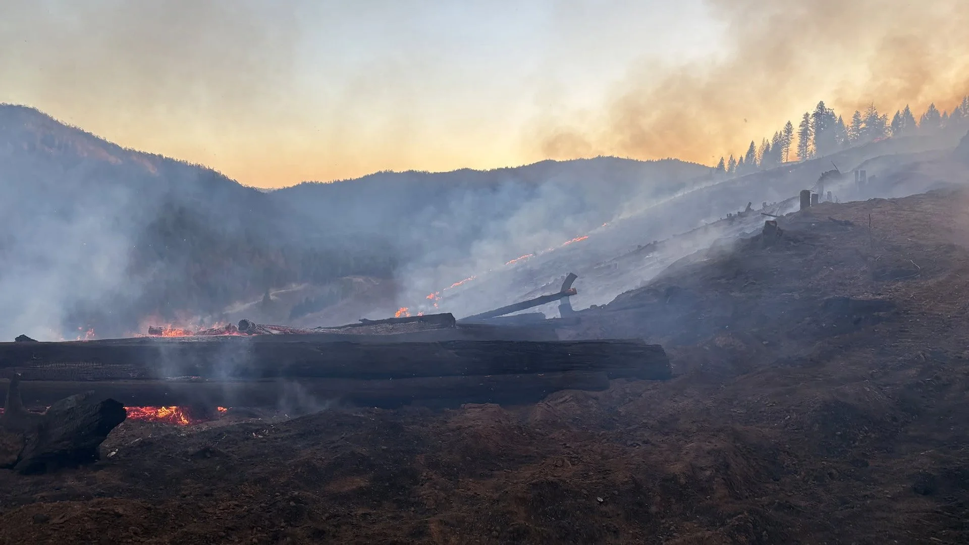
Crews must systematically search those areas for remaining heat, break apart heavy fuels, extinguish smoldering material and ensure fire cannot work its way back toward control lines.
Firefighters are using additional equipment to break apart berms created during bulldozer operations, improving access to buried heat and helping crews build greater depth behind the perimeter.
BOARD MOUNTAIN CREWS CONTINUE BUILDING DEPTH
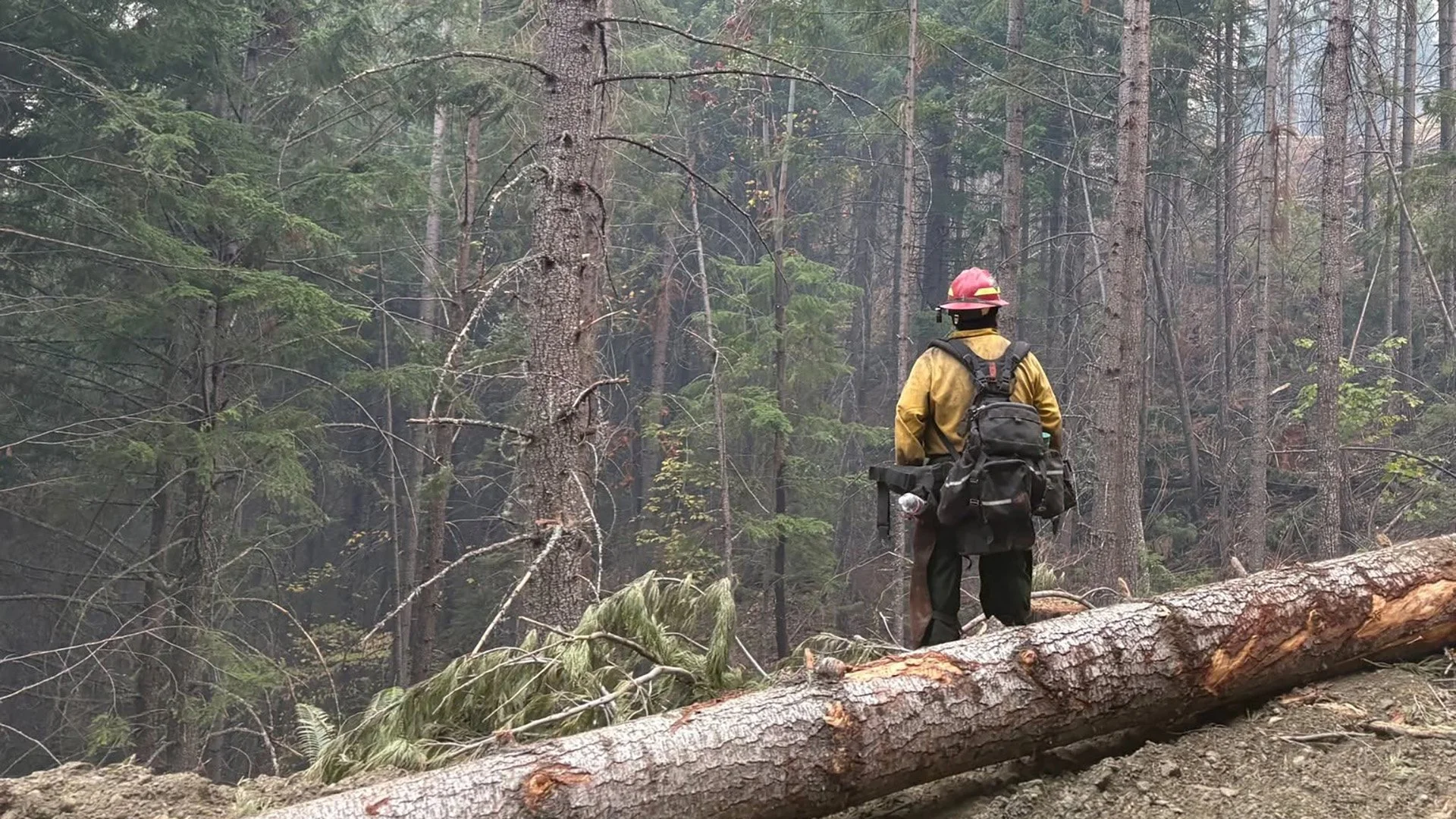
Around the Board Mountain spot fire, crews continue working the entire perimeter with particular attention on remaining heat and hazardous trees.
Mop-up has reached approximately 100 to 150 feet inside the fire in some locations.
Firefighters are removing additional fire-weakened trees that could fall across lines or endanger crews working below.
Handheld infrared cameras and drones equipped with infrared technology are also being used to locate heat that may be burning underground or beneath heavy fuels without producing visible smoke.
That information allows crews to precisely target areas requiring additional work.
INFRARED DRONES HELP FIND HIDDEN HEAT
The incident is increasingly relying on infrared technology as obvious flames become less common and hidden heat becomes the greater concern.
Crews are using both handheld infrared cameras and Unmanned Aircraft Systems equipped with infrared sensors around Board Mountain and along portions of the main fire perimeter.
The technology can identify buried or concealed heat that firefighters might otherwise miss during visual inspections.
Those locations are then mapped or flagged for crews to extinguish.
Night crews used infrared equipment around the Hull Mountain spot fire and along the main fire from the southern control line toward the northeast corner before turning those findings over to Thursday’s day shift.
CONTINGENCY LINE COMPLETED TO ANTIOCH ROAD
Firefighters reached another important milestone Wednesday when crews completed the remaining contingency line extending toward Antioch Road.
That work had been intended to provide an additional layer of protection should the main fire or spot fires escape primary containment lines.
With the contingency line now tied together, equipment assigned to that operation is beginning to transition into suppression repair.
Crews will work with resource advisors to repair impacts from firefighting operations, including dozer lines and other disturbed areas.
The goal is to reduce erosion and other long-term impacts before seasonal rains arrive later in the year.

STRUCTURE THREAT CONTINUES TO DECLINE
The threat to homes and other structures has decreased significantly as firefighters strengthen containment and move farther into mop-up.
As a result, Oregon State Fire Marshal resources are returning to their home agencies Thursday morning.
Remaining structural resources will continue patrolling neighborhoods, supporting mop-up around homes and maintaining protection where needed.
Local fire agencies also remain available should conditions change.
ODF’s Complex Incident Management Team remains assigned to the fire.
Resources no longer needed on the East Evans Creek Fire are being released so they can respond to other incidents around Oregon.
MORE FIREFIGHTERS SHIFT TO DAY OPERATIONS
The incident continues moving additional wildland resources from overnight assignments to daytime operations.
That puts more firefighters on the line during peak weather hours while reflecting the reduced need for intensive overnight suppression work.
Day crews will continue deepening mop-up, removing hazardous trees and responding to heat identified overnight through infrared surveys.
Aircraft remain available for aerial observation, intelligence gathering and water drops where needed.
SHELTER CLOSING THURSDAY
The American Red Cross shelter at Eagle Point Middle School is closing Thursday as evacuation levels continue to decrease and residents transition home.
The Red Cross will continue working with remaining shelter residents during that transition.
Anyone still needing sheltering assistance should contact Non-Emergency Dispatch at 541-776-7206.
LATEST FIRE MAPS
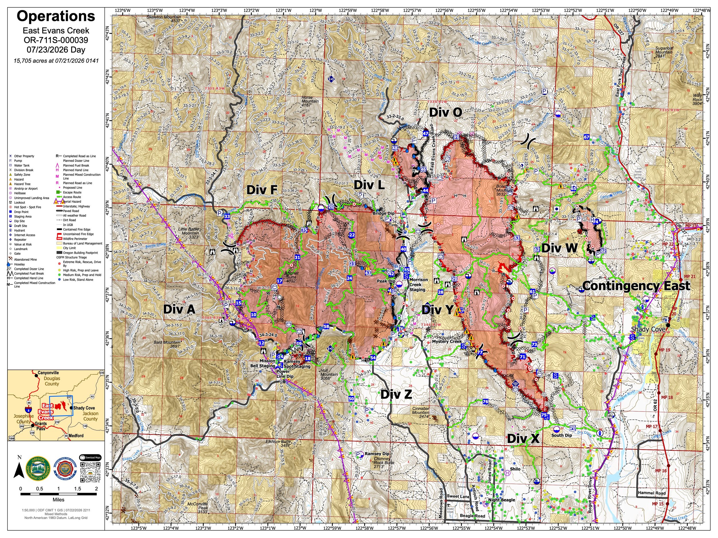
The July 23 operations map places the East Evans Creek Fire at 15,705 acres and shows the main fire, associated spot-fire areas and the extensive network of control lines established around the incident. (Oregon Department of Forestry) View all current maps on the East Evans Creek Fire Maps page.
Updated official maps released Thursday continue to place the East Evans Creek Fire at 15,705 acres, with no new overnight growth reported.
The maps show the main fire and associated spot-fire areas around Board Mountain, Canyon Creek and northwest of Hull Mountain, along with the extensive network of control lines established across the incident.
More than 63 miles of fireline have now been constructed.
As the incident increasingly transitions toward mop-up, infrared technology is becoming especially important for locating residual heat that may no longer produce visible smoke.
View the complete collection of current public information, operations, briefing, infrared, evacuation and incident maps on the East Evans Creek Fire Maps page.
FIRE WEATHER
Firefighters successfully held established control lines through thunderstorms and wind gusts of approximately 30 to 35 mph Wednesday.
Similar winds are possible again Thursday.
Although the fire has remained within its footprint for multiple operational shifts, dry fuels outside containment lines remain capable of supporting new fire growth.
Wind can also increase visible smoke by exposing or fanning remaining pockets of heat inside the burned area.
Crews will continue watching for:
Wind-driven flare-ups near control lines
New spotting outside the perimeter
Hidden heat exposed by stronger winds
Thunderstorm-related shifts in wind direction
Aircraft remain available to assist with reconnaissance and water drops as conditions allow.
FIRE DANGER

Extreme fire danger remains in effect on Oregon Department of Forestry-protected lands across Jackson and Josephine counties.
Restrictions remain in place on activities capable of producing sparks or igniting dry vegetation.
Wednesday’s lightning threat creates an additional concern for new starts, particularly in areas that receive little or no rainfall.
Residents should immediately report any new smoke or fire by calling 911..
EVACUATION LEVELS
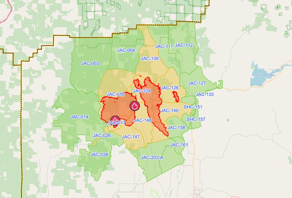
The latest evacuation map showing level 1, 2, and 3 evacuations due to the East Evans Creek Fire. Residents should use the interactive Genasys map to check current conditions for a specific address. (Project Genasys)
Level 1 and Level 2 notices remain in portions of Jackson County.
Evacuation levels can still change quickly if thunderstorms, strong winds or renewed fire activity threaten containment lines.
Residents should continue checking official Jackson County evacuation information for their current zone.
EVACUATION SHELTER
The American Red Cross shelter at Eagle Point Middle School is closing Thursday, July 23.
The Red Cross continues working with remaining residents as they transition home or to other arrangements.
Anyone still needing sheltering assistance should contact:
Non-Emergency Dispatch: 541-776-7206
CLOSURES
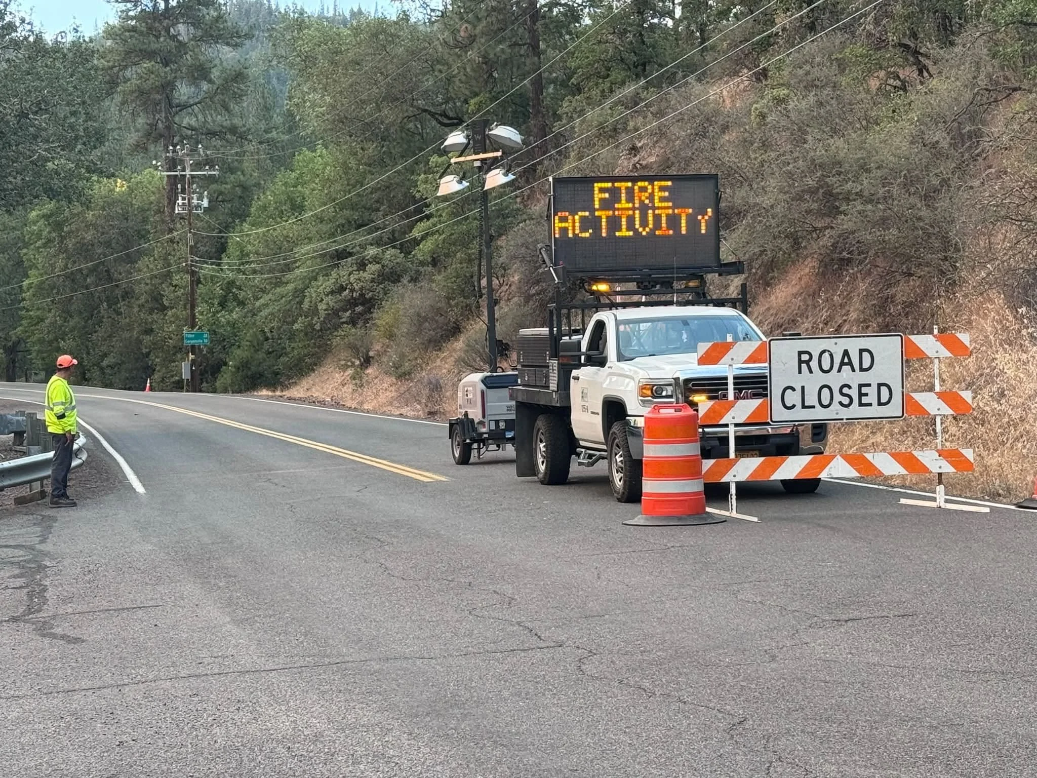
A Jackson County Roads employee staffs a closure as an electronic sign warns drivers of nearby fire activity. (Courtesy Jackson County Parks)
Fire-related road and land closures remain in effect.
ODF continues to list:
East Evans Creek Road at Meadows Road
West Fork Evans Creek Road
Rock Creek Road
Access restrictions remain around portions of the fire area to protect firefighters, heavy equipment operators and residents.
BLM-administered lands near the East Evans Creek Fire remain closed to public entry, including hunting, hiking and camping.
A 24-hour Temporary Flight Restriction remains in effect over the incident.
Flying a drone near the fire is illegal and can force firefighting aircraft to suspend operations.


More Firewatch