
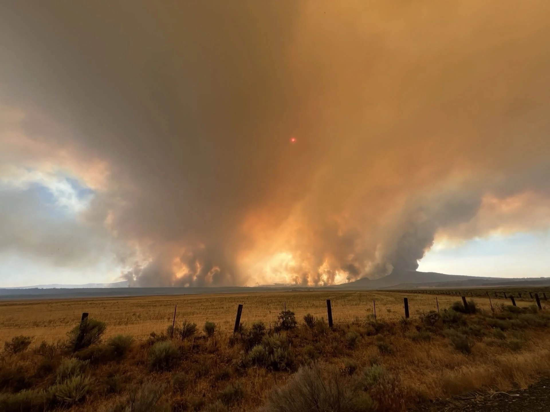

Wrights Spring Fire
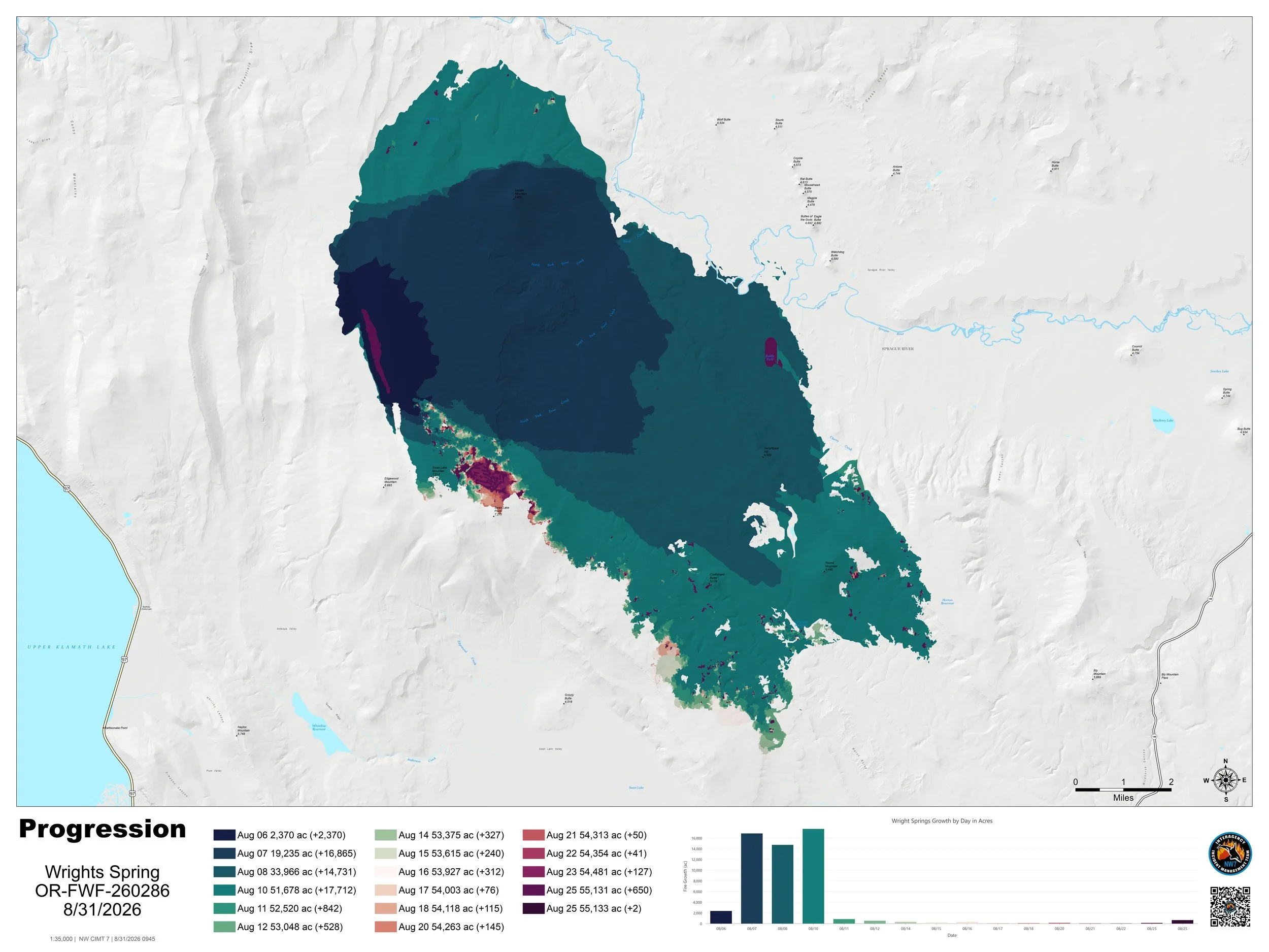
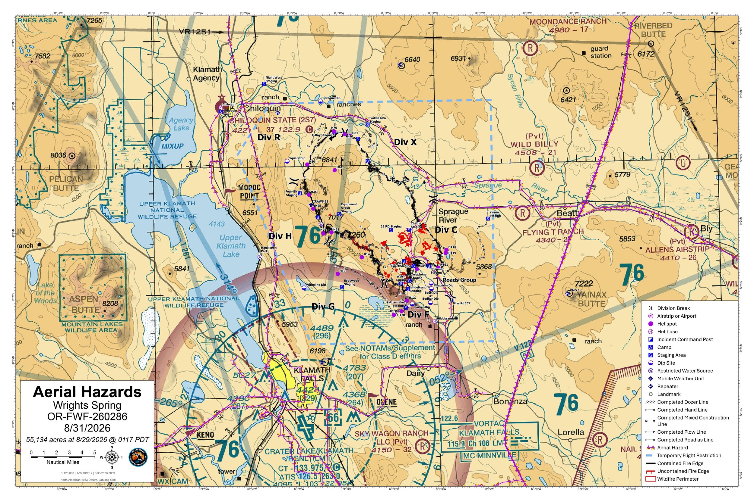
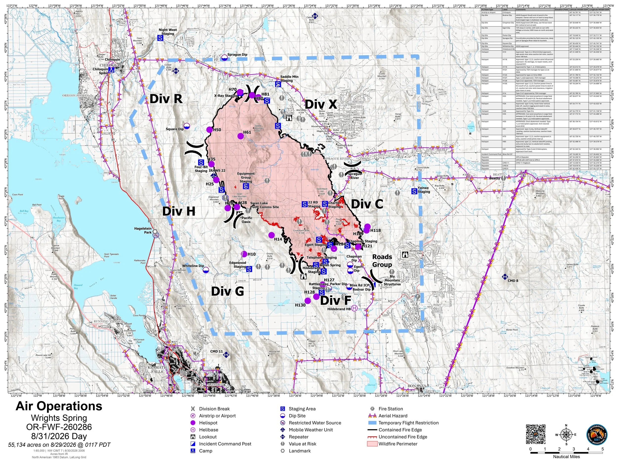
Official Fire Maps
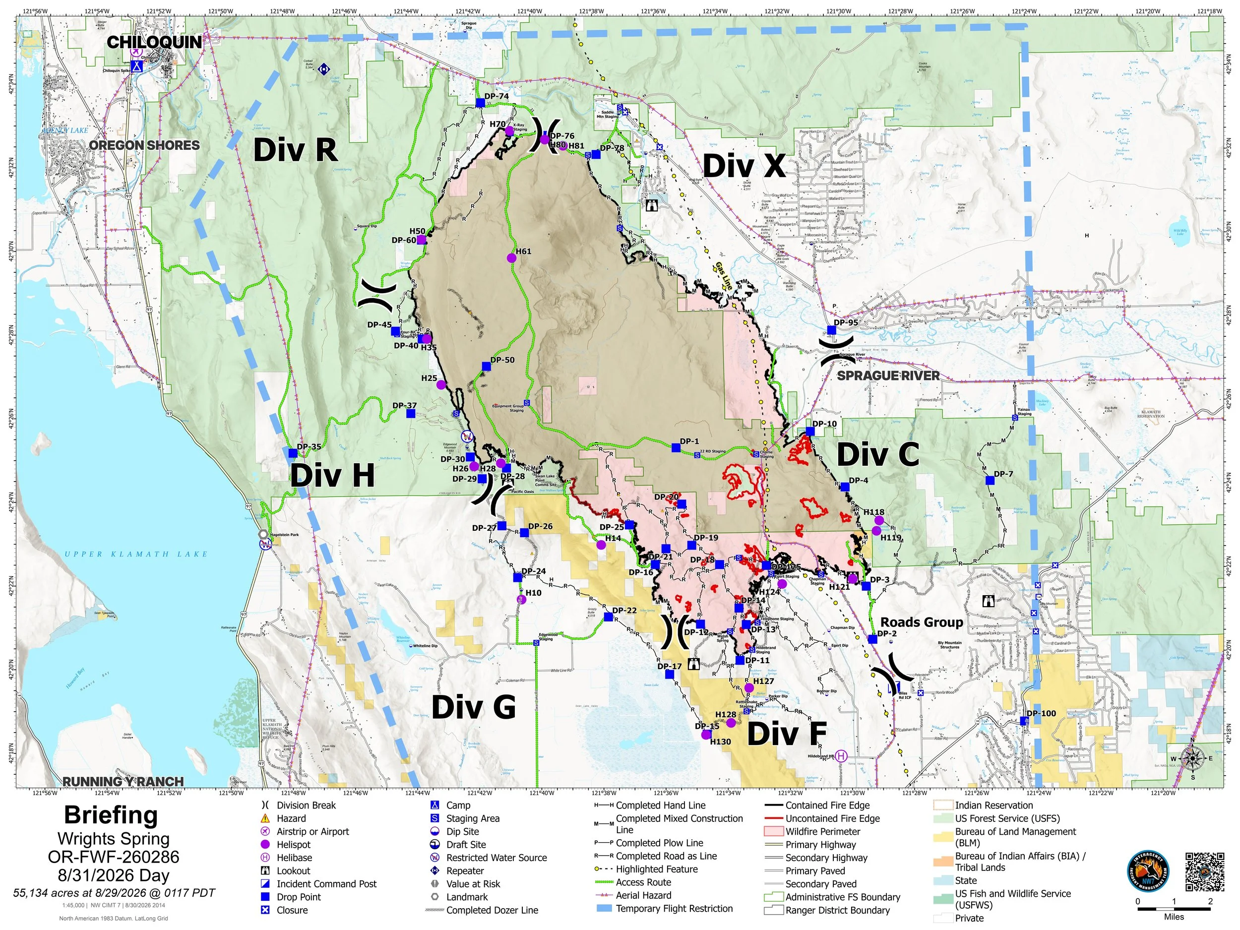
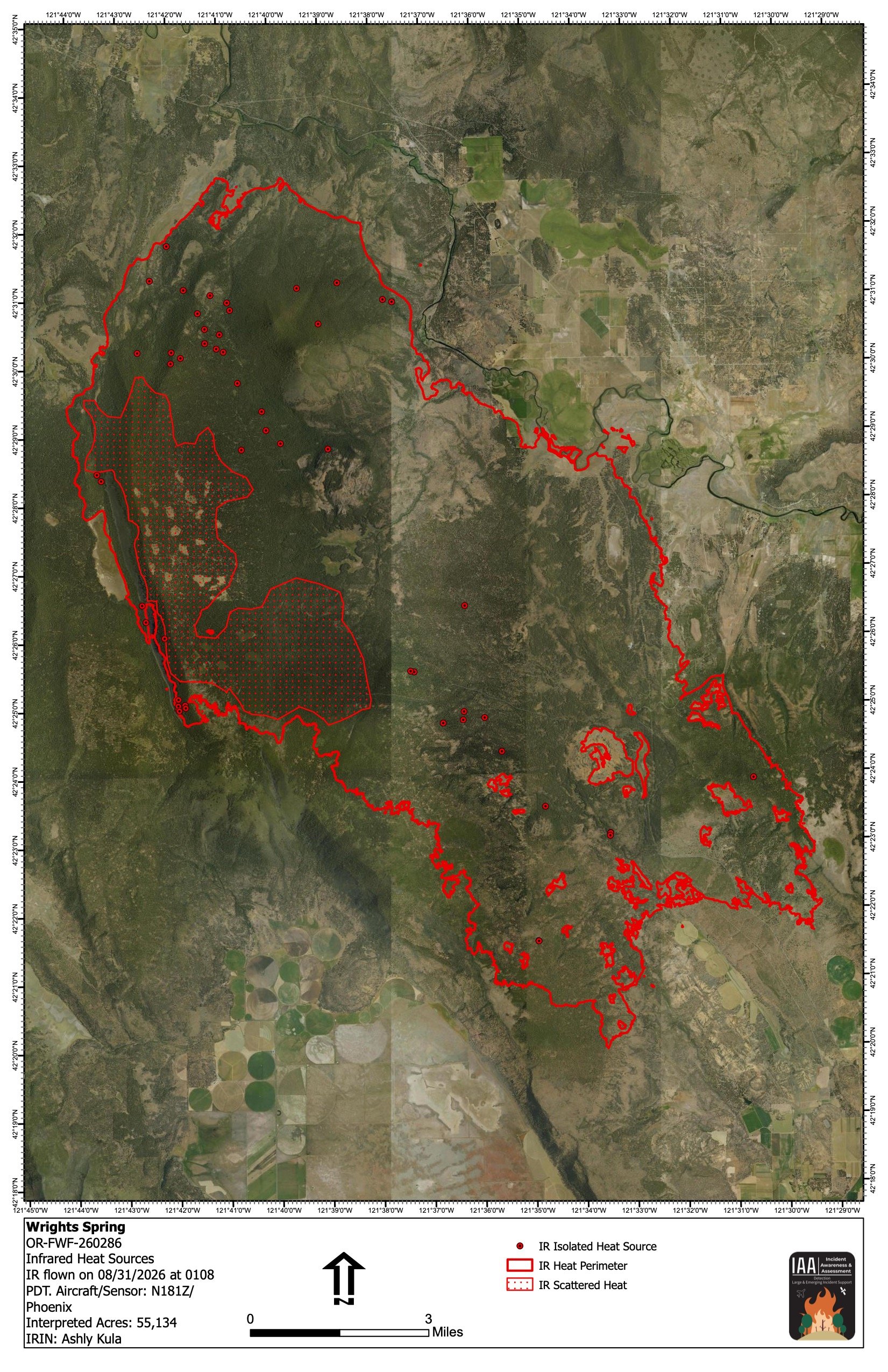
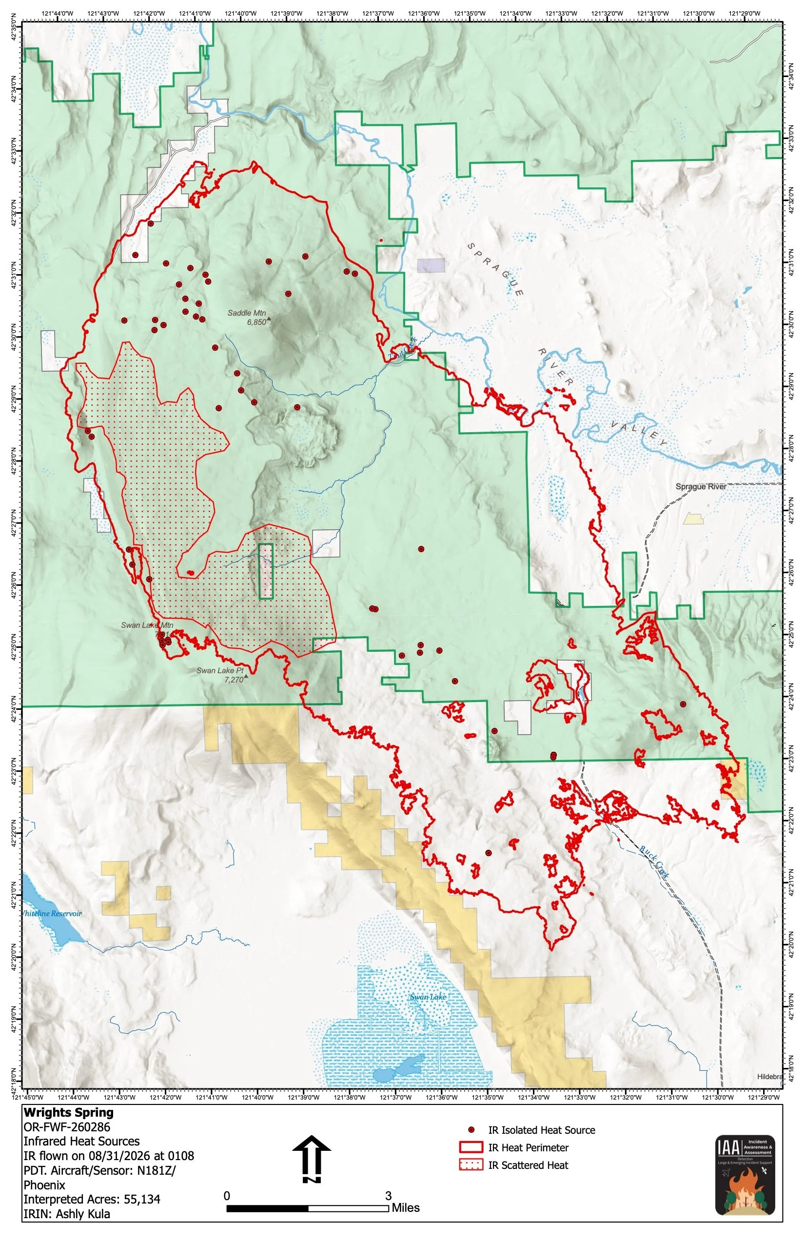
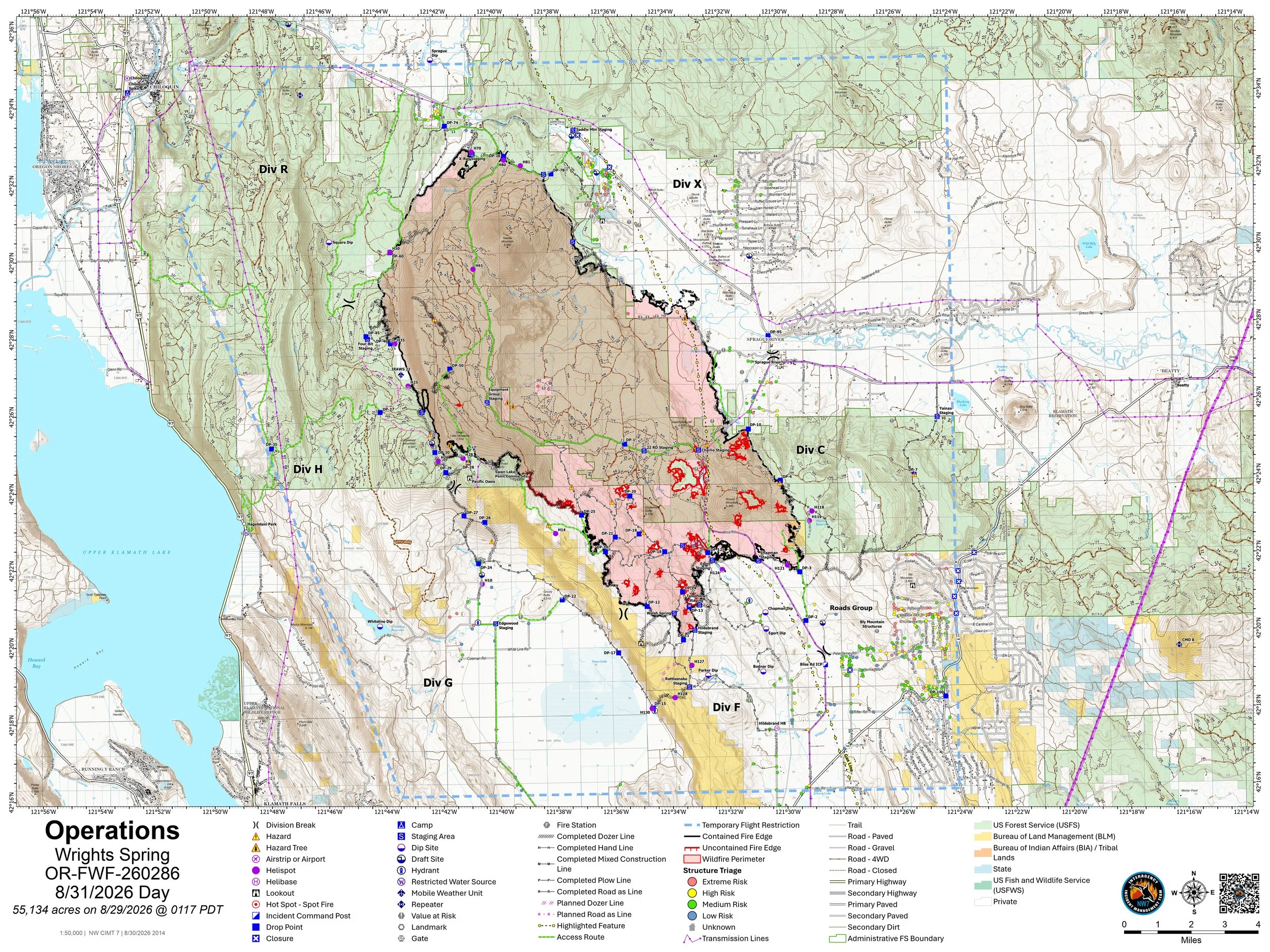
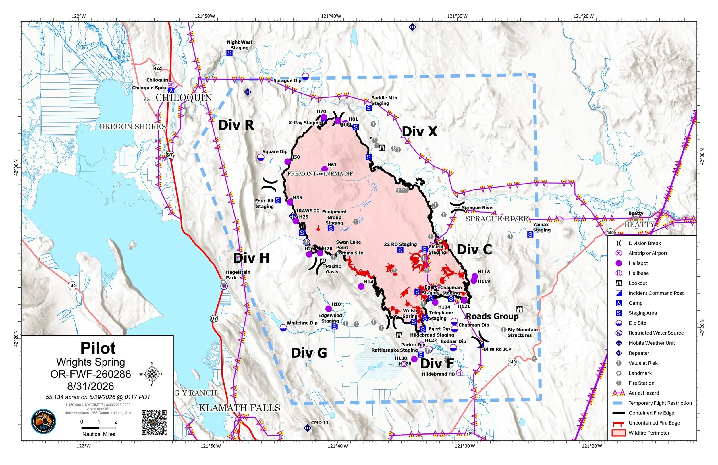
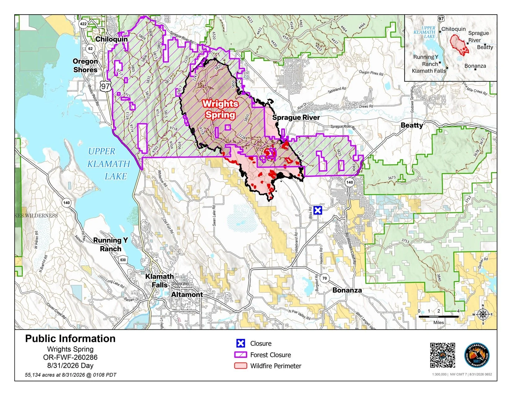
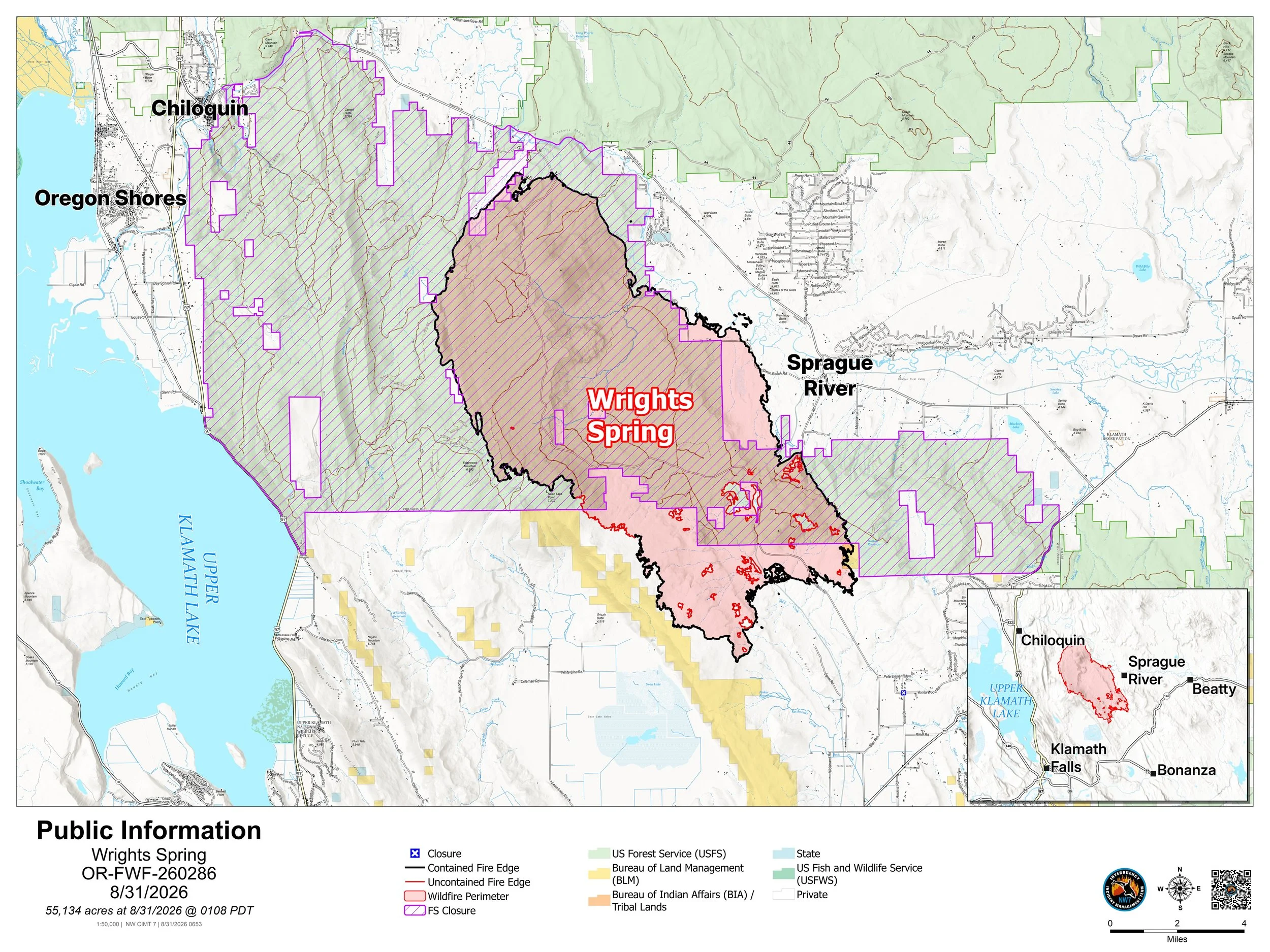
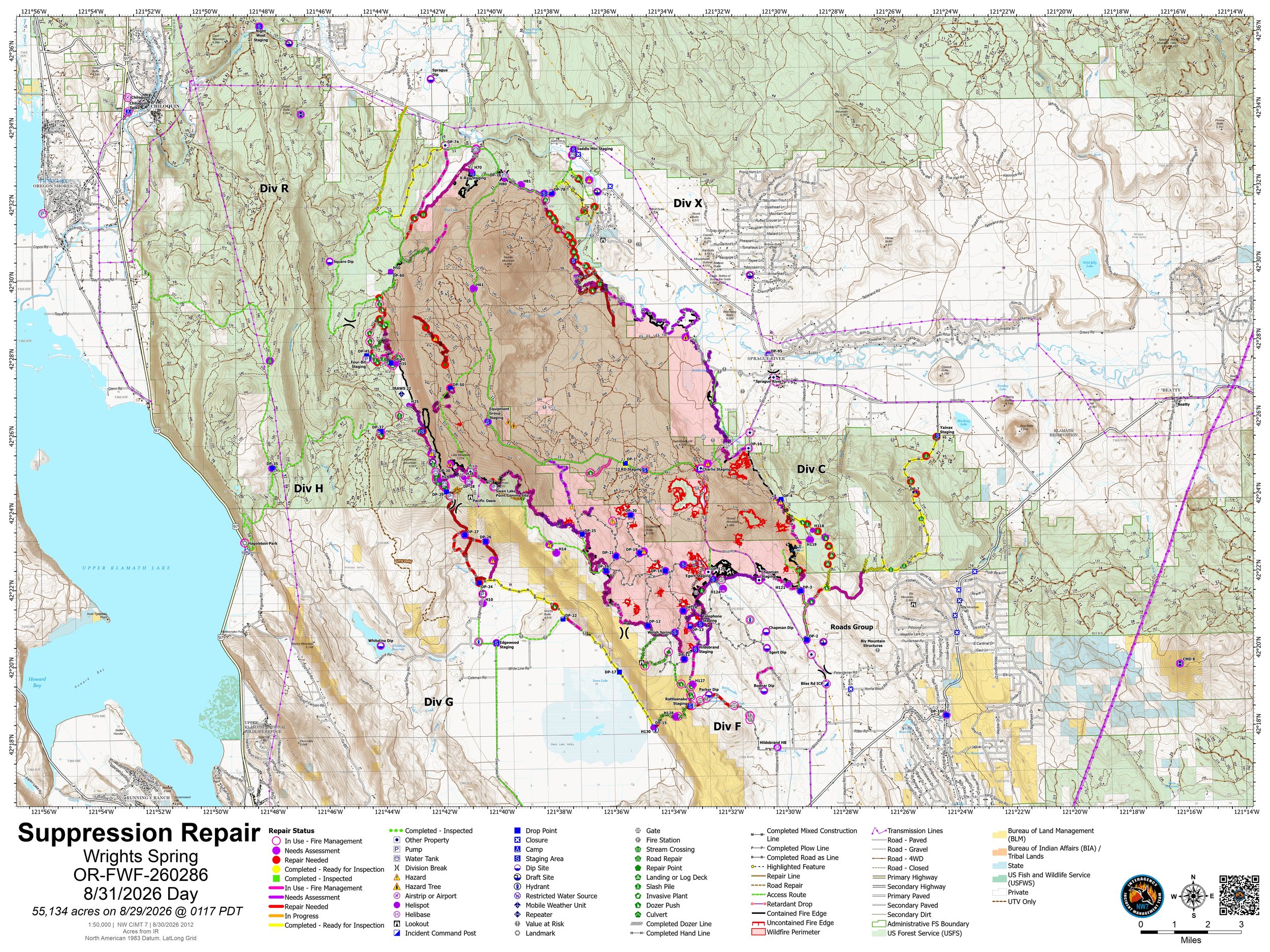
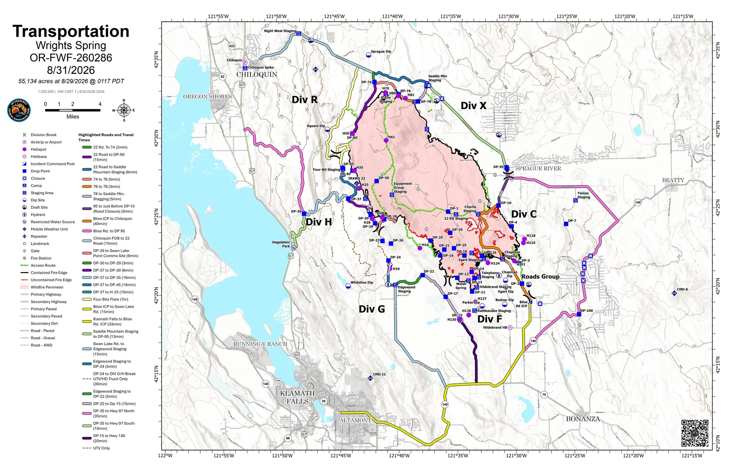
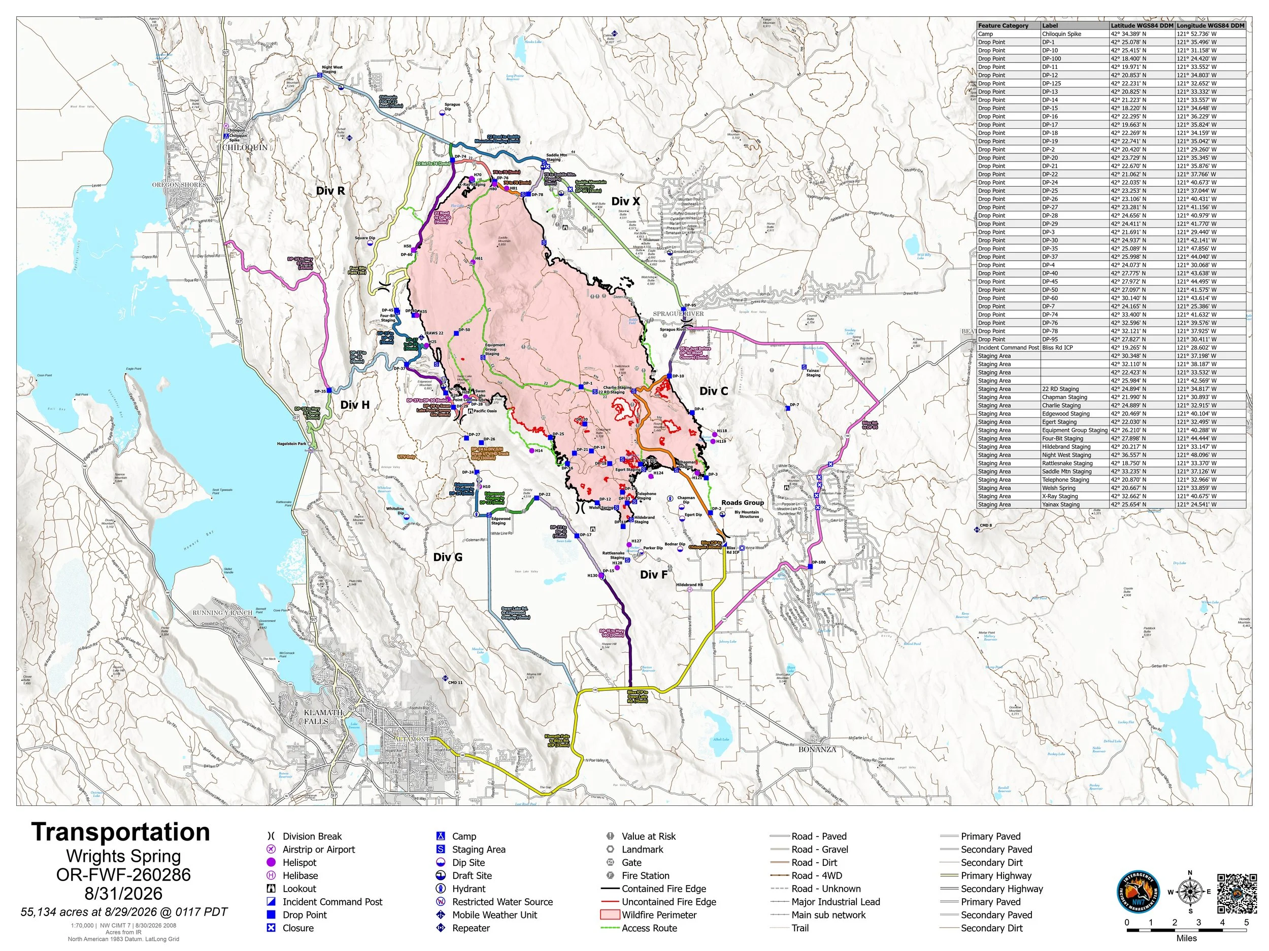
View the latest official maps for the Wrights Spring Fire in Klamath County, including infrared, operations, briefing and public information maps. Maps are updated as new products are released by fire command. Select any map to enlarge.
Fire Status
Updated: August 31, 2026
Mapped Size: 55,134 acres
Containment: 90%
Latest Mapping:
Official Aug. 31 mapping shows the fire perimeter holding with no measurable growth during the past 48 hours.
Available Maps:
Public Information Map
Operational Map
Fire Progression Map
Evacuation Map
Map Note:
Interior portions of the fire may continue to smolder and produce isolated smoke, but officials say that activity remains well inside the perimeter and is not threatening containment lines.
Latest Update:
Containment has reached 90% as crews remove equipment and shift primarily into patrol and suppression repair.
Emergency Information: Jefferson Firewatch provides news and incident information. Always follow evacuation orders and emergency instructions issued by public safety officials.